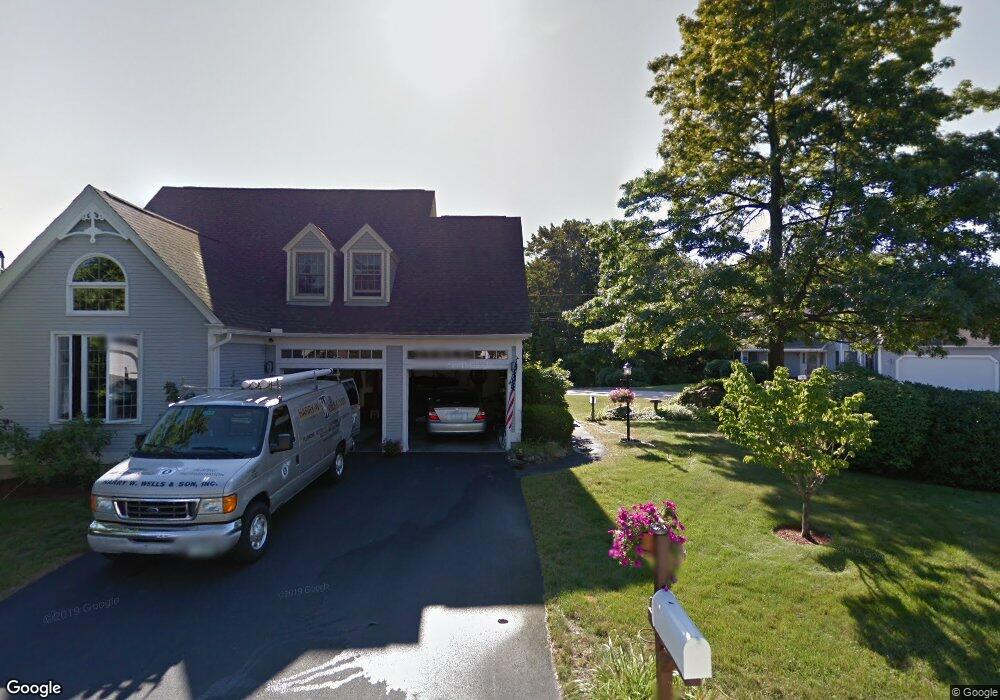
6 Ipswich Cir Unit U290 Nashua, NH 03063
Northwest Nashua NeighborhoodEstimated Value: $547,000 - $699,000
3
Beds
2
Baths
2,077
Sq Ft
$290/Sq Ft
Est. Value
About This Home
This home is located at 6 Ipswich Cir Unit U290, Nashua, NH 03063 and is currently estimated at $602,340, approximately $290 per square foot. 6 Ipswich Cir Unit U290 is a home located in Hillsborough County with nearby schools including Broad Street Elementary School, Pennichuck Middle School, and Nashua High School North.
Ownership History
Date
Name
Owned For
Owner Type
Purchase Details
Closed on
Aug 15, 2011
Sold by
Patricia A Belanger Re
Bought by
Azarakhsh Ebrahim and Daneshvar Akram
Current Estimated Value
Home Financials for this Owner
Home Financials are based on the most recent Mortgage that was taken out on this home.
Original Mortgage
$200,000
Interest Rate
4.51%
Mortgage Type
Purchase Money Mortgage
Create a Home Valuation Report for This Property
The Home Valuation Report is an in-depth analysis detailing your home's value as well as a comparison with similar homes in the area
Home Values in the Area
Average Home Value in this Area
Purchase History
| Date | Buyer | Sale Price | Title Company |
|---|---|---|---|
| Azarakhsh Ebrahim | $302,400 | -- |
Source: Public Records
Mortgage History
| Date | Status | Borrower | Loan Amount |
|---|---|---|---|
| Open | Azarakhsh Ebrahim | $196,800 | |
| Closed | Azarakhsh Ebrahim | $200,000 |
Source: Public Records
Tax History Compared to Growth
Tax History
| Year | Tax Paid | Tax Assessment Tax Assessment Total Assessment is a certain percentage of the fair market value that is determined by local assessors to be the total taxable value of land and additions on the property. | Land | Improvement |
|---|---|---|---|---|
| 2024 | $9,915 | $623,600 | $0 | $623,600 |
| 2023 | $9,345 | $512,600 | $0 | $512,600 |
| 2022 | $9,263 | $512,600 | $0 | $512,600 |
| 2021 | $9,228 | $397,400 | $0 | $397,400 |
| 2020 | $8,985 | $397,400 | $0 | $397,400 |
| 2019 | $8,510 | $391,100 | $0 | $391,100 |
| 2018 | $8,295 | $391,100 | $0 | $391,100 |
| 2017 | $7,360 | $285,400 | $0 | $285,400 |
| 2016 | $7,155 | $285,400 | $0 | $285,400 |
| 2015 | $7,001 | $285,400 | $0 | $285,400 |
| 2014 | $6,864 | $285,400 | $0 | $285,400 |
Source: Public Records
Map
Nearby Homes
- 38 Highbridge Hill Rd Unit 186
- 26 Andover Down Unit 276
- 66 Tinker Rd
- 5 Dumaine Ave Unit B
- 5 Dumaine Ave Unit N
- 75 Deerwood Dr Unit B
- 77 Deerwood Dr Unit E
- 123 Cannongate III
- 218 Millwright Dr Unit 218
- 201 Millwright Dr
- 3 Roedean Dr Unit C-207
- 2 New Haven Dr Unit E303
- 74 Profile Cir
- 47 Hanna Cir Unit 47
- 47 Hanna Cir
- 18 Swift Ln
- 33 Ferry Rd
- 7 Robert Dr
- 40 Merrimack Dr
- 28 Merrimack Dr
- 8 Ipswich Cir Unit U291
- 4 Ipswich Cir Unit U289
- 18 Grasmere Ln Unit U358
- 16 Grasmere Ln Unit U356
- 7 Ipswich Cir Unit U292
- 20 Grasmere Ln Unit U360
- 5 Ipswich Cir Unit U293
- 14 Grasmere Ln Unit U354
- 3 Ipswich Cir Unit U294
- 3 Grasmere Ln Unit U296
- 5 Grasmere Ln Unit U295
- 2 Glencliff Way Unit U420
- 17 Grasmere Ln Unit U357
- 15 Grasmere Ln Unit U355
- 4 Suffolk Park Unit U362
- 19 Grasmere Ln Unit U359
- 9 Grasmere Ln Unit U352
- 7 Grasmere Ln Unit U351
- 11 Grasmere Ln Unit U353
- 7 Suffolk Park Unit U365