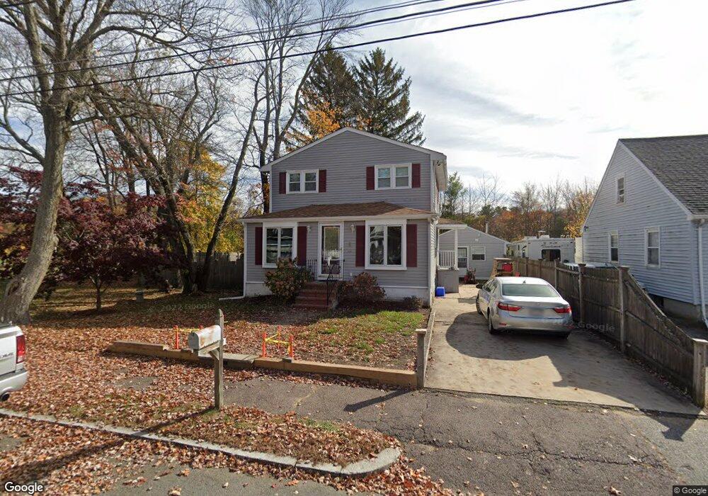
6 Line Rd Wakefield, MA 01880
West Side NeighborhoodEstimated Value: $703,000 - $780,000
4
Beds
2
Baths
1,575
Sq Ft
$470/Sq Ft
Est. Value
About This Home
This home is located at 6 Line Rd, Wakefield, MA 01880 and is currently estimated at $739,571, approximately $469 per square foot. 6 Line Rd is a home located in Middlesex County with nearby schools including Wakefield Memorial High School and Austin Preparatory School.
Ownership History
Date
Name
Owned For
Owner Type
Purchase Details
Closed on
May 1, 1992
Sold by
Federal National Mortgage Association
Bought by
Murphy Kathleen
Current Estimated Value
Purchase Details
Closed on
Jul 19, 1991
Sold by
Bancroft Richard C
Bought by
Federal National Mortgage Association
Create a Home Valuation Report for This Property
The Home Valuation Report is an in-depth analysis detailing your home's value as well as a comparison with similar homes in the area
Home Values in the Area
Average Home Value in this Area
Purchase History
| Date | Buyer | Sale Price | Title Company |
|---|---|---|---|
| Murphy Kathleen | $75,000 | -- | |
| Murphy Kathleen | $75,000 | -- | |
| Federal National Mortgage Association | $110,000 | -- |
Source: Public Records
Mortgage History
| Date | Status | Borrower | Loan Amount |
|---|---|---|---|
| Open | Federal National Mortgage Association | $55,000 | |
| Closed | Federal National Mortgage Association | $25,000 |
Source: Public Records
Tax History
| Year | Tax Paid | Tax Assessment Tax Assessment Total Assessment is a certain percentage of the fair market value that is determined by local assessors to be the total taxable value of land and additions on the property. | Land | Improvement |
|---|---|---|---|---|
| 2025 | $6,967 | $613,800 | $315,800 | $298,000 |
| 2024 | $6,865 | $610,200 | $313,900 | $296,300 |
| 2023 | $6,538 | $557,400 | $286,300 | $271,100 |
| 2022 | $6,265 | $508,500 | $260,700 | $247,800 |
| 2021 | $6,200 | $487,000 | $243,100 | $243,900 |
| 2020 | $5,813 | $455,200 | $227,200 | $228,000 |
| 2019 | $5,553 | $432,800 | $216,000 | $216,800 |
| 2018 | $5,171 | $399,300 | $199,300 | $200,000 |
| 2017 | $4,860 | $373,000 | $186,200 | $186,800 |
| 2016 | $4,879 | $361,700 | $176,200 | $185,500 |
| 2015 | $4,563 | $338,500 | $164,600 | $173,900 |
| 2014 | $4,165 | $325,900 | $158,300 | $167,600 |
Source: Public Records
Map
Nearby Homes
- 3 Carnation Cir Unit C
- 50 Quannapowitt Pkwy
- 24 Smith Ave
- 41 Winter St
- 103 Orange St
- 48 Village St Unit 1001
- 16 Beebe Ln
- 22 Indian Hill Rd
- 29 Cordis St
- 25 Wakefield St
- 43 Wakefield St
- 69 Ash St
- 67 Woodcrest Dr
- 159 Main St
- 52 Sanborn St Unit 7
- 863 Main St
- 80 Redfield Rd
- 241 Main St Unit C3
- 57 Wave Ave
- 18 Heritage Ln
Your Personal Tour Guide
Ask me questions while you tour the home.