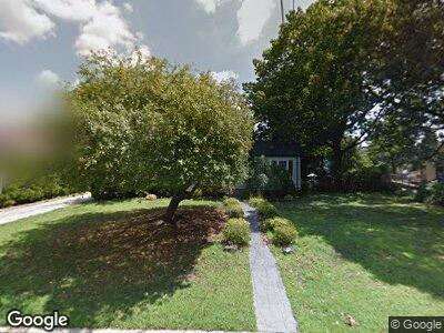
6 Loring Rd Levittown, NY 11756
Levittown NeighborhoodEstimated Value: $835,335 - $839,000
5
Beds
2
Baths
1,903
Sq Ft
$440/Sq Ft
Est. Value
About This Home
This home is located at 6 Loring Rd, Levittown, NY 11756 and is currently estimated at $837,168, approximately $439 per square foot. 6 Loring Rd is a home located in Nassau County with nearby schools including Abbey Lane Elementary School, Wisdom Lane Middle School, and Division Avenue Senior High School.
Ownership History
Date
Name
Owned For
Owner Type
Purchase Details
Closed on
Aug 31, 2017
Sold by
Beck Dorothy G
Bought by
Grabher Kurt F and Grabher Ryann E
Current Estimated Value
Home Financials for this Owner
Home Financials are based on the most recent Mortgage that was taken out on this home.
Original Mortgage
$503,500
Outstanding Balance
$429,699
Interest Rate
3.93%
Mortgage Type
New Conventional
Estimated Equity
$353,680
Create a Home Valuation Report for This Property
The Home Valuation Report is an in-depth analysis detailing your home's value as well as a comparison with similar homes in the area
Home Values in the Area
Average Home Value in this Area
Purchase History
| Date | Buyer | Sale Price | Title Company |
|---|---|---|---|
| Grabher Kurt F | $535,000 | Paragon Abstract Inc | |
| Grabher Kurt F | $535,000 | Paragon Abstract Inc |
Source: Public Records
Mortgage History
| Date | Status | Borrower | Loan Amount |
|---|---|---|---|
| Open | Grabher Kurt F | $503,500 | |
| Closed | Grabher Kurt F | $503,500 |
Source: Public Records
Tax History Compared to Growth
Tax History
| Year | Tax Paid | Tax Assessment Tax Assessment Total Assessment is a certain percentage of the fair market value that is determined by local assessors to be the total taxable value of land and additions on the property. | Land | Improvement |
|---|---|---|---|---|
| 2024 | $3,962 | $486 | $358 | $128 |
| 2023 | $15,929 | $557 | $410 | $147 |
| 2022 | $15,929 | $557 | $410 | $147 |
| 2021 | $20,446 | $530 | $390 | $140 |
| 2020 | $13,564 | $530 | $460 | $70 |
| 2019 | $3,102 | $530 | $460 | $70 |
| 2018 | $6,113 | $530 | $0 | $0 |
| 2017 | $5,356 | $530 | $389 | $141 |
| 2016 | $8,231 | $530 | $357 | $173 |
| 2015 | $3,143 | $627 | $422 | $205 |
| 2014 | $3,143 | $627 | $422 | $205 |
| 2013 | $3,159 | $683 | $460 | $223 |
Source: Public Records
Map
Nearby Homes
- 3 Loring Rd
- 2600 Hempstead Turnpike
- 44 Meadow Ln
- 109 Loring Rd
- 17 Aldin Ln
- 21 Aldin Ln
- 29 Taylor Ave
- 65 Meadow Ln
- 28 Crabtree Ln
- 70 Ridge Ln
- 92 Diamond Ave
- 115 Wolcott Rd
- 2716 Sheila Ct
- 151 Diamond Ave
- 269 N Newbridge Rd Unit C1
- 209 Bellmore Rd
- 18 Old Farm Rd
- 267 N Newbridge Rd Unit 1C
- 37 Old Farm Rd
- 108 Barnyard Ln