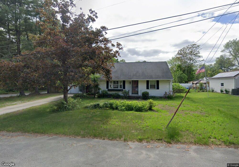
6 Meadowlark Ln Springfield, MA 01119
Sixteen Acres NeighborhoodEstimated Value: $355,000 - $395,000
4
Beds
2
Baths
1,744
Sq Ft
$213/Sq Ft
Est. Value
About This Home
This home is located at 6 Meadowlark Ln, Springfield, MA 01119 and is currently estimated at $371,178, approximately $212 per square foot. 6 Meadowlark Ln is a home located in Hampden County with nearby schools including Glickman Elementary, John J Duggan Middle, and Springfield Central High School.
Ownership History
Date
Name
Owned For
Owner Type
Purchase Details
Closed on
Mar 22, 2012
Sold by
Mcneish David P and Mcneish Marianne
Bought by
Mcneish Marianne
Current Estimated Value
Purchase Details
Closed on
Aug 1, 2001
Sold by
Scibelli Alice R
Bought by
Mcneish David P and Mcneish Marianne
Home Financials for this Owner
Home Financials are based on the most recent Mortgage that was taken out on this home.
Original Mortgage
$118,825
Interest Rate
7.14%
Mortgage Type
Purchase Money Mortgage
Create a Home Valuation Report for This Property
The Home Valuation Report is an in-depth analysis detailing your home's value as well as a comparison with similar homes in the area
Home Values in the Area
Average Home Value in this Area
Purchase History
| Date | Buyer | Sale Price | Title Company |
|---|---|---|---|
| Mcneish Marianne | -- | -- | |
| Mcneish David P | $122,500 | -- |
Source: Public Records
Mortgage History
| Date | Status | Borrower | Loan Amount |
|---|---|---|---|
| Previous Owner | Mcneish David P | $118,825 | |
| Previous Owner | Mcneish David P | $62,000 |
Source: Public Records
Tax History Compared to Growth
Tax History
| Year | Tax Paid | Tax Assessment Tax Assessment Total Assessment is a certain percentage of the fair market value that is determined by local assessors to be the total taxable value of land and additions on the property. | Land | Improvement |
|---|---|---|---|---|
| 2025 | $4,905 | $312,800 | $52,600 | $260,200 |
| 2024 | $4,752 | $295,900 | $52,600 | $243,300 |
| 2023 | $4,615 | $270,700 | $50,100 | $220,600 |
| 2022 | $4,370 | $232,200 | $50,100 | $182,100 |
| 2021 | $4,218 | $223,200 | $45,500 | $177,700 |
| 2020 | $4,054 | $207,600 | $45,500 | $162,100 |
| 2019 | $3,820 | $194,100 | $45,500 | $148,600 |
| 2018 | $3,832 | $194,700 | $45,500 | $149,200 |
| 2017 | $3,710 | $188,700 | $45,400 | $143,300 |
| 2016 | $3,501 | $178,100 | $45,400 | $132,700 |
| 2015 | $3,511 | $178,500 | $45,400 | $133,100 |
Source: Public Records
Map
Nearby Homes
- 134 Granger St
- 35 Juniper Dr
- 63 Granger St
- 381 N Brook Rd
- 43 Birchland Ave
- 1606 Wilbraham Rd
- 64 Wilmington St
- 195 Almira Rd
- 321 Rosewell St
- 401 Grayson Dr
- 251 Rosewell St
- 200 Slater Ave
- 55 Gardens Dr
- Lot 37 Kane St
- 56 Contessa Ln
- 99 Rosewell St
- 74 Valley Rd
- 46 Puritan Cir
- 150 Seymour Ave
- 44 Rest Way
- 16 Meadowlark Ln
- 106 N Brook Rd
- 134 N Brook Rd
- 96 N Brook Rd
- 26 Meadowlark Ln
- 103 Northway Dr
- 93 Northway Dr
- 31 Meadowlark Ln
- 146 N Brook Rd
- 36 Meadowlark Ln
- 18 Pidgeon Dr
- 83 Northway Dr
- 39 Meadowlark Ln
- 28 Pidgeon Dr
- 102 Northway Dr
- 48 Meadowlark Ln
- 74 N Brook Rd
- 94 Northway Dr
- 36 Pidgeon Dr
- 75 Northway Dr