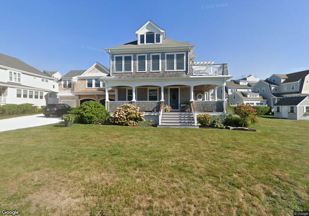
6 Michael Ave Scituate, MA 02066
Estimated Value: $1,489,000 - $2,061,000
--
Bed
2
Baths
2,586
Sq Ft
$714/Sq Ft
Est. Value
About This Home
This home is located at 6 Michael Ave, Scituate, MA 02066 and is currently estimated at $1,847,206, approximately $714 per square foot. 6 Michael Ave is a home located in Plymouth County with nearby schools including Jenkins Elementary School, Lester J. Gates Middle School, and Scituate High School.
Ownership History
Date
Name
Owned For
Owner Type
Purchase Details
Closed on
Aug 18, 2000
Sold by
Fitch Peter N
Bought by
Jones Brian and Jones Nancy
Current Estimated Value
Create a Home Valuation Report for This Property
The Home Valuation Report is an in-depth analysis detailing your home's value as well as a comparison with similar homes in the area
Home Values in the Area
Average Home Value in this Area
Purchase History
| Date | Buyer | Sale Price | Title Company |
|---|---|---|---|
| Jones Brian | $480,000 | -- |
Source: Public Records
Mortgage History
| Date | Status | Borrower | Loan Amount |
|---|---|---|---|
| Open | Jones Brian | $405,000 |
Source: Public Records
Tax History Compared to Growth
Tax History
| Year | Tax Paid | Tax Assessment Tax Assessment Total Assessment is a certain percentage of the fair market value that is determined by local assessors to be the total taxable value of land and additions on the property. | Land | Improvement |
|---|---|---|---|---|
| 2025 | $17,277 | $1,729,400 | $1,157,000 | $572,400 |
| 2024 | $16,882 | $1,629,500 | $1,107,200 | $522,300 |
| 2023 | $15,716 | $1,471,600 | $1,006,500 | $465,100 |
| 2022 | $15,716 | $1,245,300 | $854,600 | $390,700 |
| 2021 | $15,353 | $1,151,800 | $813,900 | $337,900 |
| 2020 | $14,915 | $1,104,800 | $782,500 | $322,300 |
| 2019 | $14,724 | $1,071,600 | $767,200 | $304,400 |
| 2018 | $12,697 | $910,200 | $632,700 | $277,500 |
| 2017 | $12,220 | $867,300 | $589,800 | $277,500 |
| 2016 | $11,663 | $824,800 | $557,700 | $267,100 |
| 2015 | $9,681 | $739,000 | $471,900 | $267,100 |
Source: Public Records
Map
Nearby Homes
- 37 Moorland Rd
- 2 Collier Rd
- 59 Greenfield Ln
- 67 Greenfield Ln
- 26 Damons Point Cir
- 29 Ladds Way Unit 29
- 50 First Parish Rd
- 91 Front St Unit 106
- 110 Damons Point Rd
- 19 Ford Place Unit 3
- 19 Ford Place Unit 1
- 55 Macombers Way
- 76 A Brook St
- 76 A Brook St Unit 1
- 23 Sunset Rd
- 48 Neal Gate St
- 9 Cushing Park Rd
- 12 Sassamon Rd
- 17 Old Oaken Bucket Rd
- 49 Cornet Stetson Rd