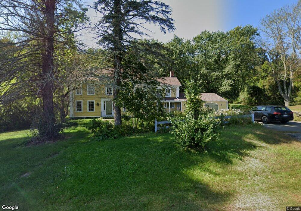
6 Mill Stone Rd West Brookfield, MA 01585
Estimated Value: $476,000 - $809,000
4
Beds
3
Baths
3,000
Sq Ft
$209/Sq Ft
Est. Value
About This Home
This home is located at 6 Mill Stone Rd, West Brookfield, MA 01585 and is currently estimated at $626,931, approximately $208 per square foot. 6 Mill Stone Rd is a home located in Worcester County with nearby schools including Quaboag Regional High School.
Ownership History
Date
Name
Owned For
Owner Type
Purchase Details
Closed on
Mar 27, 2006
Sold by
Devoie Kenneth M and Devoie Sharon F
Bought by
Carville Angela A and Carville Leslie William
Current Estimated Value
Home Financials for this Owner
Home Financials are based on the most recent Mortgage that was taken out on this home.
Original Mortgage
$368,000
Interest Rate
6.28%
Mortgage Type
Purchase Money Mortgage
Purchase Details
Closed on
Jun 13, 1997
Sold by
Leslie Buren C
Bought by
Devoie Kenneth M and Devoie Sharon F
Home Financials for this Owner
Home Financials are based on the most recent Mortgage that was taken out on this home.
Original Mortgage
$148,950
Interest Rate
7.97%
Mortgage Type
Purchase Money Mortgage
Create a Home Valuation Report for This Property
The Home Valuation Report is an in-depth analysis detailing your home's value as well as a comparison with similar homes in the area
Home Values in the Area
Average Home Value in this Area
Purchase History
| Date | Buyer | Sale Price | Title Company |
|---|---|---|---|
| Carville Angela A | $460,000 | -- | |
| Devoie Kenneth M | $177,000 | -- |
Source: Public Records
Mortgage History
| Date | Status | Borrower | Loan Amount |
|---|---|---|---|
| Open | Devoie Kenneth M | $343,500 | |
| Closed | Carville Angela A | $368,000 | |
| Previous Owner | Devoie Kenneth M | $105,000 | |
| Previous Owner | Devoie Kenneth M | $151,600 | |
| Previous Owner | Devoie Kenneth M | $148,950 |
Source: Public Records
Tax History
| Year | Tax Paid | Tax Assessment Tax Assessment Total Assessment is a certain percentage of the fair market value that is determined by local assessors to be the total taxable value of land and additions on the property. | Land | Improvement |
|---|---|---|---|---|
| 2025 | $5,505 | $510,700 | $55,000 | $455,700 |
| 2024 | $5,735 | $510,700 | $55,000 | $455,700 |
| 2023 | $5,581 | $465,500 | $49,600 | $415,900 |
| 2022 | $5,215 | $394,200 | $47,300 | $346,900 |
| 2021 | $5,030 | $358,500 | $47,300 | $311,200 |
| 2020 | $4,166 | $283,400 | $47,300 | $236,100 |
| 2019 | $4,441 | $283,400 | $47,300 | $236,100 |
| 2018 | $2,352 | $273,200 | $47,300 | $225,900 |
| 2017 | $4,232 | $263,500 | $47,600 | $215,900 |
| 2016 | $5,092 | $328,300 | $47,600 | $280,700 |
| 2015 | $4,918 | $328,300 | $47,600 | $280,700 |
Source: Public Records
Map
Nearby Homes
- 260 Wickaboag Valley Rd
- 25 Highland Trail
- 138 Ragged Hill Rd
- 65 Pierce Rd
- 22 Beach Dr
- 207 Shoreline Dr
- 221 Pierce Rd
- 91 W Main St
- 233 Ragged Hill Rd
- 179 Pierce Rd
- 940 Old West Brookfield Rd
- 37 Central St
- 0 Barr Rd
- 3 Foster Rd
- 0 Gilbertville Rd Unit 73387398
- 18-20 Old w Brookfield Rd
- 431 Coy Hill Rd
- Lot 2 Brimfield Rd
- Lot 1 Brimfield Rd
- 300 Padre Rd
- 8 John Gilbert Rd
- 12 Mill Stone Rd
- 205 Wickaboag Valley Rd
- 198 Wickaboag Valley Rd
- 1 Ragged Hill Rd
- 194 Wickaboag Valley Rd
- 14 John Gilbert Rd
- 196 Wickaboag Valley Rd
- 195 Wickaboag Valley Rd
- 1 Shea Rd
- 5 Ragged Hill Rd
- 2 Shea Rd
- 8 Ragged Hill Rd
- 11 John Gilbert Rd
- 3 Shea Rd
- 25 Shea Rd
- 15 John Gilbert Rd
- 222 Wickaboag Valley Rd
- 18 John Gilbert Rd
- 10 Shea Rd
Your Personal Tour Guide
Ask me questions while you tour the home.