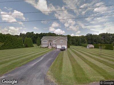
6 Nicholson Hill Rd Southwick, MA 01077
Southwick NeighborhoodEstimated Value: $528,000 - $670,000
4
Beds
3
Baths
1,800
Sq Ft
$315/Sq Ft
Est. Value
About This Home
This home is located at 6 Nicholson Hill Rd, Southwick, MA 01077 and is currently estimated at $566,584, approximately $314 per square foot. 6 Nicholson Hill Rd is a home located in Hampden County with nearby schools including Woodland School, Powder Mill Middle School, and Southwick Regional School.
Ownership History
Date
Name
Owned For
Owner Type
Purchase Details
Closed on
Apr 3, 2020
Sold by
Rebenske Jennifer and Sygarowski Sean
Bought by
Zygarowski Sean and Zygarowski Jennifer
Current Estimated Value
Home Financials for this Owner
Home Financials are based on the most recent Mortgage that was taken out on this home.
Original Mortgage
$282,000
Interest Rate
3.2%
Mortgage Type
Stand Alone Refi Refinance Of Original Loan
Purchase Details
Closed on
Feb 4, 2013
Sold by
Waitt James E
Bought by
Rebenske Jennifer and Zygarowski Sean
Home Financials for this Owner
Home Financials are based on the most recent Mortgage that was taken out on this home.
Original Mortgage
$240,000
Interest Rate
3.41%
Mortgage Type
New Conventional
Create a Home Valuation Report for This Property
The Home Valuation Report is an in-depth analysis detailing your home's value as well as a comparison with similar homes in the area
Home Values in the Area
Average Home Value in this Area
Purchase History
| Date | Buyer | Sale Price | Title Company |
|---|---|---|---|
| Zygarowski Sean | -- | None Available | |
| Rebenske Jennifer | $260,000 | -- |
Source: Public Records
Mortgage History
| Date | Status | Borrower | Loan Amount |
|---|---|---|---|
| Open | Zygarowski Jennifer | $343,000 | |
| Closed | Zygarowski Jennifer L | $284,500 | |
| Previous Owner | Rebenske Jennifer | $240,000 | |
| Previous Owner | Waitt James E | $50,935 |
Source: Public Records
Tax History Compared to Growth
Tax History
| Year | Tax Paid | Tax Assessment Tax Assessment Total Assessment is a certain percentage of the fair market value that is determined by local assessors to be the total taxable value of land and additions on the property. | Land | Improvement |
|---|---|---|---|---|
| 2025 | $6,882 | $442,000 | $87,600 | $354,400 |
| 2024 | $6,579 | $425,300 | $81,300 | $344,000 |
| 2023 | $6,251 | $388,000 | $81,300 | $306,700 |
| 2022 | $5,996 | $353,100 | $74,100 | $279,000 |
| 2021 | $5,890 | $328,000 | $74,100 | $253,900 |
| 2020 | $5,955 | $340,500 | $74,100 | $266,400 |
| 2019 | $5,755 | $329,400 | $72,900 | $256,500 |
| 2018 | $5,765 | $329,400 | $72,900 | $256,500 |
| 2017 | $5,553 | $313,200 | $69,100 | $244,100 |
| 2016 | $5,356 | $313,200 | $69,100 | $244,100 |
| 2015 | $5,573 | $329,000 | $67,900 | $261,100 |
Source: Public Records
Map
Nearby Homes
- Lot 11 Ridgeview Terrace
- 8 Noble Steed Crossing
- 3 Eastwood Dr
- 221 Mort Vining Rd
- 233 Mort Vining Rd
- 4 Eric Dr
- 5 (lot 17) Stoneybrook Dr
- 6 (lot 15) Stoneybrook Dr
- 24 Congamond Rd
- 12 Candlewood Ln
- 17 Candlewood Ln
- 62 Davis Rd
- 116 Congamond Rd
- 24 Shore Rd
- 87 Klaus Anderson Rd
- 283 N Granby Rd
- 9 Stonehedge Way
- 196 Day St
- 3 Evergreen St
- 8 Curtis Rd
- 6 Nicholson Hill Rd
- 6 Nicholson Hill Rd
- 24 Nicholson Hill Rd
- 4 Nicholson Hill Rd
- 4 Nicholson Hill Rd
- 8 Nicholson Hill Rd
- 5 Nicholson Hill Rd
- 7 Nicholson Hill Rd
- 2 Nicholson Hill Rd
- 2 Nicholson Hill Rd
- 3 Nicholson Hill Rd
- 3 Nicholson Hill Rd
- 1 Nicholson Hill Rd
- 1 Nicholson Hill Rd
- 2 Ferrin Dr
- 4 Ferrin Dr
- 10 Nicholson Hill Rd
- 104 Mort Vining Rd
- 104 Mort Vining Rd
- 110 Mort Vining Rd