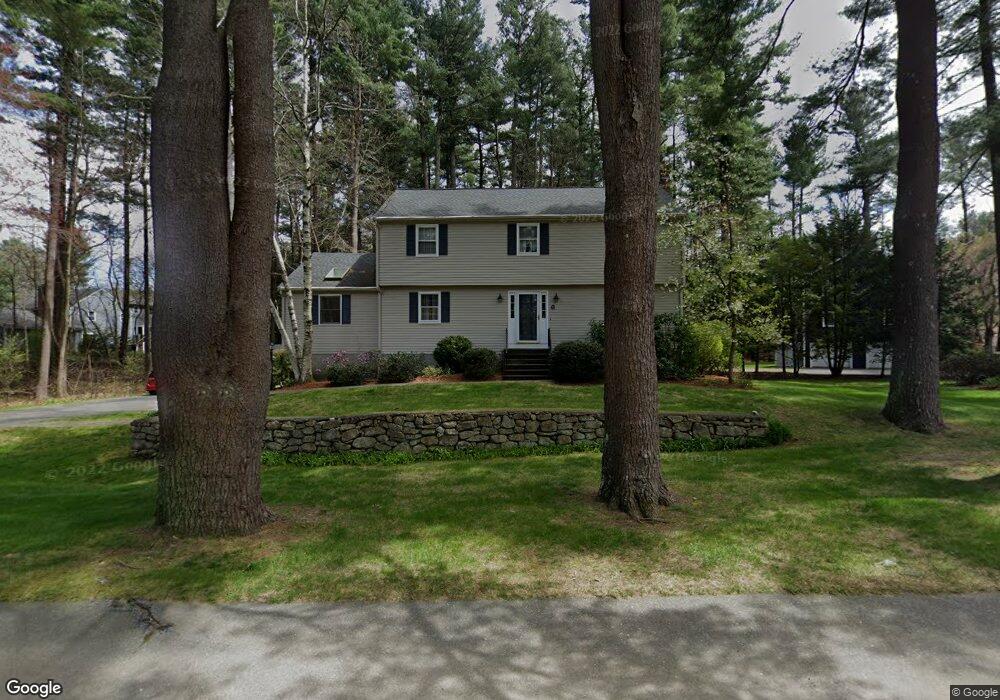
6 Robert Frost Rd Sudbury, MA 01776
Estimated Value: $900,000 - $1,245,000
4
Beds
3
Baths
2,268
Sq Ft
$481/Sq Ft
Est. Value
About This Home
This home is located at 6 Robert Frost Rd, Sudbury, MA 01776 and is currently estimated at $1,090,923, approximately $481 per square foot. 6 Robert Frost Rd is a home located in Middlesex County with nearby schools including Israel Loring Elementary School, Ephraim Curtis Middle School, and Lincoln-Sudbury Regional High School.
Ownership History
Date
Name
Owned For
Owner Type
Purchase Details
Closed on
Apr 19, 2023
Sold by
Schrager Paul B and Schrager Arlene W
Bought by
Schrager Ft
Current Estimated Value
Purchase Details
Closed on
May 29, 1987
Sold by
Lowe Joan
Bought by
Schrager Paul B
Home Financials for this Owner
Home Financials are based on the most recent Mortgage that was taken out on this home.
Original Mortgage
$240,000
Interest Rate
10.25%
Mortgage Type
Purchase Money Mortgage
Create a Home Valuation Report for This Property
The Home Valuation Report is an in-depth analysis detailing your home's value as well as a comparison with similar homes in the area
Home Values in the Area
Average Home Value in this Area
Purchase History
| Date | Buyer | Sale Price | Title Company |
|---|---|---|---|
| Schrager Ft | -- | None Available | |
| Schrager Paul B | $392,500 | -- |
Source: Public Records
Mortgage History
| Date | Status | Borrower | Loan Amount |
|---|---|---|---|
| Previous Owner | Schrager Paul B | $203,150 | |
| Previous Owner | Schrager Paul B | $203,150 | |
| Previous Owner | Schrager Paul B | $202,300 | |
| Previous Owner | Schrager Paul B | $240,000 |
Source: Public Records
Tax History Compared to Growth
Tax History
| Year | Tax Paid | Tax Assessment Tax Assessment Total Assessment is a certain percentage of the fair market value that is determined by local assessors to be the total taxable value of land and additions on the property. | Land | Improvement |
|---|---|---|---|---|
| 2025 | $14,845 | $1,014,000 | $502,600 | $511,400 |
| 2024 | $14,322 | $980,300 | $488,200 | $492,100 |
| 2023 | $13,389 | $849,000 | $436,200 | $412,800 |
| 2022 | $13,408 | $742,800 | $400,200 | $342,600 |
| 2021 | $12,970 | $688,800 | $400,200 | $288,600 |
| 2020 | $12,708 | $688,800 | $400,200 | $288,600 |
| 2019 | $12,336 | $688,800 | $400,200 | $288,600 |
| 2018 | $12,368 | $689,800 | $425,800 | $264,000 |
| 2017 | $12,129 | $683,700 | $422,200 | $261,500 |
| 2016 | $11,753 | $660,300 | $406,200 | $254,100 |
| 2015 | $11,331 | $643,800 | $394,600 | $249,200 |
| 2014 | $11,310 | $627,300 | $383,000 | $244,300 |
Source: Public Records
Map
Nearby Homes
- 91 Eaton Rd W
- 14 Eisenhower Rd
- 19 Nob Hill Dr
- 84 Hopestill Brown Rd
- 32 Eaton Rd W
- 128 Nobscot Rd
- 30 Nobscot Rd Unit 14
- 27 Sloane Dr
- 0 Wagonwheel Rd
- 41 James St
- 40 Gregory Rd
- 63 Landham Rd
- 106 Baldwin Ave
- 1011 Boston Post Rd
- 78 Apple d or Rd
- 53 Davidson Rd
- 30 Edith Rd
- 24 Woodland Rd
- 7 Adams Rd
- 216 Landham Rd
- 11 Robert Frost Rd
- 60 Cider Mill Rd
- 9 Lands End Ln
- 71 Cider Mill Rd
- 19 Robert Frost Rd
- 15 Lands End Ln
- 54 Cider Mill Rd
- 77 Cider Mill Rd
- 8 Lands End Ln
- 86 Cider Mill Rd
- 61 Cider Mill Rd
- 83 Cider Mill Rd
- 83 Cider Mill Rd Unit 1
- 83 Cider Mill Rd
- 46 Cider Mill Rd
- 27 Robert Frost Rd
- 14 Raymond Rd
- 55 Cider Mill Rd
- 52 Raymond Rd
- 22 Raymond Rd