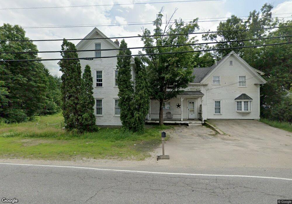
6 S Mast St Goffstown, NH 03045
Estimated Value: $564,000 - $617,000
3
Beds
2
Baths
2,279
Sq Ft
$261/Sq Ft
Est. Value
About This Home
This home is located at 6 S Mast St, Goffstown, NH 03045 and is currently estimated at $594,333, approximately $260 per square foot. 6 S Mast St is a home with nearby schools including Mountain View Middle School, Goffstown High School, and Namaste Montessori School.
Ownership History
Date
Name
Owned For
Owner Type
Purchase Details
Closed on
May 9, 2017
Sold by
Delcous Gregory R
Bought by
Gregory R Delcous Ret
Current Estimated Value
Purchase Details
Closed on
Dec 27, 2000
Sold by
Golding Theresa L and Golding Elsie J
Bought by
Golding Theresa L
Home Financials for this Owner
Home Financials are based on the most recent Mortgage that was taken out on this home.
Original Mortgage
$118,500
Interest Rate
7.7%
Create a Home Valuation Report for This Property
The Home Valuation Report is an in-depth analysis detailing your home's value as well as a comparison with similar homes in the area
Home Values in the Area
Average Home Value in this Area
Purchase History
| Date | Buyer | Sale Price | Title Company |
|---|---|---|---|
| Gregory R Delcous Ret | -- | -- | |
| Golding Theresa L | $40,000 | -- |
Source: Public Records
Mortgage History
| Date | Status | Borrower | Loan Amount |
|---|---|---|---|
| Previous Owner | Golding Theresa L | $25,000 | |
| Previous Owner | Golding Theresa L | $118,500 |
Source: Public Records
Tax History Compared to Growth
Tax History
| Year | Tax Paid | Tax Assessment Tax Assessment Total Assessment is a certain percentage of the fair market value that is determined by local assessors to be the total taxable value of land and additions on the property. | Land | Improvement |
|---|---|---|---|---|
| 2024 | $8,057 | $394,200 | $210,900 | $183,300 |
| 2023 | $7,435 | $394,200 | $210,900 | $183,300 |
| 2022 | $6,622 | $251,700 | $146,000 | $105,700 |
| 2021 | $6,247 | $251,700 | $146,000 | $105,700 |
| 2020 | $6,247 | $251,700 | $146,000 | $105,700 |
| 2019 | $6,187 | $251,700 | $146,000 | $105,700 |
| 2018 | $1,183 | $251,700 | $146,000 | $105,700 |
| 2017 | $6,046 | $220,500 | $124,200 | $96,300 |
| 2016 | $1,273 | $220,500 | $124,200 | $96,300 |
| 2015 | $6,029 | $214,100 | $107,200 | $106,900 |
| 2014 | $5,862 | $217,100 | $107,200 | $109,900 |
Source: Public Records
Map
Nearby Homes
- 12 S Mast St
- 39 S Mast St
- 25 Pleasant St
- 99 Elm St
- 120 S Mast St
- 137 Elm St
- 152 S Mast St
- 16 Palmer Rd
- 22 Winter Hill Rd
- 21A Apple Tree Dr
- 12 Maplewood Ave
- 2 Larch St Unit 1
- 232 N Mast St
- 88 Saunders Rd
- 45 Range Rd
- 914 Back Mountain Rd
- 111 Bog Brook Rd
- 0 Mast Rd Unit 49 5054665
- 99 Cambridge Rd
- 76 Donald Dr
- 5 S Mast St
- 11 S Mast St
- 1 S Mast St
- 3 S Mast St
- 4 Mountain Rd
- 18 S Mast St
- 16B Sudeka Ln
- 19 Sudeka Ln
- 9B Sudeka Ln
- 19 Sudeka Ln
- 9 Knollcrest Rd
- 15 Mountain Rd Unit 204
- 15 Mountain Rd Unit 106
- 15 Mountain Rd Unit 105
- 15 Mountain Rd Unit 202
- 15 Mountain Rd Unit 201
- 15 Mountain Rd Unit 101
- 15 Mountain Rd Unit 203
- 15 Mountain Rd Unit 102
- 15 Mountain Rd Unit 205