


6 Samuel Rd Portland, ME 04103
North Deering Neighborhood
1
Bed
1
Bath
506
Sq Ft
9,365
Sq Ft Lot
About This Home
Property Id: 2270374
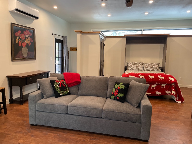
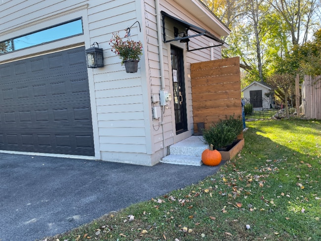
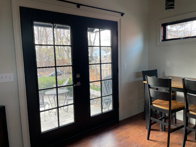
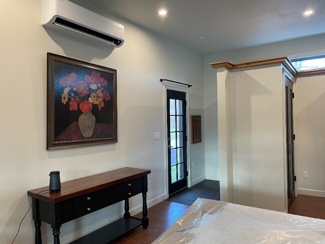
This private entrance studio apt has off street parking, private patio, 10ft. ceiling with fan. All utilities included, its furnished, full fridge, stove with oven, heated bathroom floor. Great quiet little neighborhood, minutes from intown Portland, close to grocery stores and resturants, bus line and schools.
Renters will have a background check, rent-to-income, credit score, and a backround check.
Listing Provided By

Map
Property History
| Date | Event | Price | List to Sale | Price per Sq Ft |
|---|---|---|---|---|
| 12/21/2025 12/21/25 | For Rent | $2,000 | -- | -- |
Nearby Homes
- 30 Chesley Ave
- 74 Chesley Ave
- 32 Harvard Common Unit A
- 1155 Washington Ave
- 1155 Washington Ave Unit 1
- 1155 Washington Ave Unit 2
- 12 Dakota St
- Lots 23-25 Fisher St
- 428 Allen Ave
- 459 Allen Ave Unit 16
- 30 Sanborn St
- 47 Fall Brook St
- 1435 Forest Ave
- 90 Farragut St
- 1 Coolidge Ave
- 2 Apple Ledge Dr Unit A
- 20 Tampa St
- 98 Regan Ln
- 153 Regan Ln
- 1 Holbrook St
- 10 White Birch Ln
- 9 Cornell St Unit 9B Cornell st
- 12 Lawrence Ave
- 1375 Forest Ave
- 1619 Washington Ave
- 836 Washington Ave Unit 10
- 18 Rosedale St
- 121 Ocean Ave Unit 1
- 49 Berkshire Rd
- 147 Pleasant Ave
- 3 Pleasant Ave Unit Clark Lofts on Pleasant
- 46 Saunders St Unit FLOOR 1
- 583 Washington Ave Unit 2
- 123 Glenwood Ave Unit 123GlenwoodAve.
- 41 Winchester Dr
- 70 Pleasant Hill Rd
- 119 Sherwood St Unit 1
- 164 Veranda St
- 164 Veranda St
- 723 Riverside St