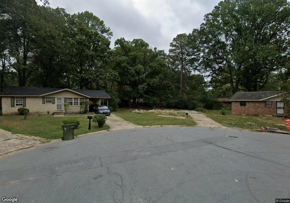
6 Sandhurst Cir Little Rock, AR 72209
Wakefield NeighborhoodEstimated Value: $71,000 - $111,000
--
Bed
3
Baths
900
Sq Ft
$101/Sq Ft
Est. Value
About This Home
This home is located at 6 Sandhurst Cir, Little Rock, AR 72209 and is currently estimated at $90,685, approximately $100 per square foot. 6 Sandhurst Cir is a home located in Pulaski County with nearby schools including Wakefield Elementary School, Cloverdale Middle School, and Little Rock Southwest High School.
Ownership History
Date
Name
Owned For
Owner Type
Purchase Details
Closed on
Jan 6, 2009
Sold by
Talley Liddie G and Talley James W
Bought by
Capital Property Management Llc
Current Estimated Value
Home Financials for this Owner
Home Financials are based on the most recent Mortgage that was taken out on this home.
Original Mortgage
$36,350
Outstanding Balance
$23,853
Interest Rate
5.99%
Mortgage Type
Future Advance Clause Open End Mortgage
Estimated Equity
$66,832
Create a Home Valuation Report for This Property
The Home Valuation Report is an in-depth analysis detailing your home's value as well as a comparison with similar homes in the area
Home Values in the Area
Average Home Value in this Area
Purchase History
| Date | Buyer | Sale Price | Title Company |
|---|---|---|---|
| Capital Property Management Llc | $29,000 | Pulaski County Title |
Source: Public Records
Mortgage History
| Date | Status | Borrower | Loan Amount |
|---|---|---|---|
| Open | Capital Property Management Llc | $36,350 |
Source: Public Records
Tax History Compared to Growth
Tax History
| Year | Tax Paid | Tax Assessment Tax Assessment Total Assessment is a certain percentage of the fair market value that is determined by local assessors to be the total taxable value of land and additions on the property. | Land | Improvement |
|---|---|---|---|---|
| 2025 | $84 | $1,200 | $1,200 | -- |
| 2024 | $669 | $1,200 | $1,200 | -- |
| 2023 | $669 | $11,907 | $1,200 | $10,707 |
| 2022 | $613 | $11,907 | $1,200 | $10,707 |
| 2021 | $561 | $7,960 | $600 | $7,360 |
| 2020 | $557 | $7,960 | $600 | $7,360 |
| 2019 | $557 | $7,960 | $600 | $7,360 |
| 2018 | $557 | $7,960 | $600 | $7,360 |
| 2017 | $557 | $7,960 | $600 | $7,360 |
| 2016 | $594 | $8,480 | $1,800 | $6,680 |
| 2015 | $594 | $8,480 | $1,800 | $6,680 |
| 2014 | $594 | $8,200 | $1,800 | $6,400 |
Source: Public Records
Map
Nearby Homes
- 37 Sheffield Dr
- 29 Rugby Dr
- 19 Daven Ct
- 22 Daven Ct
- 11 Eaton Dr
- 14 Wellford Dr
- 14 Mansfield Dr
- 40 Wellford Dr
- 000 Young Rd
- 31 Allyson Cir
- 7 Linkay Ct
- 7102 Geyer Springs Rd
- 4623 Stratton Ave
- 8301 Stanton Rd
- 5303 W 57th St
- 8406 Dreher Ln
- 5505 Chaucer Ln
- 5900-5908 Geyer Springs
- 8511 Dreher Ln
- 5419 Western Ln
- 7 Sandhurst Cir
- 4 Sandhurst Cir
- 11 Westminister Dr
- 13 Westminister Dr
- 9 Westminister Dr
- 5 Sandhurst Cir
- 11 Exeter Dr
- 9 Exeter Dr
- 15 Exeter Dr
- 7 Westminister Dr
- 17 Exeter Dr
- 3 Sandhurst Cir
- 7 Exeter Dr
- 5 Westminister Dr
- 50 S Wakefield Dr
- 44 S Wakefield Dr
- 19 Exeter Dr
- 12 Westminister Dr
- 14 Westminister Dr
- 10 Westminister Dr