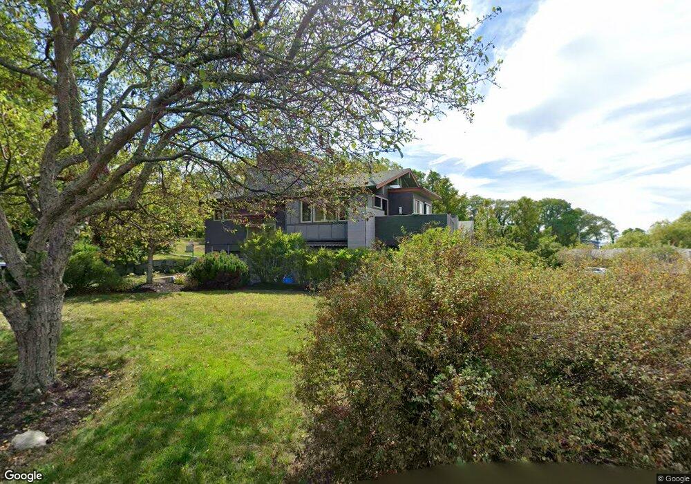
6 Ships Bell Rd Unit 1 Gloucester, MA 01930
Estimated Value: $1,422,000 - $1,904,000
2
Beds
1
Bath
825
Sq Ft
$2,038/Sq Ft
Est. Value
About This Home
This home is located at 6 Ships Bell Rd Unit 1, Gloucester, MA 01930 and is currently estimated at $1,681,366, approximately $2,038 per square foot. 6 Ships Bell Rd Unit 1 is a home located in Essex County with nearby schools including Plum Cove School, Ralph B O'maley Middle School, and Gloucester High School.
Ownership History
Date
Name
Owned For
Owner Type
Purchase Details
Closed on
Apr 3, 2006
Sold by
Anderson William G and Anderson Yvette H
Bought by
Ships Bell Road Assn L
Current Estimated Value
Purchase Details
Closed on
Aug 1, 1971
Bought by
Anderson William G and Anderson Yvette H
Create a Home Valuation Report for This Property
The Home Valuation Report is an in-depth analysis detailing your home's value as well as a comparison with similar homes in the area
Purchase History
| Date | Buyer | Sale Price | Title Company |
|---|---|---|---|
| Ships Bell Road Assn L | -- | -- | |
| Anderson William G | -- | -- |
Source: Public Records
Mortgage History
| Date | Status | Borrower | Loan Amount |
|---|---|---|---|
| Open | Anderson William G | $509,000 | |
| Closed | Anderson William G | $151,500 | |
| Closed | Anderson William G | $523,750 |
Source: Public Records
Tax History
| Year | Tax Paid | Tax Assessment Tax Assessment Total Assessment is a certain percentage of the fair market value that is determined by local assessors to be the total taxable value of land and additions on the property. | Land | Improvement |
|---|---|---|---|---|
| 2025 | $12,197 | $1,253,500 | $664,700 | $588,800 |
| 2024 | $12,197 | $1,253,500 | $664,700 | $588,800 |
| 2023 | $11,572 | $1,092,700 | $593,500 | $499,200 |
| 2022 | $11,170 | $952,300 | $516,500 | $435,800 |
| 2021 | $10,777 | $866,300 | $469,300 | $397,000 |
| 2020 | $10,395 | $843,100 | $442,500 | $400,600 |
| 2019 | $10,762 | $848,100 | $442,500 | $405,600 |
| 2018 | $10,312 | $797,500 | $442,500 | $355,000 |
| 2017 | $10,241 | $776,400 | $421,400 | $355,000 |
| 2016 | $9,884 | $726,200 | $399,500 | $326,700 |
| 2015 | $9,619 | $704,700 | $399,500 | $305,200 |
Source: Public Records
Map
Nearby Homes
- 10 Emerald St
- 43 High St Unit B
- 7 Colburn St
- 94 Phillips Ave
- 13 Phillips Ave
- 32 Haven Ave
- 5 Boulder Top
- 33 Quarry Ridge Ln Unit 33
- 5 Smith St Unit R
- 672 Washington St
- 1 Main St Unit R
- 1 Main St Unit C
- 1 Charte Ct
- 1 Jewett St Unit 2
- 177 Main St
- 27 Hodgkins Rd
- 4 Norwood Ave
- 226 Atlantic St
- 2 Breezy Point Rd
- 34R Summer St
- 6 Ships Bell Rd
- 6 Ships Bell Rd Unit WINTER
- 8 Ships Bell Rd
- 7 Ships Bell Rd Unit 1
- 7 Ships Bell Rd Unit 7
- 7 Ships Bell Rd Unit WINTER
- 9 Ships Bell Rd
- 5 Ships Bell Rd
- 10 Ships Bell Rd
- 2 Ships Bell Rd
- 30 Langsford St
- 8 Wishart Rd
- 3 Ships Bell Rd
- 18 Wishart Rd
- 6 Wishart Rd
- 11 Ships Bell Rd
- 11 Ship's Bell Rd
- 4 Wishart Rd
- 13 Ships Bell Rd
- 42 Langsford St
Your Personal Tour Guide
Ask me questions while you tour the home.