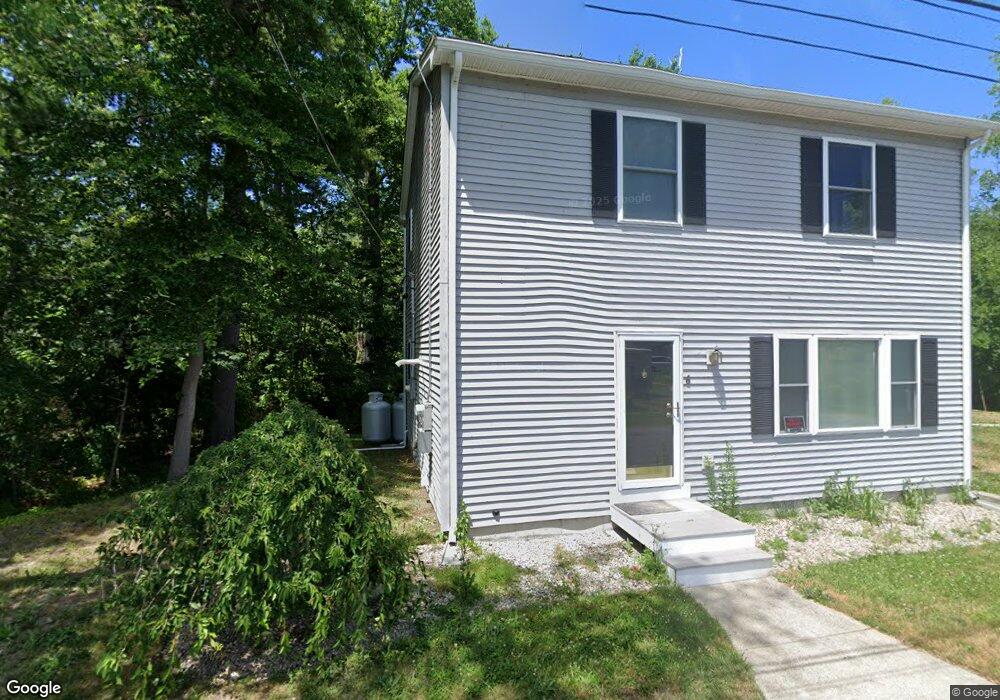
6 Standish St Unit 1 Halifax, MA 02338
Estimated Value: $461,964 - $530,000
2
Beds
2
Baths
1,042
Sq Ft
$471/Sq Ft
Est. Value
About This Home
This home is located at 6 Standish St Unit 1, Halifax, MA 02338 and is currently estimated at $490,991, approximately $471 per square foot. 6 Standish St Unit 1 is a home located in Plymouth County with nearby schools including Silver Lake Regional High School, Halifax Elementary School, and Silver Lake Regional Middle School.
Ownership History
Date
Name
Owned For
Owner Type
Purchase Details
Closed on
Oct 10, 2013
Sold by
Bent 2Nd Dennis R
Bought by
Anderson Christopher A and Mcleaod Maryterese D
Current Estimated Value
Home Financials for this Owner
Home Financials are based on the most recent Mortgage that was taken out on this home.
Original Mortgage
$244,800
Outstanding Balance
$184,163
Interest Rate
4.53%
Mortgage Type
New Conventional
Estimated Equity
$306,828
Purchase Details
Closed on
Mar 10, 2011
Sold by
Gamache Matthew and Gamache Peter
Bought by
Bent Dennis R
Home Financials for this Owner
Home Financials are based on the most recent Mortgage that was taken out on this home.
Original Mortgage
$100,000
Interest Rate
4.83%
Mortgage Type
Purchase Money Mortgage
Create a Home Valuation Report for This Property
The Home Valuation Report is an in-depth analysis detailing your home's value as well as a comparison with similar homes in the area
Home Values in the Area
Average Home Value in this Area
Purchase History
| Date | Buyer | Sale Price | Title Company |
|---|---|---|---|
| Anderson Christopher A | $240,000 | -- | |
| Anderson Christopher A | $240,000 | -- | |
| Bent Dennis R | $50,000 | -- |
Source: Public Records
Mortgage History
| Date | Status | Borrower | Loan Amount |
|---|---|---|---|
| Open | Anderson Christopher A | $244,800 | |
| Closed | Anderson Christopher A | $244,800 | |
| Previous Owner | Bent Dennis R | $100,000 |
Source: Public Records
Tax History Compared to Growth
Tax History
| Year | Tax Paid | Tax Assessment Tax Assessment Total Assessment is a certain percentage of the fair market value that is determined by local assessors to be the total taxable value of land and additions on the property. | Land | Improvement |
|---|---|---|---|---|
| 2025 | $5,144 | $360,500 | $107,900 | $252,600 |
| 2024 | $5,034 | $349,600 | $103,800 | $245,800 |
| 2023 | $4,835 | $324,900 | $100,700 | $224,200 |
| 2022 | $4,846 | $302,700 | $99,900 | $202,800 |
| 2021 | $4,264 | $245,200 | $96,100 | $149,100 |
| 2020 | $4,020 | $230,500 | $96,100 | $134,400 |
| 2019 | $3,791 | $217,000 | $93,300 | $123,700 |
| 2018 | $3,422 | $193,900 | $83,600 | $110,300 |
| 2017 | $3,269 | $176,400 | $74,800 | $101,600 |
| 2016 | $4,071 | $211,500 | $74,100 | $137,400 |
| 2015 | $4,043 | $212,900 | $74,100 | $138,800 |
Source: Public Records
Map
Nearby Homes
- 2 Wood St N
- 29 Ocean Ave
- 35 Dwight St
- 0 Union Park St
- 91 Snow St
- 71 Annawon Dr
- 273 Twin Lakes Dr
- 144 Woodbine Ave
- 43 Buttonwood Rd
- 784 Pleasant St
- 47 Chestnut Rd
- 10 Ridge Rd
- 0 Thompson St
- 8 10th Ave
- 118 Lingan St
- 88 Colby Dr
- 164 Plymouth St
- 151 Plymouth St Unit 151A
- The Wind Plan at Featherwinds
- The Drift Plan at Featherwinds