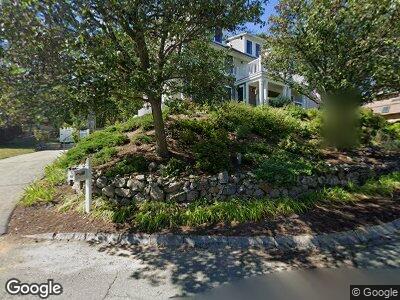
6 Twin Light Cir Unit A Rockport, MA 01966
Estimated Value: $913,726 - $935,000
4
Beds
3
Baths
2,046
Sq Ft
$451/Sq Ft
Est. Value
About This Home
This home is located at 6 Twin Light Cir Unit A, Rockport, MA 01966 and is currently estimated at $921,909, approximately $450 per square foot. 6 Twin Light Cir Unit A is a home located in Essex County with nearby schools including Rockport Elementary School, Rockport Middle School, and Rockport High School.
Ownership History
Date
Name
Owned For
Owner Type
Purchase Details
Closed on
Jul 25, 2003
Sold by
Monroy Maureen E and Monroy Rodney L
Bought by
Mcniff Keith A and Mcniff Catherine A
Current Estimated Value
Create a Home Valuation Report for This Property
The Home Valuation Report is an in-depth analysis detailing your home's value as well as a comparison with similar homes in the area
Home Values in the Area
Average Home Value in this Area
Purchase History
| Date | Buyer | Sale Price | Title Company |
|---|---|---|---|
| Mcniff Keith A | $380,000 | -- |
Source: Public Records
Mortgage History
| Date | Status | Borrower | Loan Amount |
|---|---|---|---|
| Open | Mcniff Catherine | $50,000 | |
| Open | Mcniff Catherine | $257,000 | |
| Closed | Mcniff Keith A | $294,080 | |
| Closed | Mcniff Keith A | $50,000 | |
| Closed | Mcniff Keith A | $35,100 | |
| Closed | Mcniff Keith A | $318,000 |
Source: Public Records
Tax History Compared to Growth
Tax History
| Year | Tax Paid | Tax Assessment Tax Assessment Total Assessment is a certain percentage of the fair market value that is determined by local assessors to be the total taxable value of land and additions on the property. | Land | Improvement |
|---|---|---|---|---|
| 2025 | $7,502 | $856,400 | $0 | $856,400 |
| 2024 | $6,998 | $831,100 | $0 | $831,100 |
| 2023 | $7,086 | $751,400 | $0 | $751,400 |
| 2022 | $7,544 | $768,200 | $0 | $768,200 |
| 2021 | $6,111 | $627,400 | $0 | $627,400 |
| 2020 | $6,302 | $624,000 | $0 | $624,000 |
| 2019 | $6,220 | $630,800 | $0 | $630,800 |
| 2018 | $5,884 | $582,000 | $0 | $582,000 |
| 2017 | $6,317 | $560,000 | $0 | $560,000 |
| 2016 | $6,083 | $540,700 | $0 | $540,700 |
| 2015 | $5,905 | $536,800 | $0 | $536,800 |
| 2014 | $6,041 | $536,000 | $0 | $536,000 |
Source: Public Records
Map
Nearby Homes
- 6 Squam Hill Ct Unit C
- 1 Doctors Run
- 23 Bayridge Ln
- 123 Main St Unit 2
- 3 Railroad Ave
- 6 Highland St
- 5 Boulder Top
- 1 Jewett St Unit 1
- 1 Jewett St Unit 2
- 177 Main St
- 46 High St Unit 3
- 1 Dock Square
- 2 Wharf Rd
- 2 Mount Pleasant St Unit 3
- 42 Bearskin Neck
- 1 Gott St
- 10 Mt Pleasant Unit A
- 90 Pleasant St Unit D
- 9 Hodgkins Rd
- 76 Granite St
- 6 Twin Light Cir Unit B
- 6 Twin Light Cir Unit A
- 6 Twin Light Cir Unit 6B
- 8 Mckays Dr
- 4 Twin Light Cir Unit B
- 4 Twin Light Cir Unit A
- 4 Twin Light Cir Unit WINTER
- 4 Twin Light Cir Unit WINTER
- 4 Twin Light Cir Unit 4A
- 4 Twin Light Cir Unit 4
- 8 Twin Light Cir
- 6 Mckays Dr
- 10 Twin Light Cir
- 7 Mckays Dr
- Lot 51M Twin Light Cir
- 4 Mckays Dr
- 11 Twin Light Cir
- 5 Mckays Dr
- 5 Twin Light Cir
- 9 Twin Light Cir