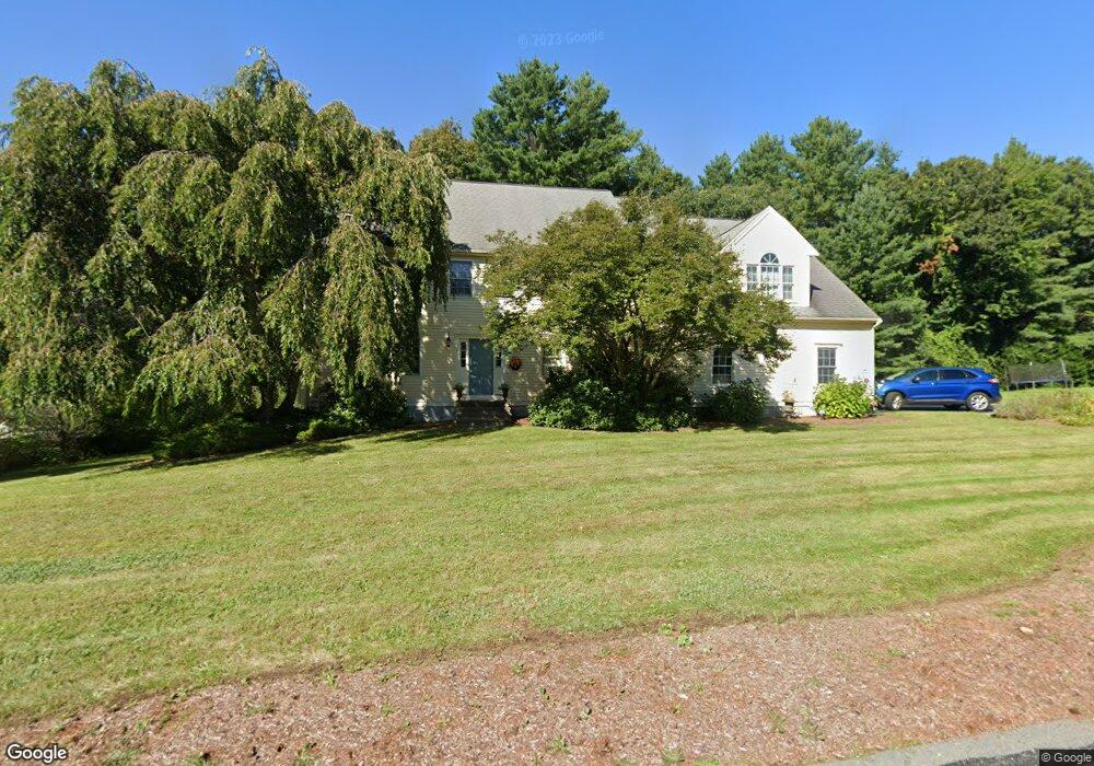
6 Villa Dr Medway, MA 02053
Estimated Value: $900,147 - $1,189,000
4
Beds
3
Baths
3,473
Sq Ft
$294/Sq Ft
Est. Value
About This Home
This home is located at 6 Villa Dr, Medway, MA 02053 and is currently estimated at $1,020,287, approximately $293 per square foot. 6 Villa Dr is a home located in Norfolk County with nearby schools including John D. McGovern Elementary School, Burke-Memorial Elementary, and Medway Middle School.
Ownership History
Date
Name
Owned For
Owner Type
Purchase Details
Closed on
Dec 15, 1998
Sold by
Coras Tr Gregory J
Bought by
Bradford Charles M and Bradford Carole H
Current Estimated Value
Home Financials for this Owner
Home Financials are based on the most recent Mortgage that was taken out on this home.
Original Mortgage
$227,000
Outstanding Balance
$51,652
Interest Rate
6.8%
Mortgage Type
Purchase Money Mortgage
Estimated Equity
$968,635
Create a Home Valuation Report for This Property
The Home Valuation Report is an in-depth analysis detailing your home's value as well as a comparison with similar homes in the area
Home Values in the Area
Average Home Value in this Area
Purchase History
| Date | Buyer | Sale Price | Title Company |
|---|---|---|---|
| Bradford Charles M | $379,900 | -- |
Source: Public Records
Mortgage History
| Date | Status | Borrower | Loan Amount |
|---|---|---|---|
| Open | Bradford Charles M | $227,000 |
Source: Public Records
Tax History Compared to Growth
Tax History
| Year | Tax Paid | Tax Assessment Tax Assessment Total Assessment is a certain percentage of the fair market value that is determined by local assessors to be the total taxable value of land and additions on the property. | Land | Improvement |
|---|---|---|---|---|
| 2025 | $11,810 | $828,800 | $323,400 | $505,400 |
| 2024 | $11,935 | $828,800 | $323,400 | $505,400 |
| 2023 | $11,789 | $739,600 | $294,400 | $445,200 |
| 2022 | $10,784 | $637,000 | $217,700 | $419,300 |
| 2021 | $10,706 | $613,200 | $203,200 | $410,000 |
| 2020 | $10,656 | $608,900 | $203,200 | $405,700 |
| 2019 | $9,963 | $587,100 | $194,900 | $392,200 |
| 2018 | $10,047 | $568,900 | $186,600 | $382,300 |
| 2017 | $9,944 | $554,900 | $182,400 | $372,500 |
| 2016 | $9,551 | $527,400 | $167,900 | $359,500 |
| 2015 | $9,600 | $526,300 | $165,800 | $360,500 |
| 2014 | $9,217 | $489,200 | $165,800 | $323,400 |
Source: Public Records
Map
Nearby Homes
- 280 Village St Unit D2
- 22 Sunset Dr
- 4 Shaw St
- 28 Wellington St
- 14 Heritage Dr
- 176 Main St Unit 3
- 3 Meryl St
- 12 Lovering St
- 36 Lovering St
- 106 Holliston St
- 50 Main St
- 20 Broad St Unit 6
- 20 Broad St Unit A
- 20 Broad St Unit 4
- 14 Sanford St Unit 15
- 21 Riverside Rd
- 220 Main St Unit 220
- 5 Fales St
- 9 Sanford St
- 0 Elm St