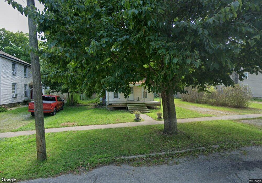
6 W Sharp St Hillsdale, MI 49242
Estimated Value: $147,000 - $160,000
--
Bed
1
Bath
1,032
Sq Ft
$148/Sq Ft
Est. Value
About This Home
This home is located at 6 W Sharp St, Hillsdale, MI 49242 and is currently estimated at $152,911, approximately $148 per square foot. 6 W Sharp St is a home located in Hillsdale County with nearby schools including Bailey Early Childhood Center, Gier Elementary School, and Davis Middle School.
Ownership History
Date
Name
Owned For
Owner Type
Purchase Details
Closed on
Sep 12, 2018
Sold by
Hillsdale County
Bought by
Stier Belle
Current Estimated Value
Purchase Details
Closed on
Mar 3, 2014
Sold by
Frosch Timothy J and Frosch Annette L
Bought by
March Brian
Purchase Details
Closed on
Feb 28, 2014
Sold by
Smith Lezlie and March Lezlie
Bought by
March Brian
Purchase Details
Closed on
Feb 27, 2014
Sold by
Frosch Douglas L and Frosch Lucile
Bought by
March Brian
Purchase Details
Closed on
Nov 21, 2001
Sold by
Frosch Douglas and Frosch Timothy
Bought by
March Brian and March Lezlie
Purchase Details
Closed on
Mar 1, 2001
Sold by
Frosch Douglas and Frosch Timothy
Bought by
March Brian and March Lezlie
Purchase Details
Closed on
Dec 23, 1997
Sold by
Mccluskey John and Mccluskey Jean
Bought by
Frosch Douglas and Frosch Timothy
Create a Home Valuation Report for This Property
The Home Valuation Report is an in-depth analysis detailing your home's value as well as a comparison with similar homes in the area
Home Values in the Area
Average Home Value in this Area
Purchase History
| Date | Buyer | Sale Price | Title Company |
|---|---|---|---|
| Stier Belle | $8,881 | None Available | |
| March Brian | -- | None Available | |
| March Brian | -- | None Available | |
| March Brian | $6,453 | None Available | |
| March Brian | $65,000 | -- | |
| March Brian | $65,000 | -- | |
| Frosch Douglas | $29,900 | -- |
Source: Public Records
Tax History Compared to Growth
Tax History
| Year | Tax Paid | Tax Assessment Tax Assessment Total Assessment is a certain percentage of the fair market value that is determined by local assessors to be the total taxable value of land and additions on the property. | Land | Improvement |
|---|---|---|---|---|
| 2025 | $2,329 | $72,000 | $0 | $0 |
| 2024 | $1,716 | $48,400 | $0 | $0 |
| 2023 | $1,651 | $39,900 | $0 | $0 |
| 2022 | $2,137 | $38,000 | $0 | $0 |
| 2021 | $2,088 | $36,700 | $0 | $0 |
| 2020 | $346 | $9,400 | $0 | $0 |
| 2019 | $338 | $5,700 | $0 | $0 |
| 2018 | $1,511 | $28,300 | $0 | $0 |
| 2017 | $1,467 | $27,300 | $0 | $0 |
| 2016 | $1,378 | $26,600 | $0 | $0 |
| 2015 | $991 | $26,600 | $0 | $0 |
| 2013 | -- | $24,660 | $0 | $0 |
| 2012 | -- | $24,440 | $0 | $0 |
Source: Public Records
Map
Nearby Homes
- 10 Armstrong St
- 95 S West St
- 100 S Manning St
- 134 S Howell St
- 16 W Lynwood Blvd
- 76 Budlong St
- 19 S Norwood Ave
- 192 S West St
- 11 Elm St
- 83 W Lynwood Blvd
- 9 S West St
- 56 Waldron St
- 97 W Hallett St
- 63 S Broad St
- 21 N Norwood St
- 3091-1 S Hillsdale Rd
- 178 Griswold St
- 64 Union St
- 243 Auseon Ct
- 245 Auseon Ct