6 Wayside Ave Byfield, MA 01922
Byfield Village NeighborhoodAbout This Lot
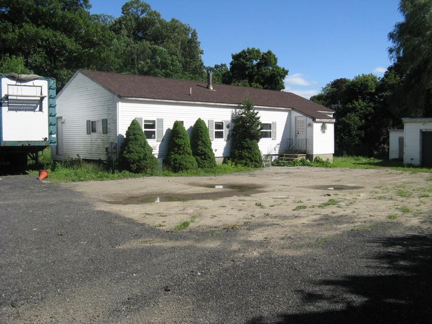
As of December 2016Land presently has mobile home on property, being sold as lot.

Property Details
Property Type
- Land
Est. Annual Taxes
- $2,827
Year Built
- 1972
Lot Details
- 1 Acre Lot
- Level Lot
- Property is zoned r/a
Utilities
- Electricity To Lot Line
- Natural Gas Not Available
- Private Sewer
Listing and Financial Details
- Assessor Parcel Number 2079763
Ownership History
Purchase Details
Purchase Details
Home Financials for this Owner
Home Financials are based on the most recent Mortgage that was taken out on this home.Purchase Details
Home Financials for this Owner
Home Financials are based on the most recent Mortgage that was taken out on this home.Map
Home Values in the Area
Average Home Value in this Area
Purchase History
| Date | Type | Sale Price | Title Company |
|---|---|---|---|
| Quit Claim Deed | -- | None Available | |
| Deed | $125,000 | -- | |
| Deed | $72,500 | -- |
Mortgage History
| Date | Status | Loan Amount | Loan Type |
|---|---|---|---|
| Previous Owner | $170,000 | No Value Available | |
| Previous Owner | $58,000 | Purchase Money Mortgage | |
| Previous Owner | $7,500 | No Value Available |
Property History
| Date | Event | Price | Change | Sq Ft Price |
|---|---|---|---|---|
| 12/29/2016 12/29/16 | Sold | $125,000 | 0.0% | $93 / Sq Ft |
| 12/29/2016 12/29/16 | Sold | $125,000 | -16.7% | $93 / Sq Ft |
| 12/03/2016 12/03/16 | Pending | -- | -- | -- |
| 11/29/2016 11/29/16 | Pending | -- | -- | -- |
| 11/02/2016 11/02/16 | Price Changed | $150,000 | -9.1% | $112 / Sq Ft |
| 09/27/2016 09/27/16 | For Sale | $165,000 | -10.8% | $123 / Sq Ft |
| 07/19/2016 07/19/16 | For Sale | $185,000 | -- | $138 / Sq Ft |
Tax History
| Year | Tax Paid | Tax Assessment Tax Assessment Total Assessment is a certain percentage of the fair market value that is determined by local assessors to be the total taxable value of land and additions on the property. | Land | Improvement |
|---|---|---|---|---|
| 2025 | $3,379 | $453,500 | $254,800 | $198,700 |
| 2024 | $3,401 | $442,800 | $254,800 | $188,000 |
| 2023 | $3,511 | $405,000 | $254,800 | $150,200 |
| 2022 | $3,349 | $344,200 | $215,600 | $128,600 |
| 2021 | $3,226 | $302,600 | $176,400 | $126,200 |
| 2020 | $3,218 | $292,800 | $166,600 | $126,200 |
| 2019 | $3,165 | $292,800 | $166,600 | $126,200 |
| 2018 | $3,068 | $281,500 | $166,600 | $114,900 |
| 2017 | $2,940 | $277,100 | $166,600 | $110,500 |
| 2016 | $2,826 | $247,900 | $137,200 | $110,700 |
| 2015 | $2,737 | $237,600 | $127,400 | $110,200 |
| 2014 | $2,533 | $223,800 | $117,600 | $106,200 |
Source: MLS Property Information Network (MLS PIN)
MLS Number: 72040463
APN: NEWB-000020R-000000-000004A
Disclaimer: Certain information contained herein is derived from information provided by parties other than Homes.com. All information provided is deemed reliable, but is not guaranteed to be accurate and should be independently verified.
![]() The property listing data and information, or the Images, set forth herein were provided to MLS Property Information Network, Inc. from third party sources, including sellers, lessors and public records, and were compiled by MLS Property Information Network, Inc. The property listing data and information, and the Images, are for the personal, non-commercial use of consumers having a good faith interest in purchasing or leasing listed properties of the type displayed to them and may not be used for any purpose other than to identify prospective properties which such consumers may have a good faith interest in purchasing or leasing. MLS Property Information Network, Inc. and its subscribers disclaim any and all representations and warranties as to the accuracy of the property listing data and information, or as to the accuracy of any of the Images, set forth herein.
The property listing data and information, or the Images, set forth herein were provided to MLS Property Information Network, Inc. from third party sources, including sellers, lessors and public records, and were compiled by MLS Property Information Network, Inc. The property listing data and information, and the Images, are for the personal, non-commercial use of consumers having a good faith interest in purchasing or leasing listed properties of the type displayed to them and may not be used for any purpose other than to identify prospective properties which such consumers may have a good faith interest in purchasing or leasing. MLS Property Information Network, Inc. and its subscribers disclaim any and all representations and warranties as to the accuracy of the property listing data and information, or as to the accuracy of any of the Images, set forth herein.
- 55 Pearson Dr
- 15 Central St
- 32 Central St
- 34 Central St
- 5 Courser Brook Dr
- 172 Orchard St
- 18 Forest St
- 18 River St
- LOT 2 Cricket Ln Unit THE BIRCH
- LOT 3 Cricket Ln Unit THE ALDER
- 66 Parish Rd Unit 2
- 66 Parish Rd Unit 3
- 170 Orchard St
- 4 Swanton Way
- 39 Fatherland Dr
- 13 Turkey Hill Rd
- 88 Jackman St
- 2 School St
- 452 North St
- 66 Warren St