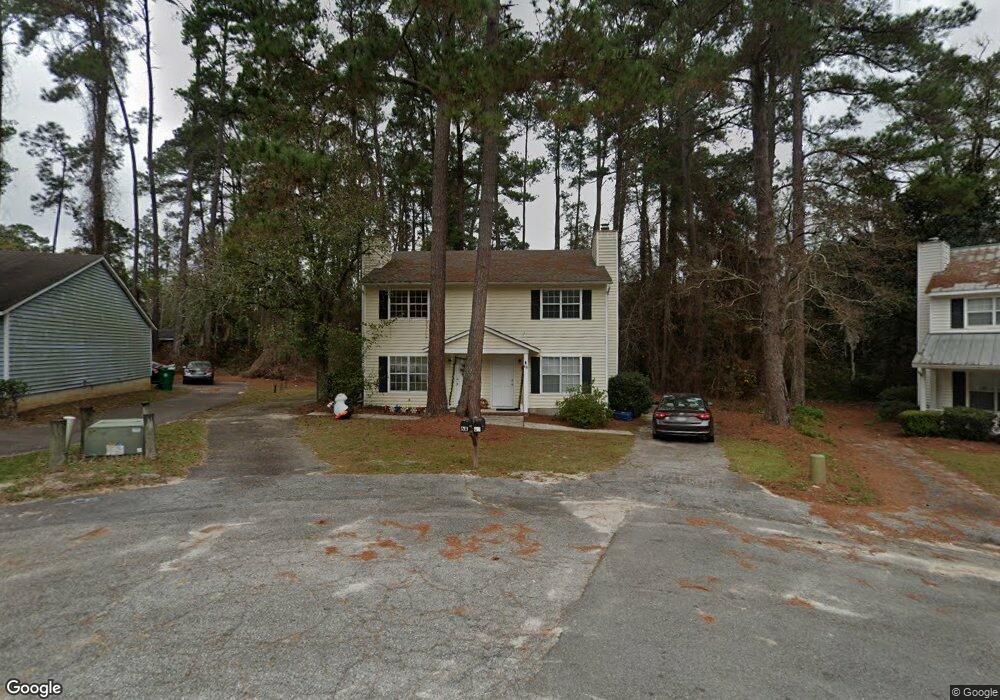
6 Westbrook Cir Valdosta, GA 31602
Estimated Value: $211,000 - $240,671
--
Bed
4
Baths
2,176
Sq Ft
$107/Sq Ft
Est. Value
About This Home
This home is located at 6 Westbrook Cir, Valdosta, GA 31602 and is currently estimated at $232,168, approximately $106 per square foot. 6 Westbrook Cir is a home with nearby schools including S.L. Mason Elementary School, Valdosta Middle School, and Valdosta High School.
Ownership History
Date
Name
Owned For
Owner Type
Purchase Details
Closed on
Feb 5, 2015
Sold by
Vineyard Valdosta Llc
Bought by
Brice Investments Llc
Current Estimated Value
Purchase Details
Closed on
Jul 29, 2005
Sold by
Brown Cat Development Llp
Bought by
Vineyard Valdosta Llc
Home Financials for this Owner
Home Financials are based on the most recent Mortgage that was taken out on this home.
Original Mortgage
$92,667
Interest Rate
5.48%
Mortgage Type
New Conventional
Purchase Details
Closed on
Mar 8, 2002
Sold by
Sineath James B
Bought by
Brown Cat Deveolpment Inc
Purchase Details
Closed on
Oct 9, 1984
Bought by
Sineath James B
Purchase Details
Closed on
Jun 6, 1983
Bought by
Rolling Hills Dev Co
Create a Home Valuation Report for This Property
The Home Valuation Report is an in-depth analysis detailing your home's value as well as a comparison with similar homes in the area
Home Values in the Area
Average Home Value in this Area
Purchase History
| Date | Buyer | Sale Price | Title Company |
|---|---|---|---|
| Brice Investments Llc | $315,000 | -- | |
| Vineyard Valdosta Llc | $570,000 | -- | |
| Brown Cat Deveolpment Inc | $106,700 | -- | |
| Sineath James B | $12,000 | -- | |
| Rolling Hills Dev Co | -- | -- |
Source: Public Records
Mortgage History
| Date | Status | Borrower | Loan Amount |
|---|---|---|---|
| Previous Owner | Vineyard Valdosta Llc | $92,667 |
Source: Public Records
Tax History Compared to Growth
Tax History
| Year | Tax Paid | Tax Assessment Tax Assessment Total Assessment is a certain percentage of the fair market value that is determined by local assessors to be the total taxable value of land and additions on the property. | Land | Improvement |
|---|---|---|---|---|
| 2024 | $1,939 | $69,420 | $12,000 | $57,420 |
| 2023 | $1,939 | $69,420 | $12,000 | $57,420 |
| 2022 | $1,874 | $55,454 | $12,000 | $43,454 |
| 2021 | $1,928 | $55,454 | $12,000 | $43,454 |
| 2020 | $1,490 | $41,948 | $8,000 | $33,948 |
| 2019 | $1,489 | $41,948 | $8,000 | $33,948 |
| 2018 | $1,508 | $41,948 | $8,000 | $33,948 |
| 2017 | $1,519 | $41,948 | $8,000 | $33,948 |
| 2016 | $1,458 | $41,948 | $8,000 | $33,948 |
| 2015 | -- | $41,948 | $8,000 | $33,948 |
| 2014 | $1,415 | $41,948 | $8,000 | $33,948 |
Source: Public Records
Map
Nearby Homes
- 2110 Park Ln
- 2102 Park Ln
- 2121 Northwood Cir
- 2092 S Sherwood Dr Unit L100
- 2092 S Sherwood Dr Unit N118
- 2092 S Sherwood Dr Unit P130
- 2092 S Sherwood Dr
- 2092 S Sherwood Dr Unit P130
- 2092 S Sherwood Dr Unit G52
- 2207 S Sherwood Dr
- 2214 Park Ln
- 2215 Park Ln
- 2243 Oakgrove Cir
- 2208 Dogwood Dr
- 2115 Pinecliff Dr
- 1921 Gornto Rd Unit 19
- 1921 Gornto Rd Unit 5
- 2115 Westfield Dr
- 1205 Mcree Dr
- 2206 Gornto Rd
- 4 Westbrook Cir
- 8 Westbrook Cir Unit B
- 8 Westbrook Cir Unit A & B
- 8 Westbrook Cir
- 8 Westbrook Cir Unit 2
- 8 Westbrook Cir
- 2 Westbrook Cir Unit A/B
- 2 Westbrook Cir
- 2103 S Sherwood Dr
- 7 Westbrook Cir Unit 2
- 7 Westbrook Cir
- 3 Westbrook Cir Unit B
- 3 Westbrook Cir
- 5 Westbrook Cir Unit B
- 2105 S Sherwood Dr
- 1 Westbrook Cir Unit B
- 1 Westbrook Cir Unit A
- 2100 S Sherwood Dr
- 8 Wooddale Dr
- 2102 S Sherwood Dr