
Seller's Agent in 2025
Jim Cosgrove
Magnolia Real Estate
(314) 504-4191
5 in this area
20 Total Sales
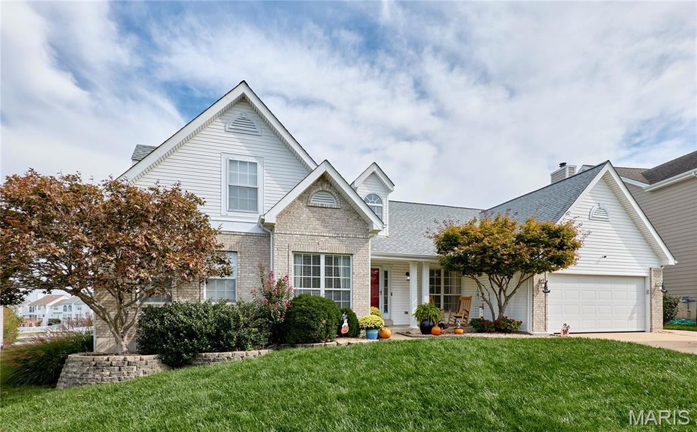
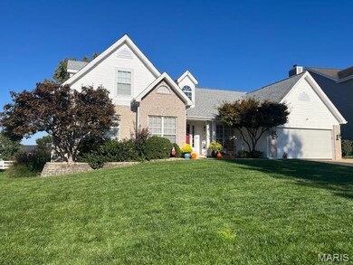
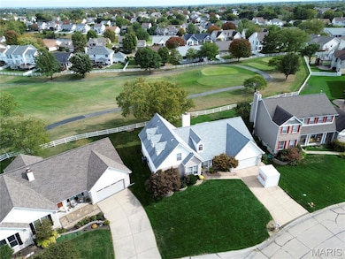
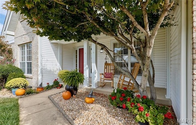
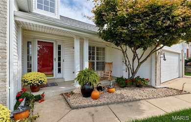
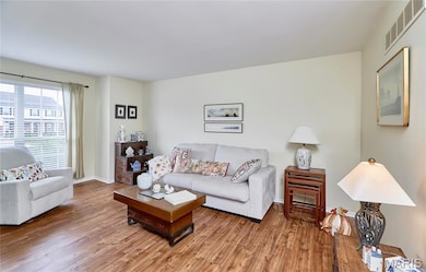
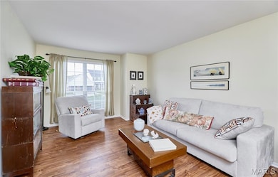
What a find! Picturesque location overlooking the 17th green of the Turtle Creek Golf Course. This spacious and open 1 1/2 story has a unique floor plan with 2 bedrooms on the main level and two bedrooms on the upper level. Gigantic kitchen with a 6x3 island, walk-in pantry to make storage and access easy, newer slate colored appliances (included!), quartz countertop in 2023, beautiful backsplash in 2023 and a planning desk. The spacious vaulted great room also features a wood burning fireplace for cozy nights in the upcoming season. Newer attractive flooring installed in 2025 shows off the living room, dining room and great room. The lower level features an office area, finished walls and other areas along with a full bath and a 16x8 cedar closet. The water heater is new in 2025. Relax and enjoy the view of the course and beautiful landscaping from your 27x14 stamped concrete patio. Come see this home today before it is gone. Friendly dog and cat. Workbench in lower level is excluded.
Last Agent to Sell the Property
Magnolia Real Estate License #1999031549 Listed on: 10/18/2025
| Date | Type | Sale Price | Title Company |
|---|---|---|---|
| Warranty Deed | -- | Investors Title | |
| Warranty Deed | $240,000 | -- | |
| Warranty Deed | -- | -- | |
| Warranty Deed | -- | -- |
| Date | Status | Loan Amount | Loan Type |
|---|---|---|---|
| Open | $275,000 | New Conventional | |
| Previous Owner | $228,000 | No Value Available | |
| Previous Owner | $162,000 | No Value Available | |
| Previous Owner | $130,000 | No Value Available |
| Date | Event | Price | List to Sale | Price per Sq Ft |
|---|---|---|---|---|
| 11/20/2025 11/20/25 | Sold | -- | -- | -- |
| 10/19/2025 10/19/25 | Pending | -- | -- | -- |
| 10/18/2025 10/18/25 | For Sale | $455,000 | -- | $169 / Sq Ft |
| Year | Tax Paid | Tax Assessment Tax Assessment Total Assessment is a certain percentage of the fair market value that is determined by local assessors to be the total taxable value of land and additions on the property. | Land | Improvement |
|---|---|---|---|---|
| 2025 | $5,033 | $83,816 | -- | -- |
| 2023 | $5,035 | $76,261 | -- | -- |
| 2022 | $4,360 | $61,412 | $0 | $0 |
| 2021 | $4,364 | $61,412 | $0 | $0 |
| 2020 | $4,248 | $57,884 | $0 | $0 |
| 2019 | $4,258 | $57,884 | $0 | $0 |
| 2018 | $3,986 | $51,720 | $0 | $0 |
| 2017 | $3,941 | $51,720 | $0 | $0 |
| 2016 | $3,770 | $49,275 | $0 | $0 |
| 2015 | $3,504 | $49,275 | $0 | $0 |
| 2014 | $3,574 | $49,413 | $0 | $0 |
Seller's Agent in 2025
Jim Cosgrove
Magnolia Real Estate
(314) 504-4191
5 in this area
20 Total Sales
D
Buyer's Agent in 2025
Drake Walsh
Realty Executives
1 in this area
2 Total Sales
Source: MARIS MLS
MLS Number: MIS25069567
APN: 2-0060-7229-00-0453.0000000
Disclaimer: Certain information contained herein is derived from information provided by parties other than Homes.com. All information provided is deemed reliable, but is not guaranteed to be accurate and should be independently verified.
![]() Based on information submitted to the MLS GRID. All data is obtained from various sources and may not have been verified by broker or MLS GRID. Supplied Open House Information is subject to change without notice. All information should be independently reviewed and verified for accuracy. Properties may or may not be listed by the office/agent presenting the information. Some IDX listings have been excluded from this website.
Based on information submitted to the MLS GRID. All data is obtained from various sources and may not have been verified by broker or MLS GRID. Supplied Open House Information is subject to change without notice. All information should be independently reviewed and verified for accuracy. Properties may or may not be listed by the office/agent presenting the information. Some IDX listings have been excluded from this website.
Based on information submitted to the MLS GRID
Ask me questions while you tour the home.