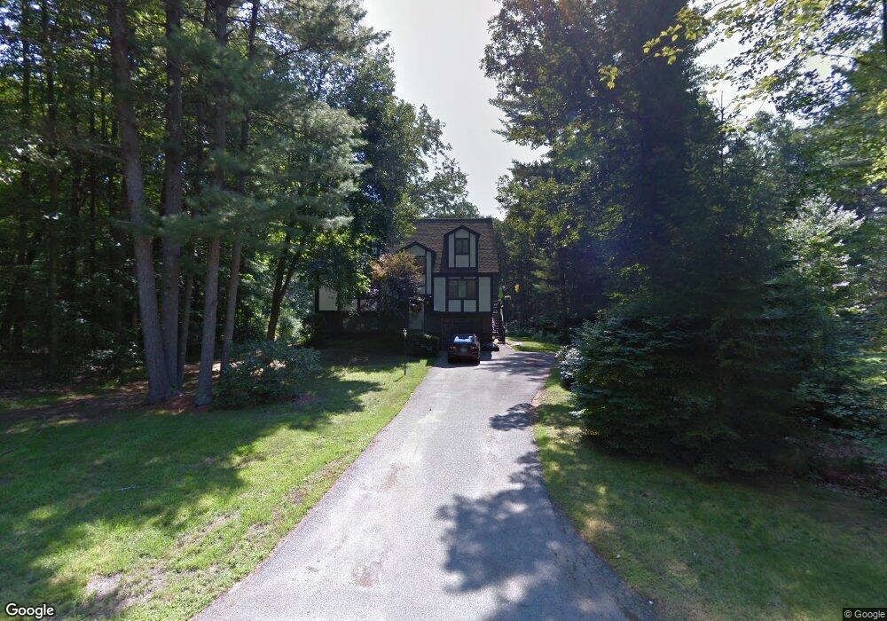
6 Wyandot Cir Londonderry, NH 03053
Estimated Value: $569,744 - $634,000
3
Beds
3
Baths
1,658
Sq Ft
$357/Sq Ft
Est. Value
About This Home
This home is located at 6 Wyandot Cir, Londonderry, NH 03053 and is currently estimated at $591,436, approximately $356 per square foot. 6 Wyandot Cir is a home with nearby schools including North Londonderry Elementary School, Londonderry Middle School, and Londonderry Senior High School.
Create a Home Valuation Report for This Property
The Home Valuation Report is an in-depth analysis detailing your home's value as well as a comparison with similar homes in the area
Home Values in the Area
Average Home Value in this Area
Tax History Compared to Growth
Tax History
| Year | Tax Paid | Tax Assessment Tax Assessment Total Assessment is a certain percentage of the fair market value that is determined by local assessors to be the total taxable value of land and additions on the property. | Land | Improvement |
|---|---|---|---|---|
| 2024 | $7,260 | $449,800 | $202,400 | $247,400 |
| 2023 | $7,144 | $456,500 | $202,400 | $254,100 |
| 2022 | $7,124 | $385,500 | $151,800 | $233,700 |
| 2021 | $7,085 | $385,500 | $151,800 | $233,700 |
| 2020 | $6,892 | $342,700 | $122,400 | $220,300 |
| 2019 | $6,645 | $342,700 | $122,400 | $220,300 |
| 2018 | $6,150 | $282,100 | $101,500 | $180,600 |
| 2017 | $6,096 | $282,100 | $101,500 | $180,600 |
| 2016 | $6,065 | $282,100 | $101,500 | $180,600 |
| 2015 | $5,930 | $282,100 | $101,500 | $180,600 |
| 2014 | $5,949 | $282,100 | $101,500 | $180,600 |
| 2011 | -- | $287,000 | $101,500 | $185,500 |
Source: Public Records
Map
Nearby Homes
- 8 Iroquois Cir
- 15 Harvey Rd
- 15 Tamarack Ct
- 67 Pullman St
- 29 Watts Landing Unit 24
- 53 Pine Ave
- 35 Red Deer Rd
- 3-C Mustang Dr Unit MODEL
- 224 High Range Rd
- 4543 Brown Ave
- 4481 Brown Ave
- 27 Buckingham Dr
- 9 Mustang Dr Unit C
- 9 Mustang Dr Unit B
- 7 Mustang Dr Unit C
- 7 Mustang Dr Unit END UNIT-A
- 4243 Brown Ave
- 769 Daniel Webster Hwy
- 490 Charles Bancroft Hwy
- 5 Hickory Hill Dr