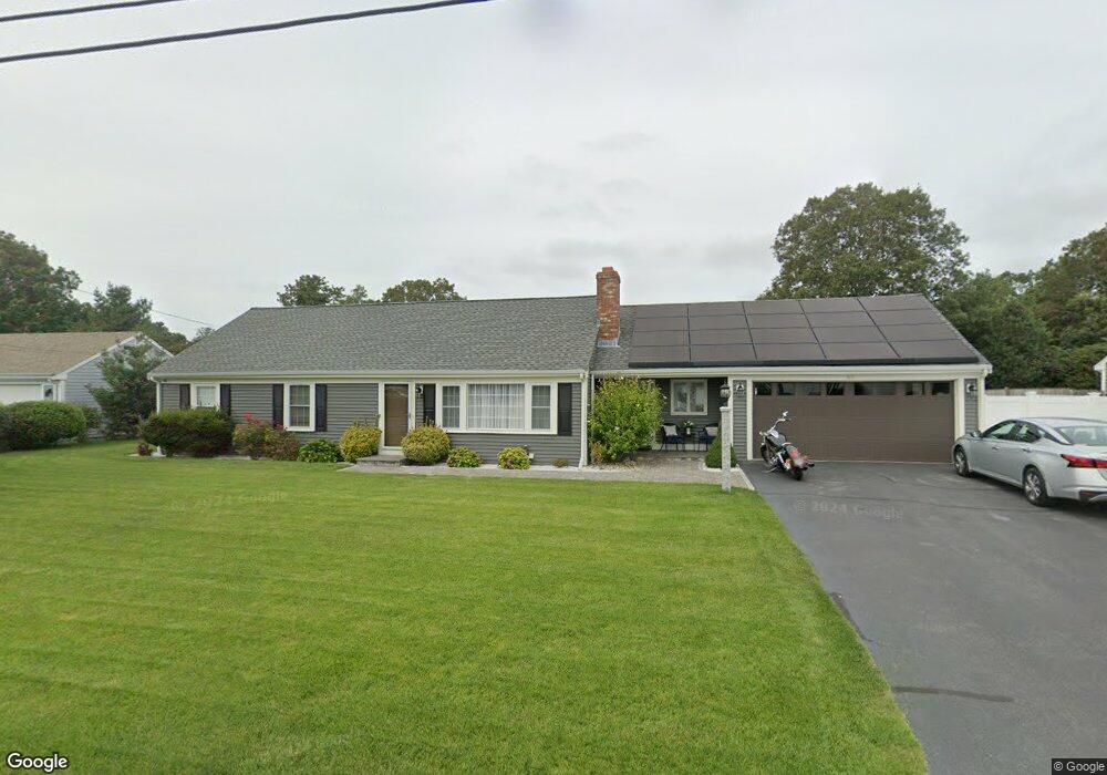
60 Capt Lothrop Rd South Yarmouth, MA 02664
Estimated Value: $646,605 - $706,000
3
Beds
2
Baths
1,516
Sq Ft
$445/Sq Ft
Est. Value
About This Home
This home is located at 60 Capt Lothrop Rd, South Yarmouth, MA 02664 and is currently estimated at $673,901, approximately $444 per square foot. 60 Capt Lothrop Rd is a home located in Barnstable County with nearby schools including Dennis-Yarmouth Regional High School and St. Pius X. School.
Ownership History
Date
Name
Owned For
Owner Type
Purchase Details
Closed on
Nov 9, 2017
Sold by
Parent John R and Cunningham Eric F
Bought by
Pereira Wanderson L and Pereira Virginia A
Current Estimated Value
Home Financials for this Owner
Home Financials are based on the most recent Mortgage that was taken out on this home.
Original Mortgage
$319,920
Outstanding Balance
$267,936
Interest Rate
3.83%
Mortgage Type
New Conventional
Estimated Equity
$405,965
Purchase Details
Closed on
Jun 30, 2017
Sold by
Fnma
Bought by
Cunningham Eric F and Parent John R
Purchase Details
Closed on
Mar 27, 2017
Sold by
Bailey Janet M
Bought by
Federal National Mortgage Association
Create a Home Valuation Report for This Property
The Home Valuation Report is an in-depth analysis detailing your home's value as well as a comparison with similar homes in the area
Home Values in the Area
Average Home Value in this Area
Purchase History
| Date | Buyer | Sale Price | Title Company |
|---|---|---|---|
| Pereira Wanderson L | $399,900 | -- | |
| Cunningham Eric F | $275,000 | -- | |
| Federal National Mortgage Association | $284,000 | -- |
Source: Public Records
Mortgage History
| Date | Status | Borrower | Loan Amount |
|---|---|---|---|
| Open | Pereira Wanderson L | $319,920 |
Source: Public Records
Tax History Compared to Growth
Tax History
| Year | Tax Paid | Tax Assessment Tax Assessment Total Assessment is a certain percentage of the fair market value that is determined by local assessors to be the total taxable value of land and additions on the property. | Land | Improvement |
|---|---|---|---|---|
| 2025 | $4,210 | $594,700 | $178,500 | $416,200 |
| 2024 | $3,935 | $533,200 | $151,000 | $382,200 |
| 2023 | $3,812 | $470,000 | $130,700 | $339,300 |
| 2022 | $3,568 | $388,700 | $118,800 | $269,900 |
| 2021 | $3,321 | $347,400 | $118,800 | $228,600 |
| 2020 | $3,226 | $322,600 | $118,800 | $203,800 |
| 2019 | $2,957 | $292,800 | $118,800 | $174,000 |
| 2018 | $2,600 | $252,700 | $101,200 | $151,500 |
| 2017 | $2,488 | $248,300 | $96,800 | $151,500 |
| 2016 | $2,390 | $239,500 | $88,000 | $151,500 |
| 2015 | $2,485 | $247,500 | $88,000 | $159,500 |
Source: Public Records
Map
Nearby Homes
- 76 Captain Chase Rd
- 75 Captain York Rd
- 147 Captain Bacon Rd
- 338 Forest Rd
- 72 Quartermaster Row
- 33 Sparrow Way
- 255 Long Pond Dr
- 30 Quartermaster Row
- 38 Autumn Dr
- 55 Lower Brook Rd
- 0 Forsyth Ave
- 105 Webbers Path
- 24 Fast Brook Rd
- 9 Victory Ln
- 3 Saturn Ln
- 17 Trowbridge Path
- 17 Merganser Ln
- 4 Raymond Ave
- 26 Grouse Ln
- 60 Captain Lothrop Rd
- 56 Capt Lothrop Rd
- 66 Captain Lothrop Rd
- 19 Capt Besse Rd
- 19 Captain Besse Rd
- 2 Captain Daniel Rd
- 15 Captain Besse Rd
- 25 Captain Besse Rd
- 53 Capt Lothrop Rd
- 50 Captain Lothrop Rd
- 53 Captain Lothrop Rd
- 3 Captain Daniel Rd
- 70 Captain Lothrop Rd
- 9 Captain Besse Rd
- 50 Capt Lothrop Rd
- 15 Capt Besse Rd
- 8 Captain Daniel Rd
- 9 Capt Crocker
- 18 Capt Besse Rd
- 9 Captain Crocker Rd