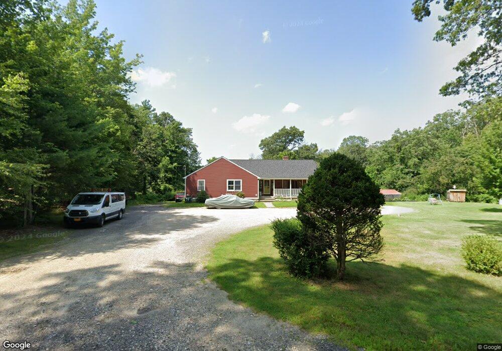
60 Duval Rd Sutton, MA 01590
Estimated Value: $466,000 - $594,987
4
Beds
2
Baths
1,752
Sq Ft
$313/Sq Ft
Est. Value
About This Home
This home is located at 60 Duval Rd, Sutton, MA 01590 and is currently estimated at $547,747, approximately $312 per square foot. 60 Duval Rd is a home located in Worcester County with nearby schools including Sutton Elementary School, Sutton Middle School, and Sutton High School.
Ownership History
Date
Name
Owned For
Owner Type
Purchase Details
Closed on
Jun 16, 2021
Sold by
Banville George and Banville Stella
Bought by
Banville James P and Banville Courtney
Current Estimated Value
Home Financials for this Owner
Home Financials are based on the most recent Mortgage that was taken out on this home.
Original Mortgage
$220,000
Outstanding Balance
$199,183
Interest Rate
2.9%
Mortgage Type
Purchase Money Mortgage
Estimated Equity
$348,564
Purchase Details
Closed on
Mar 30, 2015
Sold by
Banville George and Banville Stella
Bought by
Banville George and Banville Stella
Create a Home Valuation Report for This Property
The Home Valuation Report is an in-depth analysis detailing your home's value as well as a comparison with similar homes in the area
Home Values in the Area
Average Home Value in this Area
Purchase History
| Date | Buyer | Sale Price | Title Company |
|---|---|---|---|
| Banville James P | $250,000 | None Available | |
| Banville George | -- | -- |
Source: Public Records
Mortgage History
| Date | Status | Borrower | Loan Amount |
|---|---|---|---|
| Open | Banville James P | $220,000 |
Source: Public Records
Tax History
| Year | Tax Paid | Tax Assessment Tax Assessment Total Assessment is a certain percentage of the fair market value that is determined by local assessors to be the total taxable value of land and additions on the property. | Land | Improvement |
|---|---|---|---|---|
| 2025 | $6,942 | $577,500 | $180,800 | $396,700 |
| 2024 | $7,064 | $557,100 | $173,000 | $384,100 |
| 2023 | $6,372 | $460,100 | $157,000 | $303,100 |
| 2022 | $6,661 | $438,800 | $125,800 | $313,000 |
| 2021 | $6,010 | $375,600 | $125,800 | $249,800 |
| 2020 | $5,957 | $375,600 | $125,800 | $249,800 |
| 2019 | $5,618 | $340,100 | $125,800 | $214,300 |
| 2018 | $5,117 | $309,200 | $107,200 | $202,000 |
| 2017 | $4,970 | $301,200 | $94,300 | $206,900 |
| 2016 | $4,901 | $293,800 | $94,300 | $199,500 |
| 2015 | $4,735 | $283,900 | $94,300 | $189,600 |
| 2014 | $4,583 | $271,500 | $93,500 | $178,000 |
Source: Public Records
Map
Nearby Homes
- 4 1st St
- 108 Mumford St
- 19 Birch St
- 18 Lakeshore Dr
- 266 Putnam Hill Rd
- 36 Compass Point Dr Unit 36
- 26 Compass Point Dr Unit 26
- 33 Nautical Way Unit 107
- 22 Gilboa St
- 8 Hough Rd
- 5 B St
- Lot 27 Cedar St
- 3 S East Main St
- 408 NE Main St
- 2 White Ct
- 60 Webster St
- 80 Barnett Rd
- 41 Martin Rd
- 24 Manchaug Rd
- 109 Mendon Rd
Your Personal Tour Guide
Ask me questions while you tour the home.