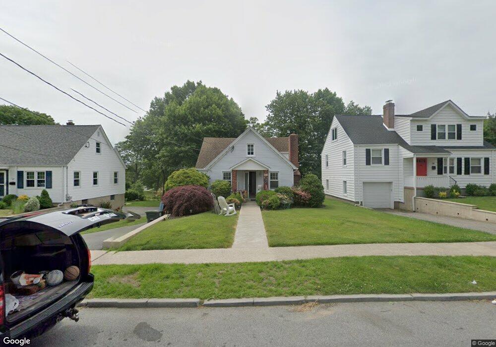
60 Halstead Ave Port Chester, NY 10573
Estimated Value: $524,000 - $630,626
2
Beds
1
Bath
1,404
Sq Ft
$415/Sq Ft
Est. Value
About This Home
This home is located at 60 Halstead Ave, Port Chester, NY 10573 and is currently estimated at $582,407, approximately $414 per square foot. 60 Halstead Ave is a home located in Westchester County with nearby schools including Port Chester Middle School, Port Chester Senior High School, and Corpus Christi Holy Rosary School.
Ownership History
Date
Name
Owned For
Owner Type
Purchase Details
Closed on
Oct 19, 2022
Sold by
Hansen Family Trust
Bought by
Antaki Michael and Antaki Joann
Current Estimated Value
Purchase Details
Closed on
Mar 28, 2011
Sold by
Hansen Richard W
Bought by
Nethercott Becky and Hansen Heidi
Purchase Details
Closed on
Mar 4, 2008
Sold by
Hansen Kathy and Hansen Richard W
Bought by
Hansen Richard W
Create a Home Valuation Report for This Property
The Home Valuation Report is an in-depth analysis detailing your home's value as well as a comparison with similar homes in the area
Home Values in the Area
Average Home Value in this Area
Purchase History
| Date | Buyer | Sale Price | Title Company |
|---|---|---|---|
| Antaki Michael | $425,000 | Great American Title | |
| Nethercott Becky | -- | None Available | |
| Hansen Richard W | -- | None Available |
Source: Public Records
Tax History Compared to Growth
Tax History
| Year | Tax Paid | Tax Assessment Tax Assessment Total Assessment is a certain percentage of the fair market value that is determined by local assessors to be the total taxable value of land and additions on the property. | Land | Improvement |
|---|---|---|---|---|
| 2024 | $12,404 | $540,800 | $189,900 | $350,900 |
| 2023 | $11,597 | $520,000 | $180,800 | $339,200 |
| 2022 | $10,182 | $481,500 | $180,800 | $300,700 |
| 2021 | $10,888 | $458,600 | $180,800 | $277,800 |
| 2020 | $10,603 | $458,600 | $180,800 | $277,800 |
| 2019 | $12,374 | $408,700 | $168,200 | $240,500 |
| 2018 | $7,496 | $403,500 | $165,200 | $238,300 |
| 2017 | $1,695 | $396,700 | $163,800 | $232,900 |
| 2016 | $9,298 | $385,000 | $162,800 | $222,200 |
| 2015 | -- | $379,800 | $166,200 | $213,600 |
| 2014 | -- | $371,400 | $150,700 | $220,700 |
| 2013 | -- | $375,600 | $146,100 | $229,500 |
Source: Public Records
Map
Nearby Homes
- 238 Madison Ave
- 38 Riverdale Ave
- 531 1/2 Willett Ave
- 53 Linden St
- 28 1/2 Pilgrim Dr
- 17 Austin Place
- 180 Madison Ave
- 567 King St
- 563 King St
- 565 King St
- 340 Locust Ave
- 263 N Regent St
- 70 Byram Terrace Dr
- 3 Green Ln
- 29 Clermont Ave
- 107 Pemberwick Rd
- 256 N Regent St
- 412 Orchard St
- 106 Puritan Dr
- 53 Upland St
- 64 Halstead Ave
- 68 Halstead Ave
- 56 Halstead Ave
- 54 Halstead Ave
- 74 Halstead Ave
- 50 Halstead Ave
- 61 Halstead Ave
- 55 Halstead Ave
- 63 Halstead Ave
- 51 Halstead Ave
- 67 Halstead Ave
- 76 Halstead Ave
- 71 Halstead Ave
- 48 Halstead Ave
- 47 Halstead Ave Unit 2
- 47 Halstead Ave Unit 1
- 47 Halstead Ave
- 595 Locust Ave
- 73 Halstead Ave
- 80 Halstead Ave