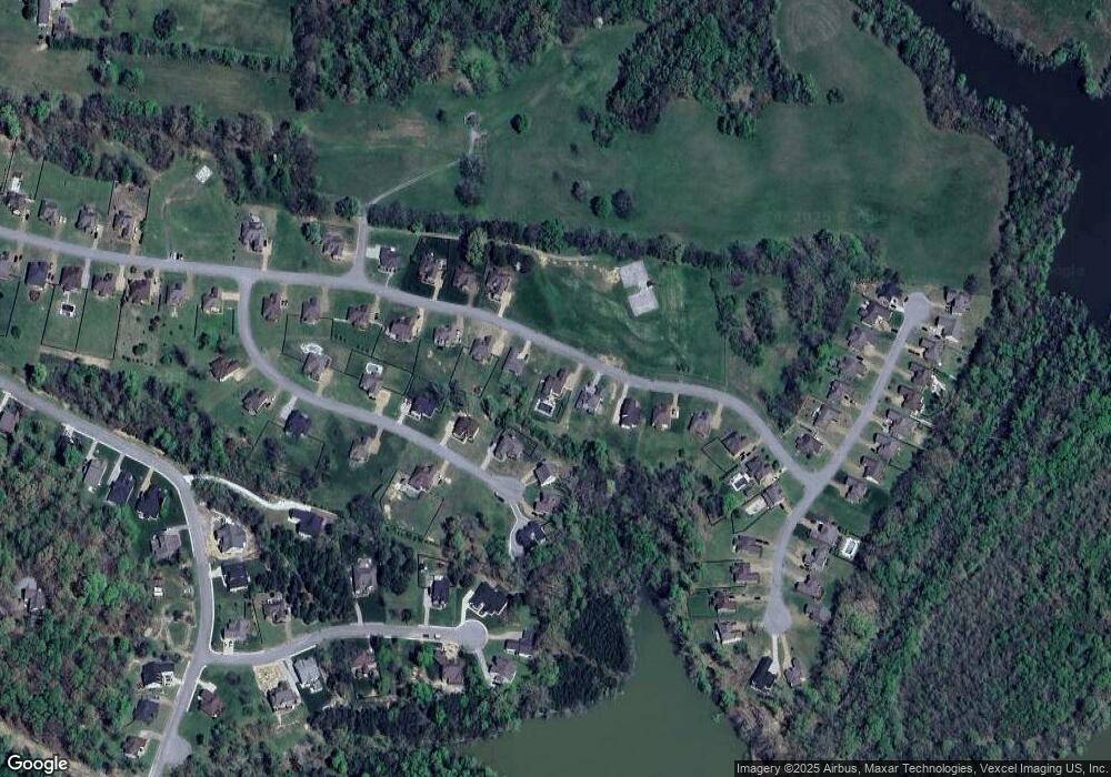
60 Harbor Point Unit 56 Lebanon, TN 37087
Estimated Value: $641,000 - $710,455
--
Bed
1
Bath
3,883
Sq Ft
$175/Sq Ft
Est. Value
About This Home
This home is located at 60 Harbor Point Unit 56, Lebanon, TN 37087 and is currently estimated at $678,864, approximately $174 per square foot. 60 Harbor Point Unit 56 is a home located in Wilson County with nearby schools including Carroll Oakland Elementary School and Lebanon High School.
Ownership History
Date
Name
Owned For
Owner Type
Purchase Details
Closed on
Oct 31, 2019
Sold by
Consuelo Uriel Gonzales
Bought by
Kirkland Brandon and Kirkland Caryn
Current Estimated Value
Home Financials for this Owner
Home Financials are based on the most recent Mortgage that was taken out on this home.
Original Mortgage
$350,276
Outstanding Balance
$308,764
Interest Rate
3.7%
Mortgage Type
New Conventional
Estimated Equity
$370,100
Purchase Details
Closed on
Aug 3, 2017
Sold by
Johnson Earl W and Johnson Johnnie C
Bought by
Consuleo Uriel Gonzalez
Purchase Details
Closed on
Jul 28, 2010
Sold by
Cairo 70 Investors Llc
Bought by
Johnson Earl W
Create a Home Valuation Report for This Property
The Home Valuation Report is an in-depth analysis detailing your home's value as well as a comparison with similar homes in the area
Home Values in the Area
Average Home Value in this Area
Purchase History
| Date | Buyer | Sale Price | Title Company |
|---|---|---|---|
| Kirkland Brandon | $385,000 | Birthright Title Agency | |
| Consuleo Uriel Gonzalez | $33,000 | Horizon Land Title Inc | |
| Johnson Earl W | $49,900 | -- |
Source: Public Records
Mortgage History
| Date | Status | Borrower | Loan Amount |
|---|---|---|---|
| Open | Kirkland Brandon | $350,276 |
Source: Public Records
Tax History Compared to Growth
Tax History
| Year | Tax Paid | Tax Assessment Tax Assessment Total Assessment is a certain percentage of the fair market value that is determined by local assessors to be the total taxable value of land and additions on the property. | Land | Improvement |
|---|---|---|---|---|
| 2024 | $2,233 | $117,000 | $11,750 | $105,250 |
| 2022 | $2,057 | $107,775 | $11,750 | $96,025 |
| 2021 | $2,057 | $107,775 | $11,750 | $96,025 |
| 2020 | $2,196 | $107,775 | $11,750 | $96,025 |
| 2019 | $296 | $86,850 | $11,750 | $75,100 |
| 2018 | $296 | $11,750 | $11,750 | $0 |
| 2017 | $296 | $11,750 | $11,750 | $0 |
| 2016 | $296 | $11,750 | $11,750 | $0 |
| 2015 | $302 | $11,750 | $11,750 | $0 |
| 2014 | $235 | $9,144 | $0 | $0 |
Source: Public Records
Map
Nearby Homes
- 64 Harbor Point
- 403 Zephyr Cove
- 304 Cedar Hollow Ct
- 2 Angels Cove Ln
- 3 Angels Cove Ln
- 139 Angels Cove Ln
- 146 Angels Cove Ln
- 1113 E Robertson Rd
- 371 Wilson Boat Dock Rd
- 232 Twin Cove Dr
- 256 Twin Cove Dr
- 306 Twin Cove Dr
- 6014 Bluewater Dr
- 6007 Bluewater Dr
- 939 Newton Ln
- 653 Flippen Rd
- 409 Stone Brook Way
- 1080 Martha Ln
- 324 Lakeview Rd
- 304 Stonebrook Point
- 60 Harbor Point
- 60 Harbor Point
- 62 Harbor Point
- 58 Harbor Pointe
- 58 Harbor Pointe Unit 57
- 58 Harbor Point Unit 58
- 58 Harbor Point
- 62 Harbor Point
- 58 Harbor Point
- 111 Mallard Point
- 111 Mallard Point Unit 67
- 111 Mallard Point
- 111 Mallard Point
- 64 Harbor Point Unit 54
- 64 Harbor Pointe
- 64 Harbor Pointe Unit 54
- 56 Harbor Point Unit 58
- 113 Mallard Point Unit 68
- 113 Mallard Point
- 109 Mallard Point
