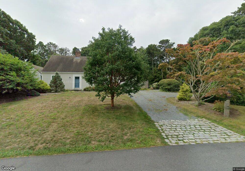
60 Ireland Way Eastham, MA 02642
Estimated Value: $796,000 - $979,000
3
Beds
2
Baths
2,172
Sq Ft
$407/Sq Ft
Est. Value
About This Home
This home is located at 60 Ireland Way, Eastham, MA 02642 and is currently estimated at $883,893, approximately $406 per square foot. 60 Ireland Way is a home located in Barnstable County with nearby schools including Eastham Elementary School, Nauset Regional Middle School, and Nauset Regional High School.
Create a Home Valuation Report for This Property
The Home Valuation Report is an in-depth analysis detailing your home's value as well as a comparison with similar homes in the area
Home Values in the Area
Average Home Value in this Area
Tax History Compared to Growth
Tax History
| Year | Tax Paid | Tax Assessment Tax Assessment Total Assessment is a certain percentage of the fair market value that is determined by local assessors to be the total taxable value of land and additions on the property. | Land | Improvement |
|---|---|---|---|---|
| 2025 | $6,311 | $818,500 | $288,400 | $530,100 |
| 2024 | $5,567 | $794,200 | $280,000 | $514,200 |
| 2023 | $5,162 | $713,000 | $259,300 | $453,700 |
| 2022 | $4,782 | $557,300 | $231,500 | $325,800 |
| 2021 | $4,649 | $506,400 | $210,400 | $296,000 |
| 2020 | $4,506 | $516,800 | $236,200 | $280,600 |
| 2019 | $4,227 | $512,400 | $239,800 | $272,600 |
| 2018 | $4,155 | $497,600 | $232,800 | $264,800 |
| 2017 | $3,878 | $490,900 | $228,200 | $262,700 |
| 2016 | $3,474 | $466,900 | $198,500 | $268,400 |
| 2015 | $3,162 | $445,400 | $194,600 | $250,800 |
Source: Public Records
Map
Nearby Homes
- 10 Cartway N
- 20 Boat Meadow Way
- 20 White Pines Dr
- 385 Bridge Rd
- 480 Dyer Prince Rd
- 339 Dyer Prince Rd
- 59 Bridge Rd
- 330 Hay Rd
- 785 State Hwy Unit 9
- 320 State Hwy
- 150 Old State Hwy Unit Compound
- 993 Intonti Way
- 995 Intonti Way
- 181 Rock Harbor Rd
- 1061 State Hwy Unit 4
- 180 Country Ln
- 188 Rock Harbor Rd
- 20 Kittiwake Ln
- 25 Twin Rocks Dr
- 6 Defiance Ln