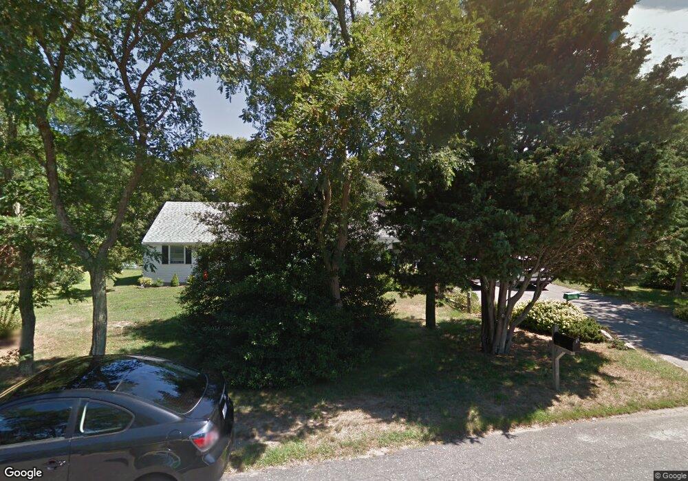
60 Leeward Way Eastham, MA 02642
Estimated Value: $849,268 - $964,000
3
Beds
3
Baths
1,970
Sq Ft
$451/Sq Ft
Est. Value
About This Home
This home is located at 60 Leeward Way, Eastham, MA 02642 and is currently estimated at $887,817, approximately $450 per square foot. 60 Leeward Way is a home located in Barnstable County with nearby schools including Eastham Elementary School, Nauset Regional Middle School, and Nauset Regional High School.
Ownership History
Date
Name
Owned For
Owner Type
Purchase Details
Closed on
Jul 15, 2025
Sold by
Ellen P Lariviere Ret and Lariviere
Bought by
Lariviere Ellen P and Kaye Laurie
Current Estimated Value
Purchase Details
Closed on
May 14, 2019
Sold by
Lariviere Ellen P
Bought by
Ellen P Lariviere Ret
Purchase Details
Closed on
Dec 28, 1984
Bought by
Lariviere Bernard R and Lariviere Ellen P
Create a Home Valuation Report for This Property
The Home Valuation Report is an in-depth analysis detailing your home's value as well as a comparison with similar homes in the area
Home Values in the Area
Average Home Value in this Area
Purchase History
| Date | Buyer | Sale Price | Title Company |
|---|---|---|---|
| Lariviere Ellen P | -- | -- | |
| Lariviere Ellen P | -- | -- | |
| Ellen P Lariviere Ret | -- | -- | |
| Ellen P Lariviere Ret | -- | -- | |
| Lariviere Bernard R | $85,000 | -- |
Source: Public Records
Mortgage History
| Date | Status | Borrower | Loan Amount |
|---|---|---|---|
| Previous Owner | Lariviere Bernard R | $20,000 | |
| Previous Owner | Lariviere Bernard R | $15,000 | |
| Previous Owner | Lariviere Bernard R | $50,000 |
Source: Public Records
Tax History Compared to Growth
Tax History
| Year | Tax Paid | Tax Assessment Tax Assessment Total Assessment is a certain percentage of the fair market value that is determined by local assessors to be the total taxable value of land and additions on the property. | Land | Improvement |
|---|---|---|---|---|
| 2025 | $5,655 | $733,400 | $275,200 | $458,200 |
| 2024 | $5,037 | $718,600 | $267,200 | $451,400 |
| 2023 | $4,605 | $636,100 | $247,400 | $388,700 |
| 2022 | $4,306 | $501,900 | $220,900 | $281,000 |
| 2021 | $4,219 | $459,600 | $200,800 | $258,800 |
| 2020 | $3,926 | $450,200 | $204,900 | $245,300 |
| 2019 | $3,634 | $440,500 | $199,000 | $241,500 |
| 2018 | $3,571 | $427,700 | $193,200 | $234,500 |
| 2017 | $3,337 | $422,400 | $189,400 | $233,000 |
| 2016 | $2,901 | $389,900 | $161,000 | $228,900 |
| 2015 | $2,720 | $383,100 | $157,800 | $225,300 |
Source: Public Records
Map
Nearby Homes
- 5 Striper Ave
- 95 Toland Dr
- 160 Toland Dr
- 125 Wamsutta Rd
- 5470 State Hwy
- 100 Gigi Ln
- 495 Aspinet Rd
- 1460 Massasoit Rd
- 1285 Massasoit Rd
- 140 Harvest Rd
- 11 Whelpley Rd
- 25 Massasoit Trail
- 115 Sparrowhawk Ln
- 230 Massasoit Trail
- 675 N Sunken Meadow Rd
- 176 Village Ln
- 210 West Rd Unit B9
- 210 West Rd Unit M-16
- 35 Old County Rd Unit 1
- 390 Brackett Rd
- 35 Wilson Ave
- 30 Leeward Way
- 65 Wilson Ave
- 90 Leeward Way
- 250 Quail Cover Ln
- 255 Quail Cover Ln
- 35 Leeward Way
- 120 Aspinet Rd
- 5365-R State Hwy
- 230 Quail Cover Ln
- 190 Aspinet Rd
- 115 Leeward Way
- 50 Wilson Ave
- 235 Quail Cover Ln
- 25 Quail Cover Ln
- 120 Leeward Way
- 135 Aspinet Rd
- 165 Aspinet Rd
- 90 Wilson Ave
- 105 Aspinet Rd