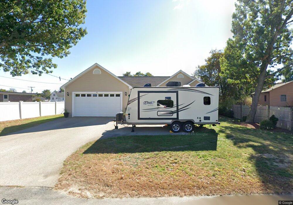
60 New Dunstable Rd Nashua, NH 03060
South End Nashua NeighborhoodEstimated Value: $538,000 - $634,232
3
Beds
3
Baths
1,575
Sq Ft
$374/Sq Ft
Est. Value
About This Home
This home is located at 60 New Dunstable Rd, Nashua, NH 03060 and is currently estimated at $588,308, approximately $373 per square foot. 60 New Dunstable Rd is a home located in Hillsborough County with nearby schools including Ledge Street Elementary School, Fairgrounds Middle School, and Nashua High School South.
Ownership History
Date
Name
Owned For
Owner Type
Purchase Details
Closed on
Nov 19, 2024
Sold by
Turcotte Karine M and Fecteau Carl M
Bought by
Turcotte-Fecteau Ret and Turcotte
Current Estimated Value
Purchase Details
Closed on
Feb 20, 2008
Sold by
Danbury Building & Dev L
Bought by
Turcotte Karine and Fecteau Carl
Home Financials for this Owner
Home Financials are based on the most recent Mortgage that was taken out on this home.
Original Mortgage
$185,000
Interest Rate
5.9%
Mortgage Type
Purchase Money Mortgage
Create a Home Valuation Report for This Property
The Home Valuation Report is an in-depth analysis detailing your home's value as well as a comparison with similar homes in the area
Home Values in the Area
Average Home Value in this Area
Purchase History
| Date | Buyer | Sale Price | Title Company |
|---|---|---|---|
| Turcotte-Fecteau Ret | -- | None Available | |
| Turcotte-Fecteau Ret | -- | None Available | |
| Turcotte Karine | $270,000 | -- | |
| Turcotte Karine | $270,000 | -- |
Source: Public Records
Mortgage History
| Date | Status | Borrower | Loan Amount |
|---|---|---|---|
| Previous Owner | Turcotte Karine | $102,279 | |
| Previous Owner | Turcotte Karine | $185,000 |
Source: Public Records
Tax History Compared to Growth
Tax History
| Year | Tax Paid | Tax Assessment Tax Assessment Total Assessment is a certain percentage of the fair market value that is determined by local assessors to be the total taxable value of land and additions on the property. | Land | Improvement |
|---|---|---|---|---|
| 2024 | $9,744 | $612,800 | $147,200 | $465,600 |
| 2023 | $9,436 | $517,600 | $117,700 | $399,900 |
| 2022 | $9,353 | $517,600 | $117,700 | $399,900 |
| 2021 | $7,892 | $339,900 | $78,500 | $261,400 |
| 2020 | $7,730 | $341,900 | $78,500 | $263,400 |
| 2019 | $7,440 | $341,900 | $78,500 | $263,400 |
| 2018 | $7,252 | $341,900 | $78,500 | $263,400 |
| 2017 | $6,370 | $247,000 | $79,800 | $167,200 |
| 2016 | $6,192 | $247,000 | $79,800 | $167,200 |
| 2015 | $6,059 | $247,000 | $79,800 | $167,200 |
| 2014 | $5,940 | $247,000 | $79,800 | $167,200 |
Source: Public Records
Map
Nearby Homes
- 41 New Dunstable Rd Unit 371
- 328 W Hollis St
- 8 Cote Ave
- 22 New Dunstable Rd Unit 132133
- 13 Wason Ave Unit 29
- 11 Bordeaux St
- 22 Kern Dr
- 169A W Hollis St Unit 193
- 247 Main Dunstable Rd
- 6 Lake Ave
- 32-34 Grand Ave
- 70 Linwood St
- 50 Hollow Ridge Dr
- 16-18 Perry Ave
- 37 White Plains Dr
- 19.5 Balcom St
- 3 Theresa Way
- 30 Dexter St Unit 106
- 4 Badger St
- 8 Althea Ln Unit U26
- 58 New Dunstable Rd
- 63 New Dunstable Rd
- 203 Kinsley St
- 193 Kinsley St
- 56 1/2 New Dunstable Rd
- 193 Kinsley St
- 200 Kinsley St
- 3 Donna St
- 1 Dale St
- 205 Kinsley St
- 4 Dale St
- 1 Ferson St
- 6 Donna St
- 89 New Dunstable Rd
- 55 New Dunstable Rd Unit 422423
- 194 Kinsley St Unit 1314
- 3 Ferson St
- 5 Dale St Unit 277
- 2 Ferson St
- 6 Dale St