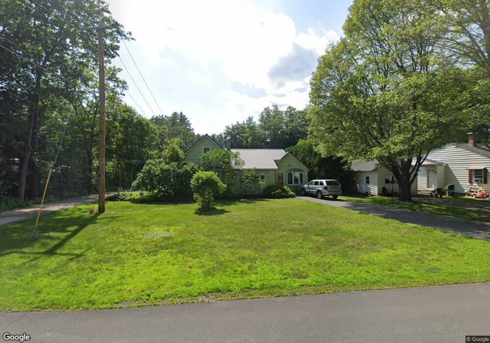
60 Newell Pond Rd Greenfield, MA 01301
Estimated Value: $275,277 - $343,000
2
Beds
1
Bath
1,307
Sq Ft
$226/Sq Ft
Est. Value
About This Home
This home is located at 60 Newell Pond Rd, Greenfield, MA 01301 and is currently estimated at $295,569, approximately $226 per square foot. 60 Newell Pond Rd is a home located in Franklin County with nearby schools including Greenfield Center School, Cornerstone Christian School, and Stoneleigh-Burnham School.
Ownership History
Date
Name
Owned For
Owner Type
Purchase Details
Closed on
Nov 29, 2016
Sold by
Tyler Leonard W and Tyler Lori J
Bought by
Tyler Christopher L
Current Estimated Value
Purchase Details
Closed on
Oct 1, 1980
Bought by
Tyler Leonard W and Tyler Lori J
Create a Home Valuation Report for This Property
The Home Valuation Report is an in-depth analysis detailing your home's value as well as a comparison with similar homes in the area
Home Values in the Area
Average Home Value in this Area
Purchase History
| Date | Buyer | Sale Price | Title Company |
|---|---|---|---|
| Tyler Christopher L | -- | -- | |
| Tyler Christopher L | -- | -- | |
| Tyler Leonard W | $32,000 | -- |
Source: Public Records
Mortgage History
| Date | Status | Borrower | Loan Amount |
|---|---|---|---|
| Previous Owner | Tyler Leonard W | $34,500 |
Source: Public Records
Tax History Compared to Growth
Tax History
| Year | Tax Paid | Tax Assessment Tax Assessment Total Assessment is a certain percentage of the fair market value that is determined by local assessors to be the total taxable value of land and additions on the property. | Land | Improvement |
|---|---|---|---|---|
| 2025 | $3,630 | $185,600 | $73,000 | $112,600 |
| 2024 | $3,548 | $174,000 | $62,200 | $111,800 |
| 2023 | $3,249 | $164,700 | $62,200 | $102,500 |
| 2022 | $3,384 | $151,600 | $62,300 | $89,300 |
| 2021 | $3,448 | $148,500 | $65,800 | $82,700 |
| 2020 | $3,332 | $145,300 | $65,800 | $79,500 |
| 2019 | $3,059 | $136,800 | $57,300 | $79,500 |
| 2018 | $3,006 | $134,000 | $56,200 | $77,800 |
| 2017 | $2,912 | $134,000 | $56,200 | $77,800 |
| 2016 | $2,909 | $133,400 | $56,200 | $77,200 |
| 2015 | $2,890 | $128,400 | $57,600 | $70,800 |
| 2014 | $2,636 | $128,400 | $57,600 | $70,800 |
Source: Public Records
Map
Nearby Homes
- 971 Bernardston Rd
- 31 Lovers Ln
- 34 Brookside Ave
- 83 Eden Trail Branch
- Lot 16 Country Club Rd
- 001 Adams Rd
- 793 Bernardston Rd
- 72 Meadowood Dr
- 47 Cross St
- 79 Burnham Rd
- 87 Oakland St
- 16 Coolidge Ave
- 75 South St Unit 3
- 44 Wildwood Ave
- 59 River St
- 2 G St
- 218 Greenfield Rd
- 539 Fox Hill Rd
- 23 Industrial Dr
- 14 Warner St
- 68 Newell Pond Rd
- 58 Newell Pond Rd
- 72 Newell Pond Rd
- 63 Newell Pond Rd
- 56 Newell Pond Rd
- 59 Newell Pond Rd
- 69 Newell Pond Rd
- 78 Newell Pond Rd
- 52 Newell Pond Rd
- 75 Newell Pond Rd
- 53 Newell Pond Rd
- 80 Newell Pond Rd
- 49 Newell Pond Rd
- 48 Newell Pond Rd
- 79 Newell Pond Rd
- 86 Newell Pond Rd
- 43 Newell Pond Rd
- 85 Newell Pond Rd
- 88 Newell Pond Rd
- 39 Newell Pond Rd