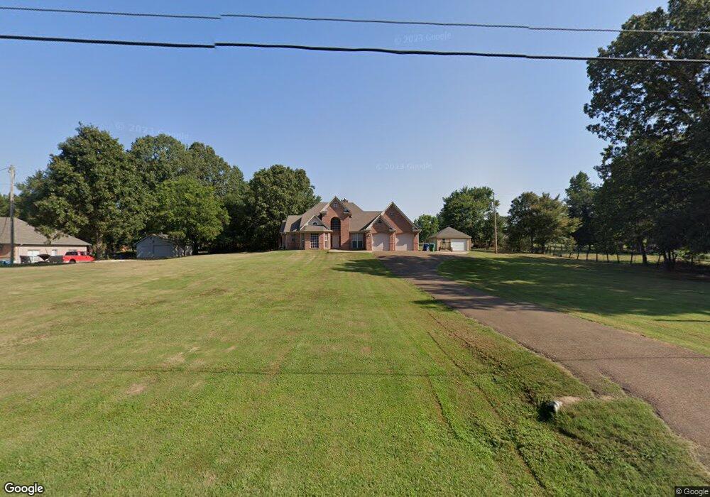
60 Ranch Rd Hernando, MS 38632
Estimated Value: $306,000 - $527,000
3
Beds
--
Bath
3,255
Sq Ft
$126/Sq Ft
Est. Value
About This Home
This home is located at 60 Ranch Rd, Hernando, MS 38632 and is currently estimated at $411,517, approximately $126 per square foot. 60 Ranch Rd is a home located in DeSoto County with nearby schools including Oak Grove Central Elementary School, Hernando Elementary School, and Hernando Hills Elementary.
Ownership History
Date
Name
Owned For
Owner Type
Purchase Details
Closed on
Nov 21, 2022
Sold by
Newsum Jacqueline Robertson
Bought by
Robertson Andre
Current Estimated Value
Purchase Details
Closed on
May 31, 2022
Sold by
Robertson Sr Anthony G
Bought by
Newsum Jacqueline R
Purchase Details
Closed on
Aug 8, 2018
Sold by
Deloris A Self
Bought by
Robertson Anthony and Newsum Keith
Home Financials for this Owner
Home Financials are based on the most recent Mortgage that was taken out on this home.
Original Mortgage
$40,000
Interest Rate
4.6%
Create a Home Valuation Report for This Property
The Home Valuation Report is an in-depth analysis detailing your home's value as well as a comparison with similar homes in the area
Home Values in the Area
Average Home Value in this Area
Purchase History
| Date | Buyer | Sale Price | Title Company |
|---|---|---|---|
| Robertson Andre | -- | -- | |
| Robertson Andre | -- | None Listed On Document | |
| Newsum Jacqueline R | -- | None Listed On Document | |
| Robertson Anthony | -- | -- |
Source: Public Records
Mortgage History
| Date | Status | Borrower | Loan Amount |
|---|---|---|---|
| Previous Owner | Robertson Anthony | $40,000 | |
| Previous Owner | Robertson Anthony | -- | |
| Previous Owner | Robertson Anthony | $151,977 |
Source: Public Records
Tax History
| Year | Tax Paid | Tax Assessment Tax Assessment Total Assessment is a certain percentage of the fair market value that is determined by local assessors to be the total taxable value of land and additions on the property. | Land | Improvement |
|---|---|---|---|---|
| 2025 | $1,885 | $26,166 | $1,000 | $25,166 |
| 2024 | $1,571 | $18,527 | $1,000 | $17,527 |
| 2023 | $1,571 | $18,527 | $0 | $0 |
| 2022 | $1,571 | $18,527 | $1,000 | $17,527 |
| 2021 | $1,571 | $18,527 | $1,000 | $17,527 |
| 2020 | $1,436 | $17,191 | $0 | $0 |
| 2019 | $1,436 | $17,191 | $1,000 | $16,191 |
| 2017 | $1,341 | $31,764 | $16,132 | $15,632 |
| 2016 | $1,341 | $16,132 | $500 | $15,632 |
| 2015 | $1,641 | $31,764 | $16,132 | $15,632 |
| 2014 | $1,341 | $16,132 | $0 | $0 |
| 2013 | $1,369 | $16,132 | $0 | $0 |
Source: Public Records
Map
Nearby Homes
- 0 Ranch Rd
- 5441 Grays Valley Dr
- 809 Green Acres Dr
- Ranch Road Lot: 1
- 5199 Brook Ln
- 5665 McIngvale Rd
- 1474 Tributary Dr
- 5333 Cane Creek Cove
- 5341 Cane Creek Cove
- 5337 Cane Creek Cove
- 5336 Cane Creek Cove
- 1528 Tributary Dr
- 1649 Tributary Dr
- 1832 Tributary Dr
- 1792 Tributary Dr
- 1593 Tributary Dr
- 1611 Cane Creek Dr
- 1570 Cane Creek Dr
- 1710 Cane Creek Dr
- 1555 Cane Creek Dr
- 100 Ranch Rd
- 40 Ranch Rd
- 190 Ranch Rd
- 37 Ranch Rd
- 5941 Highway 51 S
- 5951 Highway 51 S
- 14 Ranch Rd
- 5947 Highway 51 S
- 200 Ranch Rd
- 6001 Highway Unit 51 Suite 1
- 5988 Highway 51 S
- 250 Ranch Rd
- 5801 Highway 51 S
- 300 Ranch Rd
- 235 Sterlin Ln
- 5715 Highway 51 S
- 5907 Belmont Rd
- 5899 Belmont Rd
- 5710 Highway 51 S
- 5710 Highway 51 S
Your Personal Tour Guide
Ask me questions while you tour the home.