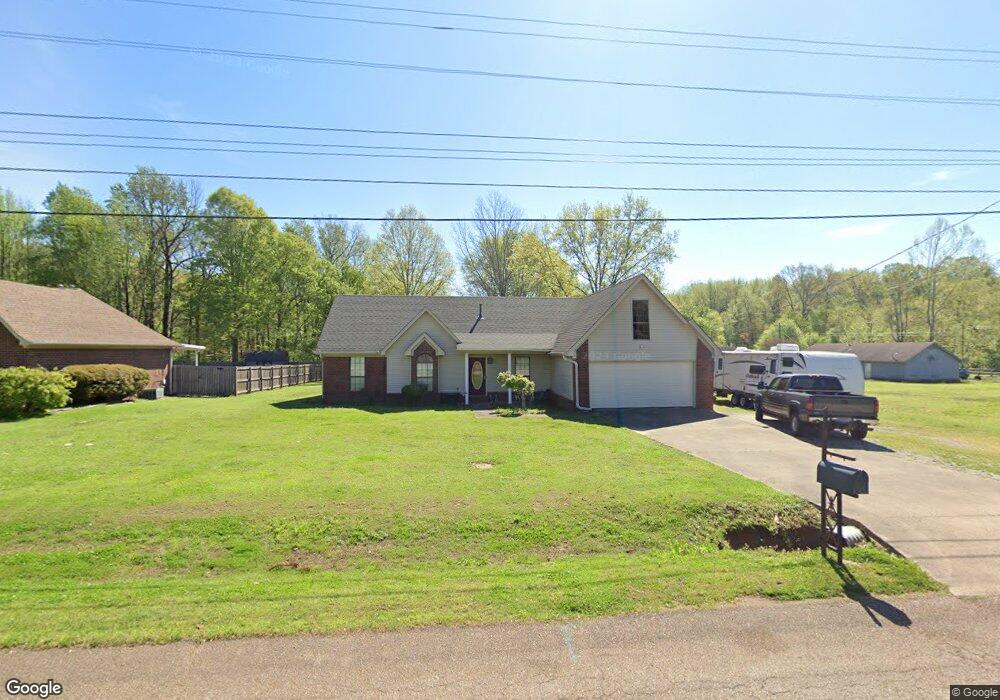
60 Rolling Meadow Dr Drummonds, TN 38023
Estimated Value: $335,313 - $437,000
--
Bed
3
Baths
2,147
Sq Ft
$176/Sq Ft
Est. Value
About This Home
This home is located at 60 Rolling Meadow Dr, Drummonds, TN 38023 and is currently estimated at $378,328, approximately $176 per square foot. 60 Rolling Meadow Dr is a home located in Tipton County with nearby schools including Drummonds Elementary School, Munford Middle School, and Munford High School.
Ownership History
Date
Name
Owned For
Owner Type
Purchase Details
Closed on
Apr 28, 2003
Sold by
Freeman David G
Bought by
Hamblin James R
Current Estimated Value
Home Financials for this Owner
Home Financials are based on the most recent Mortgage that was taken out on this home.
Original Mortgage
$135,000
Outstanding Balance
$58,973
Interest Rate
5.86%
Estimated Equity
$319,355
Purchase Details
Closed on
Oct 5, 1998
Purchase Details
Closed on
Feb 20, 1995
Sold by
Cole Heights Subdivision
Bought by
Hallford Jeffrey H
Purchase Details
Closed on
Apr 10, 1990
Bought by
Cole Heights Subdivision Inc
Create a Home Valuation Report for This Property
The Home Valuation Report is an in-depth analysis detailing your home's value as well as a comparison with similar homes in the area
Home Values in the Area
Average Home Value in this Area
Purchase History
| Date | Buyer | Sale Price | Title Company |
|---|---|---|---|
| Hamblin James R | $130,000 | -- | |
| -- | $109,500 | -- | |
| Hallford Jeffrey H | $87,500 | -- | |
| Cole Heights Subdivision Inc | -- | -- |
Source: Public Records
Mortgage History
| Date | Status | Borrower | Loan Amount |
|---|---|---|---|
| Open | Cole Heights Subdivision Inc | $135,000 |
Source: Public Records
Tax History Compared to Growth
Tax History
| Year | Tax Paid | Tax Assessment Tax Assessment Total Assessment is a certain percentage of the fair market value that is determined by local assessors to be the total taxable value of land and additions on the property. | Land | Improvement |
|---|---|---|---|---|
| 2024 | $1,196 | $78,575 | $9,000 | $69,575 |
| 2023 | $1,196 | $78,575 | $9,000 | $69,575 |
| 2022 | $1,131 | $55,425 | $6,625 | $48,800 |
| 2021 | $1,131 | $55,425 | $6,625 | $48,800 |
| 2020 | $1,130 | $55,425 | $6,625 | $48,800 |
| 2019 | $1,016 | $42,000 | $5,100 | $36,900 |
| 2018 | $1,016 | $42,000 | $5,100 | $36,900 |
| 2017 | $1,016 | $42,000 | $5,100 | $36,900 |
| 2016 | $1,016 | $42,000 | $5,100 | $36,900 |
| 2015 | $1,015 | $42,000 | $5,100 | $36,900 |
| 2014 | $1,015 | $41,992 | $0 | $0 |
Source: Public Records
Map
Nearby Homes
- 231 Country Meadow Ln
- 1336 Mathis Rd
- 856 Reed Cir
- 121 Reed Cir
- 97 Rachel Cove
- 0 Reed Cir Unit 10192357
- 321 Switchgrass Cove
- 0 Simmons Rd Unit 10197057
- 0 Hickory Ln
- 595 Hickory Ln
- 0 Bethuel Church Rd Unit RTC2971170
- 663 Tracy Rd
- 155 Pwr Loop
- 343 Pwr Loop
- 9509 Merrill Rd
- 1461 Armstrong Rd
- 447 Abbey Rd Unit D
- 9700 N Helene Cove
- 544 Rachel Shankle Dr
- 288 W Rae Dr
- 80 Rolling Meadow Dr
- 1218 Simmons Rd
- 15 Misty Meadow Trail
- 98 Rolling Meadow Dr
- 1194 Simmons Rd
- 1260 Simmons Rd
- 118 Rolling Meadow Dr
- 35 Misty Meadow Trail
- 20 Misty Meadow Trail
- 138 Rolling Meadow Dr
- 242 Mulberry Cir
- 176 Mulberry Cir
- 34 Misty Meadow Trail
- 55 Misty Meadow Trail
- 216 Mulberry Cir
- 1306 Simmons Rd
- 54 Misty Meadow Trail
- 156 Rolling Meadow Dr
- 78 Misty Meadow Trail
- 93 Misty Meadow Trail