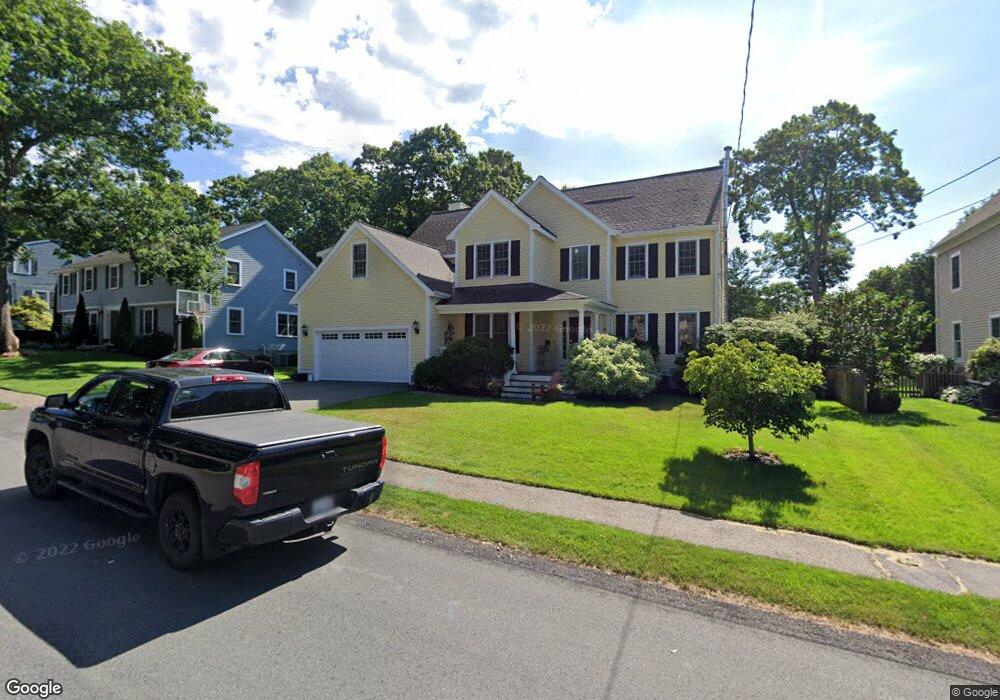
60 Savoy Rd Needham, MA 02492
Estimated Value: $1,573,000 - $2,781,000
5
Beds
4
Baths
1,437
Sq Ft
$1,618/Sq Ft
Est. Value
About This Home
This home is located at 60 Savoy Rd, Needham, MA 02492 and is currently estimated at $2,324,442, approximately $1,617 per square foot. 60 Savoy Rd is a home located in Norfolk County with nearby schools including Mitchell Elementary School, High Rock Middle School, and Pollard Middle School.
Ownership History
Date
Name
Owned For
Owner Type
Purchase Details
Closed on
Dec 13, 2012
Sold by
Kaufman Jeffrey A
Bought by
Jeffrey A Kaufman Irt and Kaufman
Current Estimated Value
Purchase Details
Closed on
Oct 18, 1999
Sold by
Slicklen Bldrs Inc
Bought by
Kaufman Marnie A
Home Financials for this Owner
Home Financials are based on the most recent Mortgage that was taken out on this home.
Original Mortgage
$445,000
Interest Rate
7.8%
Mortgage Type
Purchase Money Mortgage
Purchase Details
Closed on
Mar 30, 1999
Sold by
Hill Linda L
Bought by
Slicklen Bldrs Inc
Home Financials for this Owner
Home Financials are based on the most recent Mortgage that was taken out on this home.
Original Mortgage
$20,000
Interest Rate
7.02%
Purchase Details
Closed on
Nov 6, 1987
Sold by
Hutcheson Jk C
Bought by
Hill Linda L
Home Financials for this Owner
Home Financials are based on the most recent Mortgage that was taken out on this home.
Original Mortgage
$170,000
Interest Rate
10.97%
Mortgage Type
Purchase Money Mortgage
Create a Home Valuation Report for This Property
The Home Valuation Report is an in-depth analysis detailing your home's value as well as a comparison with similar homes in the area
Home Values in the Area
Average Home Value in this Area
Purchase History
| Date | Buyer | Sale Price | Title Company |
|---|---|---|---|
| Jeffrey A Kaufman Irt | -- | -- | |
| Jeffrey A Kaufman Irt | -- | -- | |
| Kaufman Marnie A | $655,500 | -- | |
| Slicklen Bldrs Inc | $313,000 | -- | |
| Hill Linda L | $232,500 | -- |
Source: Public Records
Mortgage History
| Date | Status | Borrower | Loan Amount |
|---|---|---|---|
| Previous Owner | Hill Linda L | $445,000 | |
| Previous Owner | Hill Linda L | $20,000 | |
| Previous Owner | Hill Linda L | $550,000 | |
| Previous Owner | Hill Linda L | $170,000 |
Source: Public Records
Tax History Compared to Growth
Tax History
| Year | Tax Paid | Tax Assessment Tax Assessment Total Assessment is a certain percentage of the fair market value that is determined by local assessors to be the total taxable value of land and additions on the property. | Land | Improvement |
|---|---|---|---|---|
| 2025 | $22,173 | $2,091,800 | $801,400 | $1,290,400 |
| 2024 | $19,310 | $1,542,300 | $589,900 | $952,400 |
| 2023 | $19,235 | $1,475,100 | $589,900 | $885,200 |
| 2022 | $18,261 | $1,365,800 | $522,100 | $843,700 |
| 2021 | $16,699 | $1,281,600 | $522,100 | $759,500 |
| 2020 | $15,770 | $1,262,600 | $522,100 | $740,500 |
| 2019 | $14,951 | $1,206,700 | $474,700 | $732,000 |
| 2018 | $14,336 | $1,206,700 | $474,700 | $732,000 |
| 2017 | $13,211 | $1,111,100 | $474,700 | $636,400 |
| 2016 | $11,668 | $1,011,100 | $474,700 | $536,400 |
| 2015 | $11,415 | $1,011,100 | $474,700 | $536,400 |
| 2014 | $10,598 | $910,500 | $395,700 | $514,800 |
Source: Public Records
Map
Nearby Homes
- 332 Hillcrest Rd
- 701 Greendale Ave
- 190 Brookline St
- 62 Washington Ave
- 8 Wilshire Park
- 247 Broad Meadow Rd
- 23 Cheney St
- 883 Greendale Ave
- 26 Pinewood Rd
- 40 Otis St Unit L
- 42 Otis St Unit R
- 556 Webster St
- 9 Jayne Rd
- 143 Hunting Rd
- 1052 Greendale Ave
- 107 Valley Rd
- 154 Warren St
- 129 Lawton Rd
- 133 Lawton Rd
- 210 Nahanton St Unit 404