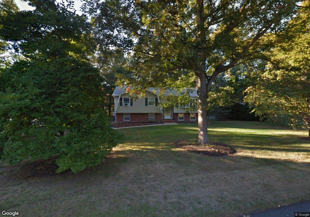
60 Whalen Dr North Attleboro, MA 02760
North Attleboro NeighborhoodEstimated Value: $565,000 - $613,000
2
Beds
2
Baths
1,132
Sq Ft
$524/Sq Ft
Est. Value
About This Home
This home is located at 60 Whalen Dr, North Attleboro, MA 02760 and is currently estimated at $592,673, approximately $523 per square foot. 60 Whalen Dr is a home located in Bristol County with nearby schools including North Attleboro High School, Cadence Academy Preschool - North Attleborough, and St John The Evangelist School.
Ownership History
Date
Name
Owned For
Owner Type
Purchase Details
Closed on
Dec 3, 2002
Sold by
Strzepka Stephen F and Beatty Lisa J
Bought by
Mackinnon David A and Mackinnon Selene
Current Estimated Value
Home Financials for this Owner
Home Financials are based on the most recent Mortgage that was taken out on this home.
Original Mortgage
$240,000
Outstanding Balance
$102,498
Interest Rate
6.16%
Mortgage Type
Purchase Money Mortgage
Estimated Equity
$490,175
Purchase Details
Closed on
Oct 30, 1992
Sold by
Shinn William S and Shinn Dorothy F
Bought by
Beatty William J and Beatty Lisa J
Home Financials for this Owner
Home Financials are based on the most recent Mortgage that was taken out on this home.
Original Mortgage
$128,250
Interest Rate
7.85%
Mortgage Type
Purchase Money Mortgage
Create a Home Valuation Report for This Property
The Home Valuation Report is an in-depth analysis detailing your home's value as well as a comparison with similar homes in the area
Home Values in the Area
Average Home Value in this Area
Purchase History
| Date | Buyer | Sale Price | Title Company |
|---|---|---|---|
| Mackinnon David A | $300,000 | -- | |
| Beatty William J | $135,000 | -- |
Source: Public Records
Mortgage History
| Date | Status | Borrower | Loan Amount |
|---|---|---|---|
| Open | Mackinnon David A | $240,000 | |
| Previous Owner | Beatty William J | $200,000 | |
| Previous Owner | Beatty William J | $160,000 | |
| Previous Owner | Beatty William J | $128,250 |
Source: Public Records
Tax History Compared to Growth
Tax History
| Year | Tax Paid | Tax Assessment Tax Assessment Total Assessment is a certain percentage of the fair market value that is determined by local assessors to be the total taxable value of land and additions on the property. | Land | Improvement |
|---|---|---|---|---|
| 2025 | $5,328 | $451,900 | $151,700 | $300,200 |
| 2024 | $5,094 | $441,400 | $151,700 | $289,700 |
| 2023 | $5,282 | $413,000 | $151,700 | $261,300 |
| 2022 | $5,111 | $366,900 | $151,700 | $215,200 |
| 2021 | $4,989 | $349,600 | $151,700 | $197,900 |
| 2020 | $4,859 | $338,600 | $151,700 | $186,900 |
| 2019 | $4,661 | $327,300 | $138,000 | $189,300 |
| 2018 | $4,155 | $311,500 | $138,000 | $173,500 |
| 2017 | $3,971 | $300,400 | $138,000 | $162,400 |
| 2016 | $3,880 | $293,500 | $153,300 | $140,200 |
| 2015 | $3,628 | $276,100 | $153,300 | $122,800 |
| 2014 | $3,399 | $256,700 | $134,500 | $122,200 |
Source: Public Records
Map
Nearby Homes
- 6 Colts Way
- 36 Cranberry Rd
- 122 Mary Ann Way
- 205 Kelley Blvd
- 11 Buckthorn Ln
- 613 Lindsey St
- 6 Cedar Creek Dr
- 47 Old Farm Rd
- 20 Sperry Ln
- 70 Sperry Ln Unit Lot 11
- 1730 West St
- 451R Gilbert St
- 546 Towne St
- 220 Oakridge Ave
- 11 Landry Ave
- 57 Vine St
- 7 Eric Ln
- 18 Quincy Way
- 14 Claire Ave
- 59 Laurelwood Dr