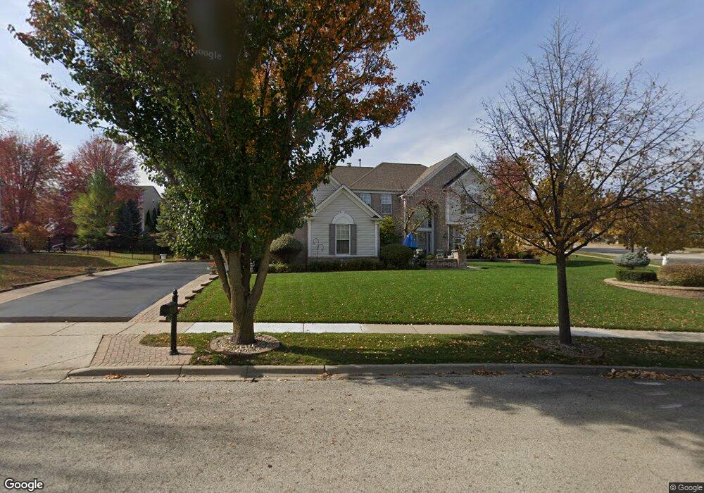
600 Brookside Ave Algonquin, IL 60102
Far West Algonquin NeighborhoodEstimated Value: $551,000 - $632,000
4
Beds
4
Baths
3,556
Sq Ft
$164/Sq Ft
Est. Value
About This Home
This home is located at 600 Brookside Ave, Algonquin, IL 60102 and is currently estimated at $582,761, approximately $163 per square foot. 600 Brookside Ave is a home located in McHenry County with nearby schools including Westfield Community School, Lincoln Prairie Elementary School, and Harry D Jacobs High School.
Ownership History
Date
Name
Owned For
Owner Type
Purchase Details
Closed on
Apr 27, 2001
Sold by
Pulte Home Corp
Bought by
Tinio Isidro T and Tinio Nelia C
Current Estimated Value
Home Financials for this Owner
Home Financials are based on the most recent Mortgage that was taken out on this home.
Original Mortgage
$273,000
Outstanding Balance
$101,938
Interest Rate
7.03%
Estimated Equity
$480,823
Create a Home Valuation Report for This Property
The Home Valuation Report is an in-depth analysis detailing your home's value as well as a comparison with similar homes in the area
Home Values in the Area
Average Home Value in this Area
Purchase History
| Date | Buyer | Sale Price | Title Company |
|---|---|---|---|
| Tinio Isidro T | $414,773 | 1St American Title |
Source: Public Records
Mortgage History
| Date | Status | Borrower | Loan Amount |
|---|---|---|---|
| Open | Tinio Isidro T | $273,000 |
Source: Public Records
Tax History
| Year | Tax Paid | Tax Assessment Tax Assessment Total Assessment is a certain percentage of the fair market value that is determined by local assessors to be the total taxable value of land and additions on the property. | Land | Improvement |
|---|---|---|---|---|
| 2024 | $11,638 | $164,771 | $29,745 | $135,026 |
| 2023 | $10,997 | $147,367 | $26,603 | $120,764 |
| 2022 | $11,470 | $144,748 | $26,214 | $118,534 |
| 2021 | $10,990 | $134,850 | $24,421 | $110,429 |
| 2020 | $10,692 | $130,076 | $23,556 | $106,520 |
| 2019 | $10,422 | $124,499 | $22,546 | $101,953 |
| 2018 | $11,993 | $136,827 | $20,828 | $115,999 |
| 2017 | $11,740 | $128,899 | $19,621 | $109,278 |
| 2016 | $11,557 | $120,896 | $18,403 | $102,493 |
| 2013 | -- | $118,716 | $17,167 | $101,549 |
Source: Public Records
Map
Nearby Homes
- 601 Woods Creek Ln
- 16 Springbrook Ln
- 3610 Lakeview Dr
- 2660 Harnish Dr
- 3260 Nottingham Dr
- 4241 Wanderlust Dr
- 940 Treeline Dr
- 531 Alpine Dr
- 895 Eineke Blvd
- 4 Greenbrier Ct
- 3650 Wintergreen Terrace
- 432 Thunder Ridge
- 2930 Harnish Dr
- 2380 Dawson Ln Unit 165
- 2956 Harnish Dr
- 1157 Sawmill Ln
- 305 Harvest Gate
- 2612 Loren Ln Unit 293
- 212 Rhinebeck Way
- 1171 Kingsmill Dr
- 610 Brookside Ave
- 601 Saratoga Cir
- 611 Saratoga Cir
- 601 Brookside Ave
- 621 Saratoga Cir
- 620 Brookside Ave
- 591 Brookside Ave
- 591 Saratoga Cir
- 611 Brookside Ave
- 580 Brookside Ave
- 631 Saratoga Cir
- 581 Brookside Ave
- 621 Brookside Ave
- 581 Saratoga Cir
- 600 Saratoga Cir
- 570 Brookside Ave
- 630 Brookside Ave
- 610 Saratoga Cir
- 571 Brookside Ave
- 641 Saratoga Cir
Your Personal Tour Guide
Ask me questions while you tour the home.