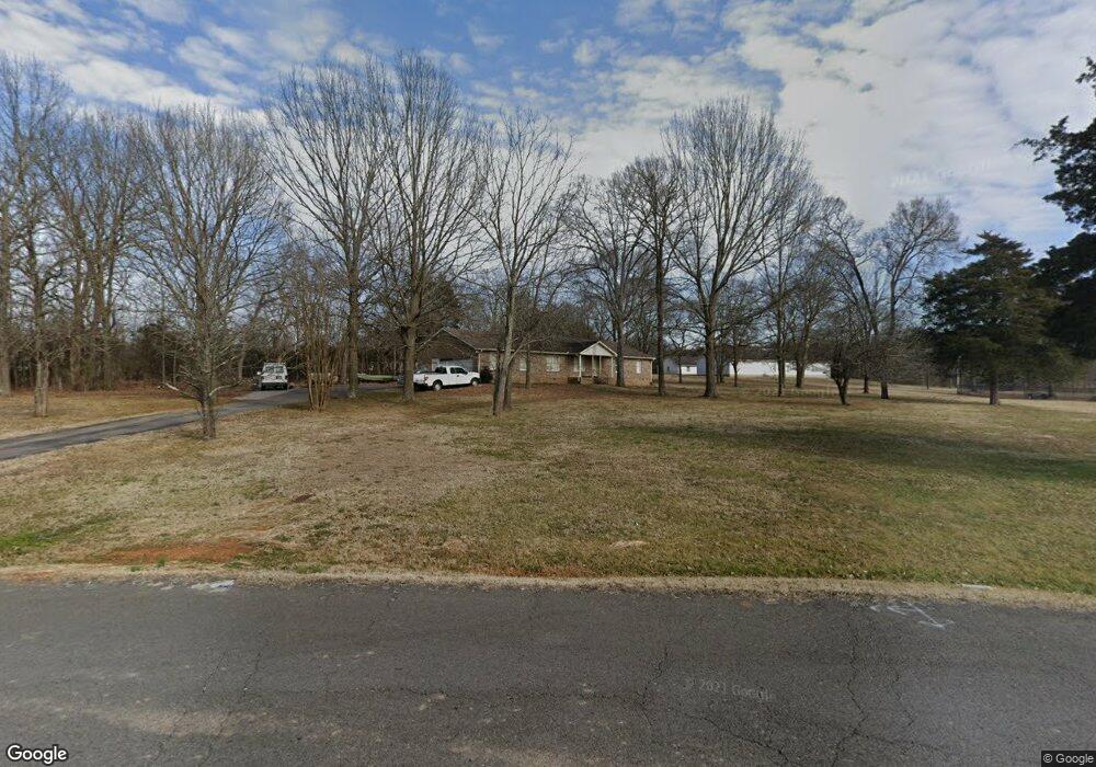
600 Clear Cir Smyrna, TN 37167
Estimated Value: $425,000 - $503,000
--
Bed
3
Baths
2,466
Sq Ft
$186/Sq Ft
Est. Value
About This Home
This home is located at 600 Clear Cir, Smyrna, TN 37167 and is currently estimated at $459,714, approximately $186 per square foot. 600 Clear Cir is a home located in Rutherford County with nearby schools including Rocky Fork Elementary School, Rocky Fork Middle School, and Smyrna High School.
Ownership History
Date
Name
Owned For
Owner Type
Purchase Details
Closed on
Aug 22, 2025
Sold by
Avt Title Services Llc
Bought by
Spring Investment Llc
Current Estimated Value
Purchase Details
Closed on
Dec 29, 2004
Sold by
Wallace Eunice W
Bought by
Wright and Leslie
Home Financials for this Owner
Home Financials are based on the most recent Mortgage that was taken out on this home.
Original Mortgage
$141,600
Interest Rate
5.75%
Purchase Details
Closed on
Jun 16, 2004
Sold by
D & R Construction Llc
Bought by
Fish Melton A and Fish Sue A
Purchase Details
Closed on
May 30, 2002
Sold by
Wallace Eunice W
Bought by
D & R Const Llc
Create a Home Valuation Report for This Property
The Home Valuation Report is an in-depth analysis detailing your home's value as well as a comparison with similar homes in the area
Home Values in the Area
Average Home Value in this Area
Purchase History
| Date | Buyer | Sale Price | Title Company |
|---|---|---|---|
| Spring Investment Llc | $303,000 | None Listed On Document | |
| Wright | $177,000 | -- | |
| Fish Melton A | $8,000 | -- | |
| D & R Const Llc | $22,500 | -- |
Source: Public Records
Mortgage History
| Date | Status | Borrower | Loan Amount |
|---|---|---|---|
| Previous Owner | D & R Const Llc | $141,600 | |
| Previous Owner | D & R Const Llc | $35,400 |
Source: Public Records
Tax History Compared to Growth
Tax History
| Year | Tax Paid | Tax Assessment Tax Assessment Total Assessment is a certain percentage of the fair market value that is determined by local assessors to be the total taxable value of land and additions on the property. | Land | Improvement |
|---|---|---|---|---|
| 2025 | $2,367 | $98,525 | $16,500 | $82,025 |
| 2024 | $2,367 | $98,525 | $16,500 | $82,025 |
| 2023 | $2,367 | $98,525 | $16,500 | $82,025 |
| 2022 | $2,110 | $98,525 | $16,500 | $82,025 |
| 2021 | $1,971 | $67,475 | $10,500 | $56,975 |
| 2020 | $1,971 | $67,475 | $10,500 | $56,975 |
| 2019 | $1,971 | $67,475 | $10,500 | $56,975 |
| 2018 | $1,890 | $67,475 | $0 | $0 |
| 2017 | $1,664 | $46,675 | $0 | $0 |
| 2016 | $1,664 | $46,675 | $0 | $0 |
| 2015 | $1,664 | $46,675 | $0 | $0 |
| 2014 | $1,161 | $46,675 | $0 | $0 |
| 2013 | -- | $49,450 | $0 | $0 |
Source: Public Records
Map
Nearby Homes
- 305 Wildwood Dr
- 920 Sky Valley Trail
- 1011 Sky Valley Trail
- 633 Glenties Dr
- 512 D Ann Dr
- 708 Rock Glen Trace
- 148 Tedder Blvd
- 1034 Leadville Dr
- 620 General Barksdale Dr
- 131 Tedder Blvd
- 4074 Utica St
- 2028 Caladonia Way
- 647 Legacy Dr
- 607 General Barksdale Dr
- 412 Gooding Blvd
- 508 Restoration Dr
- 3480 Gambill Ln
- 119 Tedder Blvd
- 2064 Caladonia Way
- 2302 Rocky Fork Rd
- 598 Clear Cir
- 530 Carter Ln
- 605 Clear Cir
- 610 Clear Cir
- 546 Carter Ln
- 542 Carter Ln
- 1 Victoria Park
- 4 Victoria Park
- 0 Buckeye Bottom Rd Unit 1882904
- 0 Florence Rd Unit 1882500
- 0 Florence Rd Unit 1593919
- 0 Buckeye Bottom Rd Unit 1591179
- 601 Clear Cir
- 538 Carter Ln
- 608 Clear Cir
- 415 Wildwood Dr
- 419 Wildwood Dr
- 501 Wildwood Dr
- 421 Wildwood Dr
- 423 Wildwood Dr