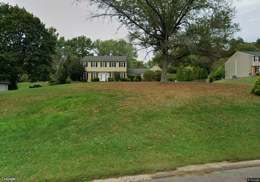
600 Edison Furlong Rd Furlong, PA 18925
Estimated Value: $712,400 - $790,000
4
Beds
3
Baths
2,600
Sq Ft
$287/Sq Ft
Est. Value
About This Home
This home is located at 600 Edison Furlong Rd, Furlong, PA 18925 and is currently estimated at $746,850, approximately $287 per square foot. 600 Edison Furlong Rd is a home located in Bucks County with nearby schools including Kutz Elementary School, Lenape Middle School, and Central Bucks High School-West.
Ownership History
Date
Name
Owned For
Owner Type
Purchase Details
Closed on
Dec 11, 2002
Sold by
Calvert Philip M and Calvert Shirley R
Bought by
Gardner Scott G and Gardner Victoria A
Current Estimated Value
Home Financials for this Owner
Home Financials are based on the most recent Mortgage that was taken out on this home.
Original Mortgage
$234,000
Outstanding Balance
$100,152
Interest Rate
6.19%
Estimated Equity
$646,698
Purchase Details
Closed on
Feb 26, 1999
Sold by
Bingler Charles L and Bingler Lois E
Bought by
Calvert Philip M and Calvert Shirley R
Home Financials for this Owner
Home Financials are based on the most recent Mortgage that was taken out on this home.
Original Mortgage
$187,000
Interest Rate
6.83%
Purchase Details
Closed on
Apr 24, 1995
Sold by
Bingler Charles L and Bingler Lois E
Bought by
Bingler Charles L and Bingler Lois E
Create a Home Valuation Report for This Property
The Home Valuation Report is an in-depth analysis detailing your home's value as well as a comparison with similar homes in the area
Home Values in the Area
Average Home Value in this Area
Purchase History
| Date | Buyer | Sale Price | Title Company |
|---|---|---|---|
| Gardner Scott G | $359,000 | -- | |
| Calvert Philip M | $220,000 | Lawyers Title Insurance Corp | |
| Bingler Charles L | -- | -- |
Source: Public Records
Mortgage History
| Date | Status | Borrower | Loan Amount |
|---|---|---|---|
| Open | Gardner Scott G | $234,000 | |
| Previous Owner | Calvert Philip M | $187,000 |
Source: Public Records
Tax History Compared to Growth
Tax History
| Year | Tax Paid | Tax Assessment Tax Assessment Total Assessment is a certain percentage of the fair market value that is determined by local assessors to be the total taxable value of land and additions on the property. | Land | Improvement |
|---|---|---|---|---|
| 2025 | $7,716 | $43,600 | $7,440 | $36,160 |
| 2024 | $7,716 | $43,600 | $7,440 | $36,160 |
| 2023 | $7,357 | $43,600 | $7,440 | $36,160 |
| 2022 | $7,275 | $43,600 | $7,440 | $36,160 |
| 2021 | $7,125 | $43,600 | $7,440 | $36,160 |
| 2020 | $7,093 | $43,600 | $7,440 | $36,160 |
| 2019 | $7,016 | $43,600 | $7,440 | $36,160 |
| 2018 | $6,995 | $43,600 | $7,440 | $36,160 |
| 2017 | $6,940 | $43,600 | $7,440 | $36,160 |
| 2016 | $6,896 | $43,600 | $7,440 | $36,160 |
| 2015 | -- | $43,600 | $7,440 | $36,160 |
| 2014 | -- | $43,600 | $7,440 | $36,160 |
Source: Public Records
Map
Nearby Homes
- 106 Saddle Dr
- 2443 Sugar Bottom Rd
- 547 Mccarty Dr
- 2310 S Whittmore St
- 126 Short Rd
- 420 Edison Furlong Rd
- 3017 Dorchester St E Unit 125
- 2294 Staffordshire Rd
- 21 Shady Springs Dr
- 152 Watercrest Dr
- 2113 Redbud Ln
- 150 Watercrest Dr
- 2209 Swamp Rd
- 223 Cherry Ln
- 000 Cherry Ln
- lot #3 next to 3739 York Rd
- 1249 Pebble Hill Rd
- 2807 Mountain Laurel Dr
- 2080 Bedfordshire Rd
- 3772 Powder Horn Dr
- 606 Edison Furlong Rd
- 594 Edison Furlong Rd
- 612 Edison Furlong Rd
- 39 Saddle Dr
- 588 Edison Furlong Rd
- 47 Saddle Dr
- 3172 Cloverly Dr
- 3196 Cloverly Dr
- 31 Saddle Dr
- 55 Saddle Dr
- 618 Edison Furlong Rd
- 10 Bridle Dr
- 23 Saddle Dr
- 3151 Edison Furlong Rd
- 63 Saddle Dr
- 15 Saddle Dr
- 3229 Edison Furlong Rd
- 46 Saddle Dr
- 38 Saddle Dr
- 3183 Cloverly Dr