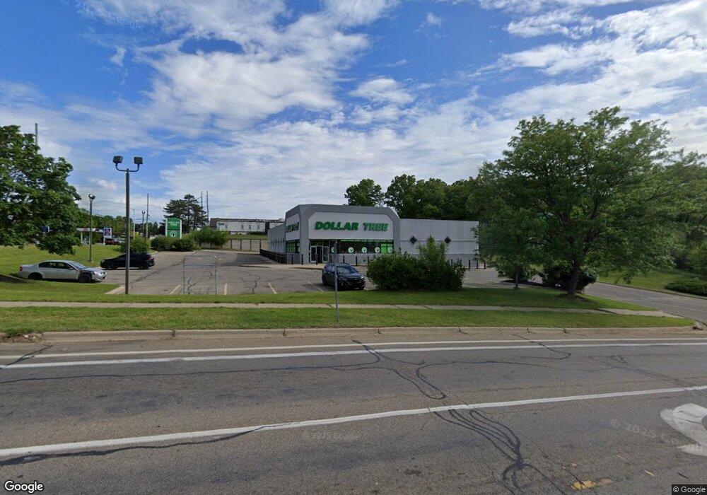
600 North Ave Unit 1 Battle Creek, MI 49017
Northeast Battle Creek NeighborhoodEstimated Value: $2,767,068
--
Bed
--
Bath
11,367
Sq Ft
$243/Sq Ft
Est. Value
About This Home
This home is located at 600 North Ave Unit 1, Battle Creek, MI 49017 and is currently estimated at $2,767,068, approximately $243 per square foot. 600 North Ave Unit 1 is a home located in Calhoun County with nearby schools including Pennfield Purdy School, Pennfield Dunlap Elementary School, and Pennfield Middle School.
Ownership History
Date
Name
Owned For
Owner Type
Purchase Details
Closed on
Mar 10, 2021
Sold by
Bcra Associates Llc
Bought by
Impulso 600 Llc
Current Estimated Value
Home Financials for this Owner
Home Financials are based on the most recent Mortgage that was taken out on this home.
Original Mortgage
$1,050,000
Outstanding Balance
$941,728
Interest Rate
2.73%
Mortgage Type
Commercial
Estimated Equity
$1,825,340
Purchase Details
Closed on
Sep 11, 2014
Sold by
Rothstein Gene and Rothstein Iris
Bought by
Bcra Associates Llc
Purchase Details
Closed on
May 9, 2003
Bought by
Rothstein Gene & Iris Trust
Purchase Details
Closed on
Sep 28, 1998
Bought by
Roosevelt & North, Llc
Create a Home Valuation Report for This Property
The Home Valuation Report is an in-depth analysis detailing your home's value as well as a comparison with similar homes in the area
Home Values in the Area
Average Home Value in this Area
Purchase History
| Date | Buyer | Sale Price | Title Company |
|---|---|---|---|
| Impulso 600 Llc | $1,751,831 | None Available | |
| Impulso 600 Llc | $1,751,831 | Quillico Walter | |
| Bcra Associates Llc | $2,620,000 | Title Connect Llc | |
| Rothstein Gene & Iris Trust | $2,150,000 | -- | |
| Roosevelt & North, Llc | $825,000 | -- |
Source: Public Records
Mortgage History
| Date | Status | Borrower | Loan Amount |
|---|---|---|---|
| Open | Impulso 600 Llc | $1,050,000 | |
| Closed | Impulso 600 Llc | $1,050,000 |
Source: Public Records
Tax History Compared to Growth
Tax History
| Year | Tax Paid | Tax Assessment Tax Assessment Total Assessment is a certain percentage of the fair market value that is determined by local assessors to be the total taxable value of land and additions on the property. | Land | Improvement |
|---|---|---|---|---|
| 2025 | $32,339 | $642,400 | $0 | $0 |
| 2024 | $14,926 | $546,500 | $0 | $0 |
| 2023 | $28,262 | $521,570 | $0 | $0 |
| 2022 | $13,539 | $466,250 | $0 | $0 |
| 2021 | $30,113 | $487,840 | $0 | $0 |
| 2020 | $29,611 | $512,520 | $0 | $0 |
| 2019 | $28,656 | $494,790 | $0 | $0 |
| 2018 | $26,560 | $456,420 | $10,880 | $445,540 |
| 2017 | $0 | $457,280 | $0 | $0 |
| 2016 | $0 | $444,610 | $0 | $0 |
| 2015 | -- | $482,800 | $428,000 | $54,800 |
| 2014 | -- | $632,670 | $428,000 | $204,670 |
Source: Public Records
Map
Nearby Homes
- 161 Wilds Ave
- 11 Coolidge Ave W
- 561 Garrison Rd
- 69 Coolidge Ave W
- 62 Coolidge Ave W
- 52 Roseneath Ave
- V/L Parkview Ave
- 266 North Ave
- 46 Walter Ave
- 706 Washington Ave N
- 5 Beglin Ct
- 51 Latta St
- 225 Eastwood Dr
- 192 Fremont St
- 435 Kendall St N
- 276 Mckinley Ave N
- 323 Garfield Ave
- 45 Central St
- 273 Garfield Ave
- 261 Emmett St E
- 600 North Ave Unit 4
- 600 North Ave Unit 3
- 600 North Ave Unit 2
- 620 North Ave
- 604 North Ave
- 632 North Ave
- 225 Roosevelt Ave E
- 595 North Ave Unit 2
- 595 North Ave Unit 1
- 595 North Ave
- 217 Goodale Ave E
- 211 Goodale Ave E
- 701 North Ave
- 240 E Roosevelt Ave Unit A
- 233 E Roosevelt Ave
- 511 North Ave
- VL E Goodale Ave
- 710 North Ave Unit B
- 710 North Ave Unit C
- 710 North Ave Unit A