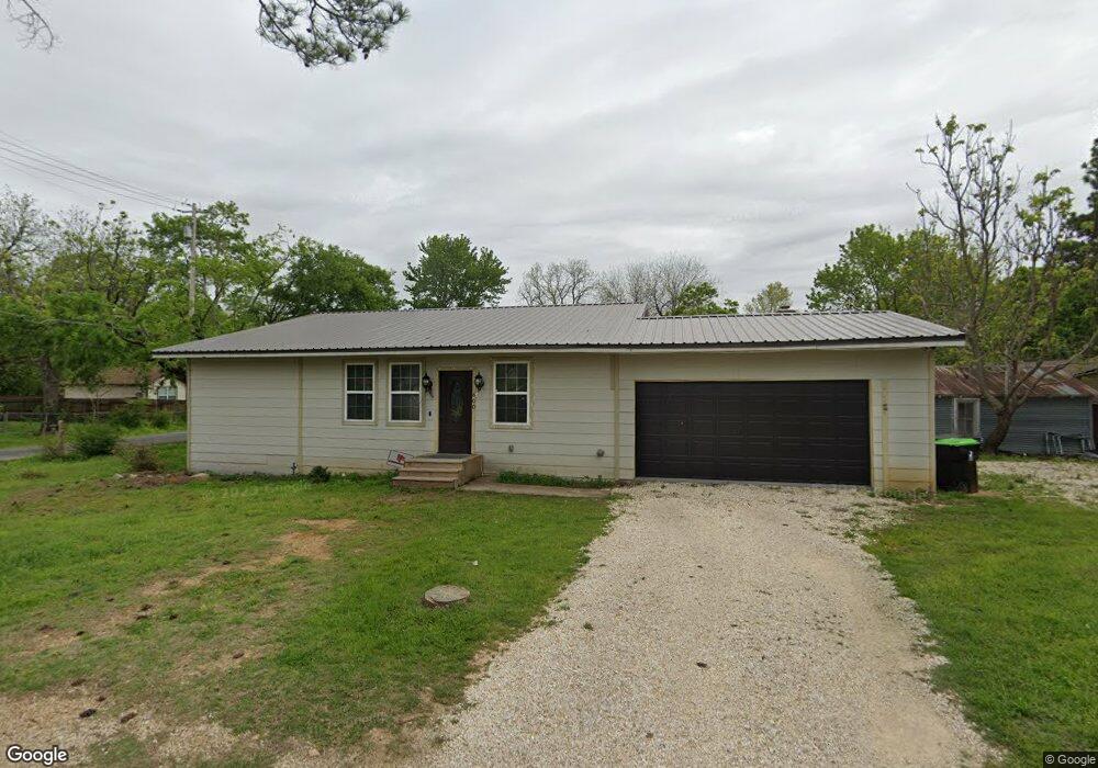
600 S Hill St Pilot Point, TX 76258
Estimated Value: $252,394 - $356,000
--
Bed
--
Bath
1,638
Sq Ft
$186/Sq Ft
Est. Value
About This Home
This home is located at 600 S Hill St, Pilot Point, TX 76258 and is currently estimated at $304,099, approximately $185 per square foot. 600 S Hill St is a home located in Denton County with nearby schools including Pilot Point Early Childhood Center, Pilot Point Elementary School, and Pilot Point Middle School.
Ownership History
Date
Name
Owned For
Owner Type
Purchase Details
Closed on
Jun 23, 2017
Sold by
Wright Samuel Edward and Wright Joann
Bought by
Tavera Marcos and Vega Rocio Mendoza
Current Estimated Value
Purchase Details
Closed on
Jun 3, 2016
Sold by
West Lillie Mae
Bought by
Wright Samuel Edward
Purchase Details
Closed on
Jan 1, 2004
Sold by
Wright Ronald Alton
Bought by
Wright Samuel Edward and Wright Helen Joyce
Create a Home Valuation Report for This Property
The Home Valuation Report is an in-depth analysis detailing your home's value as well as a comparison with similar homes in the area
Home Values in the Area
Average Home Value in this Area
Purchase History
| Date | Buyer | Sale Price | Title Company |
|---|---|---|---|
| Tavera Marcos | -- | None Available | |
| Wright Samuel Edward | -- | None Available | |
| Wright Samuel Edward | -- | -- |
Source: Public Records
Tax History Compared to Growth
Tax History
| Year | Tax Paid | Tax Assessment Tax Assessment Total Assessment is a certain percentage of the fair market value that is determined by local assessors to be the total taxable value of land and additions on the property. | Land | Improvement |
|---|---|---|---|---|
| 2025 | $2,996 | $224,572 | $86,552 | $138,020 |
| 2024 | $4,032 | $223,974 | $86,552 | $137,422 |
| 2023 | $4,327 | $232,685 | $86,552 | $146,133 |
| 2022 | $4,272 | $207,781 | $70,524 | $137,257 |
| 2021 | $2,831 | $137,213 | $70,524 | $66,689 |
| 2020 | $2,099 | $101,029 | $34,621 | $66,408 |
| 2019 | $1,352 | $63,133 | $34,621 | $28,512 |
| 2018 | $951 | $43,816 | $31,415 | $12,401 |
| 2017 | $1,245 | $57,241 | $29,492 | $27,749 |
| 2016 | $1,026 | $47,166 | $22,101 | $25,065 |
| 2015 | $1,030 | $39,080 | $22,101 | $16,979 |
| 2013 | -- | $42,517 | $28,287 | $14,230 |
Source: Public Records
Map
Nearby Homes
- TBD W Clifton St
- 405 W Clifton St
- 192 Lakeview Cir
- 188 Lakeview Cir
- 184 Lakeview Cir
- 400 S Washington St
- 168 Lakeview Cir
- 516 S Church St
- 717 S Church St
- 300 S Jefferson St
- 326 W Liberty St
- 720 Vest Ln
- 106 W Main St
- 301 E Division St
- 208 N Hill St
- 308 S Sherman St
- 00 U S Route 377
- 515 Eddleman St
- 317 E Liberty St
- 608 W Walcott St
- 400 W Mckinney St
- 417 W Mckinney St
- 614 S Hill St
- 327 W Mckinney St
- 611 S Hill St
- 408 W Mckinney St
- 622 S Hill St
- 416 W Mckinney St
- 617 S Hill St
- 319 W Mckinney St
- 520 S Hill St
- 316 W Mckinney St
- 517 S Hill St
- 525 S Morrison St
- TBD W Mckinney St
- 517 S Morrison St
- 511 S Hill St
- 428 W Clifton St
- 311 W Mckinney St
- 515 S Morrison St