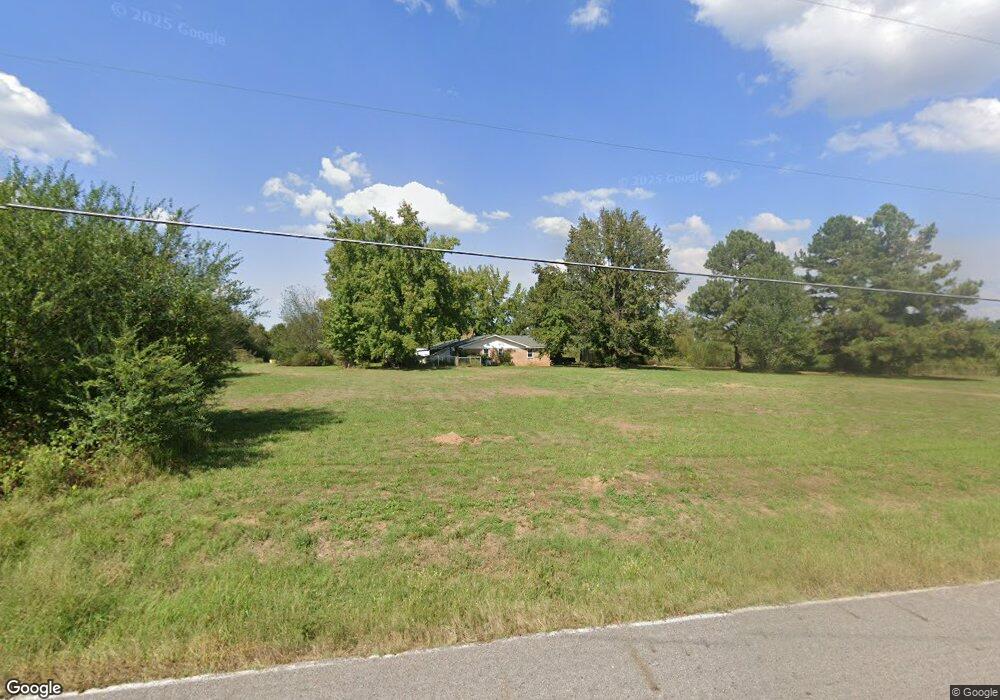
600 W Browntown Rd Huntington, AR 72940
Estimated Value: $207,000 - $331,000
3
Beds
2
Baths
2,700
Sq Ft
$94/Sq Ft
Est. Value
About This Home
This home is located at 600 W Browntown Rd, Huntington, AR 72940 and is currently estimated at $252,599, approximately $93 per square foot. 600 W Browntown Rd is a home located in Sebastian County with nearby schools including Mansfield Elementary School, Mansfield Middle School, and Mansfield High School.
Ownership History
Date
Name
Owned For
Owner Type
Purchase Details
Closed on
Mar 29, 2006
Sold by
Criswell Clifford L and Draper Barbara K
Bought by
Welden Cody J
Current Estimated Value
Home Financials for this Owner
Home Financials are based on the most recent Mortgage that was taken out on this home.
Original Mortgage
$148,000
Outstanding Balance
$83,417
Interest Rate
6.22%
Mortgage Type
Fannie Mae Freddie Mac
Estimated Equity
$169,182
Purchase Details
Closed on
Apr 21, 1989
Bought by
Criswell
Create a Home Valuation Report for This Property
The Home Valuation Report is an in-depth analysis detailing your home's value as well as a comparison with similar homes in the area
Home Values in the Area
Average Home Value in this Area
Purchase History
| Date | Buyer | Sale Price | Title Company |
|---|---|---|---|
| Welden Cody J | $185,000 | Mosley Abstract Company | |
| Criswell | -- | -- |
Source: Public Records
Mortgage History
| Date | Status | Borrower | Loan Amount |
|---|---|---|---|
| Open | Welden Cody J | $148,000 |
Source: Public Records
Tax History Compared to Growth
Tax History
| Year | Tax Paid | Tax Assessment Tax Assessment Total Assessment is a certain percentage of the fair market value that is determined by local assessors to be the total taxable value of land and additions on the property. | Land | Improvement |
|---|---|---|---|---|
| 2025 | $1,569 | $46,579 | $3,333 | $43,246 |
| 2024 | $1,426 | $29,400 | $2,690 | $26,710 |
| 2023 | $1,426 | $29,400 | $2,690 | $26,710 |
| 2022 | $1,426 | $29,400 | $2,690 | $26,710 |
| 2021 | $1,426 | $29,400 | $2,690 | $26,710 |
| 2020 | $1,418 | $29,400 | $2,690 | $26,710 |
| 2019 | $1,289 | $26,570 | $3,630 | $22,940 |
| 2018 | $1,289 | $26,570 | $3,630 | $22,940 |
| 2017 | $1,289 | $26,570 | $3,630 | $22,940 |
| 2016 | $1,278 | $26,570 | $3,630 | $22,940 |
| 2015 | $1,278 | $26,570 | $3,630 | $22,940 |
| 2014 | $1,162 | $23,945 | $3,535 | $20,410 |
Source: Public Records
Map
Nearby Homes
- 24100 Highway 71 S
- Tract 5 Vera Way
- TBD Painted Acres Ln
- 001 Frazier Rd
- 1900 Bottom Fork Rd
- 304 Stone St
- 208 W Harper
- TBD Arkansas 96
- 101 N Main Ave
- 5752 Dayton Rd
- 700 Grove St
- 901 E Center St
- 1000 E Center St
- TBD U S Highway 71
- TBD S Division Ave
- 510 Darlene Dr
- 22702 Highway 71 S
- 1706 Lana Rd
- 800 Broadway St
- 324 Park Ave
- 527 W Browntown Rd
- 501 W Browntown Rd
- 406 W Browntown Rd
- 25600 Highway 71 S
- 25708 Highway 71 S
- 25716 Highway 71 S
- 25802 Highway 71 S
- 25500 Highway 71 S
- 25711 Highway 71 S
- 8200 Williams Place
- 36 E Browntown Rd
- 909 W Browntown Rd
- 14 E Browntown Rd
- 8301 Williams Place
- 26 E Browntown Rd
- 26002 Highway 71 S
- 104 E Browntown Rd
- 216 Holland Place
- 26009 Highway 71 S
- 26101 Highway 71 S