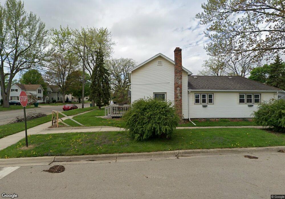
600 W Main St Durand, MI 48429
Estimated Value: $46,000 - $152,000
1
Bed
1
Bath
984
Sq Ft
$100/Sq Ft
Est. Value
About This Home
This home is located at 600 W Main St, Durand, MI 48429 and is currently estimated at $98,405, approximately $100 per square foot. 600 W Main St is a home located in Shiawassee County with nearby schools including Bertha Neal Elementary School, Robert Kerr School, and Durand Middle School.
Ownership History
Date
Name
Owned For
Owner Type
Purchase Details
Closed on
Jun 5, 2025
Sold by
Rathbun Trust and Rathbun Joseph
Bought by
Steve Richard L and Steve Angelia C
Current Estimated Value
Home Financials for this Owner
Home Financials are based on the most recent Mortgage that was taken out on this home.
Original Mortgage
$99,715
Outstanding Balance
$99,459
Interest Rate
6.81%
Mortgage Type
FHA
Estimated Equity
-$1,054
Purchase Details
Closed on
Jul 24, 2017
Sold by
Bacon Michael P and Bacon Christina S
Bought by
Bacon Michael
Purchase Details
Closed on
Jan 4, 2006
Sold by
Boeff Robert W and Beoff Barbara A
Bought by
Bank One Na
Create a Home Valuation Report for This Property
The Home Valuation Report is an in-depth analysis detailing your home's value as well as a comparison with similar homes in the area
Home Values in the Area
Average Home Value in this Area
Purchase History
| Date | Buyer | Sale Price | Title Company |
|---|---|---|---|
| Steve Richard L | $45,600 | None Listed On Document | |
| Steve Richard L | $45,600 | None Listed On Document | |
| Bacon Michael | -- | None Available | |
| Bank One Na | $60,329 | None Available |
Source: Public Records
Mortgage History
| Date | Status | Borrower | Loan Amount |
|---|---|---|---|
| Open | Steve Richard L | $99,715 | |
| Closed | Steve Richard L | $99,715 |
Source: Public Records
Tax History
| Year | Tax Paid | Tax Assessment Tax Assessment Total Assessment is a certain percentage of the fair market value that is determined by local assessors to be the total taxable value of land and additions on the property. | Land | Improvement |
|---|---|---|---|---|
| 2025 | $1,662 | $57,360 | $0 | $0 |
| 2024 | $1,662 | $54,060 | $0 | $0 |
| 2023 | $1,570 | $48,460 | $0 | $0 |
| 2022 | $1,508 | $41,800 | $0 | $0 |
| 2021 | $1,508 | $35,710 | $0 | $0 |
| 2020 | $913 | $31,060 | $0 | $0 |
| 2019 | $2,515 | $26,120 | $0 | $0 |
| 2018 | $1,355 | $26,010 | $0 | $0 |
| 2017 | $1,200 | $25,390 | $0 | $0 |
| 2016 | $1,232 | $25,390 | $0 | $0 |
| 2015 | $1,232 | $23,150 | $0 | $0 |
| 2014 | -- | $23,740 | $0 | $0 |
Source: Public Records
Map
Nearby Homes
- 409 N Lincoln St
- 402 W Perry St
- 102 W Elm St
- 310 N Mercer St
- 300 N Lenawee St
- 401 N Marquette St
- 104 W John St
- 107 E John St
- 103 N Mackinaw St
- 105 W John St
- 509 E Genesee St
- 106 E Summit St
- 609 S Kingswood St
- 1128 N Saginaw St
- 0 E Lansing Rd Unit 50159391
- 8390 E Pittsburg Rd
- 7690 Michigan 71
- 0 S New Lothrop Rd Unit 20251050266
- 10520 Garrison Rd
- 253 Leaver St
Your Personal Tour Guide
Ask me questions while you tour the home.