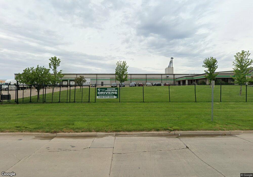
6000 Linn Aire Ave Marion, IA 52302
Estimated Value: $5,536,603
--
Bed
--
Bath
136,843
Sq Ft
$40/Sq Ft
Est. Value
About This Home
This home is located at 6000 Linn Aire Ave, Marion, IA 52302 and is currently estimated at $5,536,603, approximately $40 per square foot. 6000 Linn Aire Ave is a home located in Linn County with nearby schools including Linn Grove Elementary School, Excelsior Middle School, and Linn-Mar High School.
Ownership History
Date
Name
Owned For
Owner Type
Purchase Details
Closed on
Jun 10, 2024
Sold by
Wholesale Feeds Inc and Wfi Enterprises Inc
Bought by
Consumers Supply Distributing Llc
Current Estimated Value
Purchase Details
Closed on
May 1, 2019
Sold by
Wfi Enterprises Inc
Bought by
Consumers Supply Distributing Llc
Home Financials for this Owner
Home Financials are based on the most recent Mortgage that was taken out on this home.
Original Mortgage
$4,815,000
Interest Rate
4.5%
Mortgage Type
Land Contract Argmt. Of Sale
Create a Home Valuation Report for This Property
The Home Valuation Report is an in-depth analysis detailing your home's value as well as a comparison with similar homes in the area
Home Values in the Area
Average Home Value in this Area
Purchase History
| Date | Buyer | Sale Price | Title Company |
|---|---|---|---|
| Consumers Supply Distributing Llc | $5,350,000 | None Listed On Document | |
| Consumers Supply Distributing Llc | $5,350,000 | None Available |
Source: Public Records
Mortgage History
| Date | Status | Borrower | Loan Amount |
|---|---|---|---|
| Previous Owner | Consumers Supply Distributing Llc | $4,815,000 |
Source: Public Records
Tax History Compared to Growth
Tax History
| Year | Tax Paid | Tax Assessment Tax Assessment Total Assessment is a certain percentage of the fair market value that is determined by local assessors to be the total taxable value of land and additions on the property. | Land | Improvement |
|---|---|---|---|---|
| 2025 | $188,538 | $5,208,100 | $530,600 | $4,677,500 |
| 2024 | $160,358 | $5,235,500 | $539,700 | $4,695,800 |
| 2023 | $160,358 | $5,235,500 | $539,700 | $4,695,800 |
| 2022 | $147,024 | $4,447,000 | $415,100 | $4,031,900 |
| 2021 | $163,122 | $4,263,300 | $415,100 | $3,848,200 |
| 2020 | $163,122 | $0 | $0 | $0 |
| 2019 | $167,668 | $0 | $0 | $0 |
| 2018 | $0 | $0 | $0 | $0 |
Source: Public Records
Map
Nearby Homes
- 5805 Beall Ct Unit Land Lease
- 5975 Carlson Way
- 1510 50th St Unit 1510
- 1570 50th St Unit 1570
- 1810 50th St Unit 1810
- 4501 Surrey Ct
- 4681 Vasey Ave
- 4413 Surrey Ct
- 6166 Cope Dr
- 6188 Cope Dr
- 6177 Glenwood Dr
- 6279 Glenwood Dr
- 434 Aircom Dr
- 1350 44th Unit C St
- 6431 Rookwood Ln
- 2054 Shortgrass Place
- 0 Robinwood Ln
- 5865 Robinwood Ln
- Lots 130-137 Rookwood Estates
- 269 Lortz Dr
- 700 62nd St
- 2369 Iowa 13
- 0 62nd St Unit 1004091
- 801 62nd St
- 0 Hwy 13 Unit 1004652
- 0 Hwy 13 Unit 1108290
- 0 Hwy 13 Unit 1400197
- 0 Highway 13 Unit 1405447
- 0 Hwy 13 Unit 1604793
- 0 U S 151
- Hwy Iowa 13
- 861 62nd St Unit Lot6
- 861 62nd St
- 2369 Highway 13
- 591 62nd St Unit 103
- 591 62nd St Unit 102
- 891 62nd St Unit Lot5
- 598 57th St
- 593 62nd St Unit 107
- 593 62nd St Unit 106