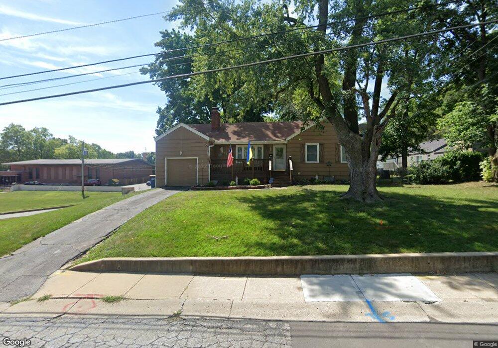
6001 W 55th St Mission, KS 66202
Estimated Value: $297,000 - $316,000
2
Beds
1
Bath
1,080
Sq Ft
$283/Sq Ft
Est. Value
About This Home
This home is located at 6001 W 55th St, Mission, KS 66202 and is currently estimated at $305,487, approximately $282 per square foot. 6001 W 55th St is a home located in Johnson County with nearby schools including Rushton Elementary School, Hocker Grove Middle School, and Shawnee Mission North High School.
Ownership History
Date
Name
Owned For
Owner Type
Purchase Details
Closed on
Apr 14, 2003
Sold by
Lavery Kerry L and Ales Kerry L
Bought by
Larson Kathryn M
Current Estimated Value
Home Financials for this Owner
Home Financials are based on the most recent Mortgage that was taken out on this home.
Original Mortgage
$122,274
Outstanding Balance
$52,104
Interest Rate
5.64%
Mortgage Type
FHA
Estimated Equity
$253,383
Create a Home Valuation Report for This Property
The Home Valuation Report is an in-depth analysis detailing your home's value as well as a comparison with similar homes in the area
Home Values in the Area
Average Home Value in this Area
Purchase History
| Date | Buyer | Sale Price | Title Company |
|---|---|---|---|
| Larson Kathryn M | -- | Kansas Title Ins Corp |
Source: Public Records
Mortgage History
| Date | Status | Borrower | Loan Amount |
|---|---|---|---|
| Open | Larson Kathryn M | $122,274 |
Source: Public Records
Tax History Compared to Growth
Tax History
| Year | Tax Paid | Tax Assessment Tax Assessment Total Assessment is a certain percentage of the fair market value that is determined by local assessors to be the total taxable value of land and additions on the property. | Land | Improvement |
|---|---|---|---|---|
| 2024 | $4,033 | $32,361 | $8,467 | $23,894 |
| 2023 | $3,750 | $29,280 | $7,694 | $21,586 |
| 2022 | $3,546 | $28,014 | $6,992 | $21,022 |
| 2021 | $3,239 | $23,967 | $5,831 | $18,136 |
| 2020 | $3,066 | $22,137 | $5,069 | $17,068 |
| 2019 | $2,843 | $20,206 | $3,378 | $16,828 |
| 2018 | $2,724 | $19,010 | $3,378 | $15,632 |
| 2017 | $2,402 | $16,089 | $3,378 | $12,711 |
| 2016 | $2,258 | $14,755 | $3,378 | $11,377 |
| 2015 | $2,212 | $14,467 | $3,378 | $11,089 |
| 2013 | -- | $14,318 | $3,378 | $10,940 |
Source: Public Records
Map
Nearby Homes
- 5431 Woodson Rd
- 5434 Maple St
- 5729 Dearborn St
- 5429 Maple St
- 5701 Russell St
- 5335 Maple St
- 6620 W 56th St
- 5504 Glenwood St
- 5400 W 58th St
- 5217 Walmer St
- 5312 W 58th St
- 6611 Florence St
- 6615 Florence St
- 5343 Rosewood St
- 6614 Florence St
- 5126 Russell St
- 6610 Florence St
- 5201 Riggs St
- 6416 W 51st St
- 5940 Nall Ave
- 6007 W 55th St
- 5505 Beverly Ave
- 5511 Beverly Ave
- 5517 Beverly Ave
- 6008 W 55th St
- 6012 W 55th St
- 6002 W 55th St
- 6018 W 55th St
- 5523 Beverly Ave
- 6101 W 55th St
- 5506 Beverly Ave
- 5912 W 55th St
- 5510 Beverly Ave
- 6020 W 55th St
- 6011 W 54th Terrace
- 6001 W 54th Terrace
- 5529 Beverly Ave
- 5516 Beverly Ave
- 6015 W 54th Terrace
- 6030 W 55th St