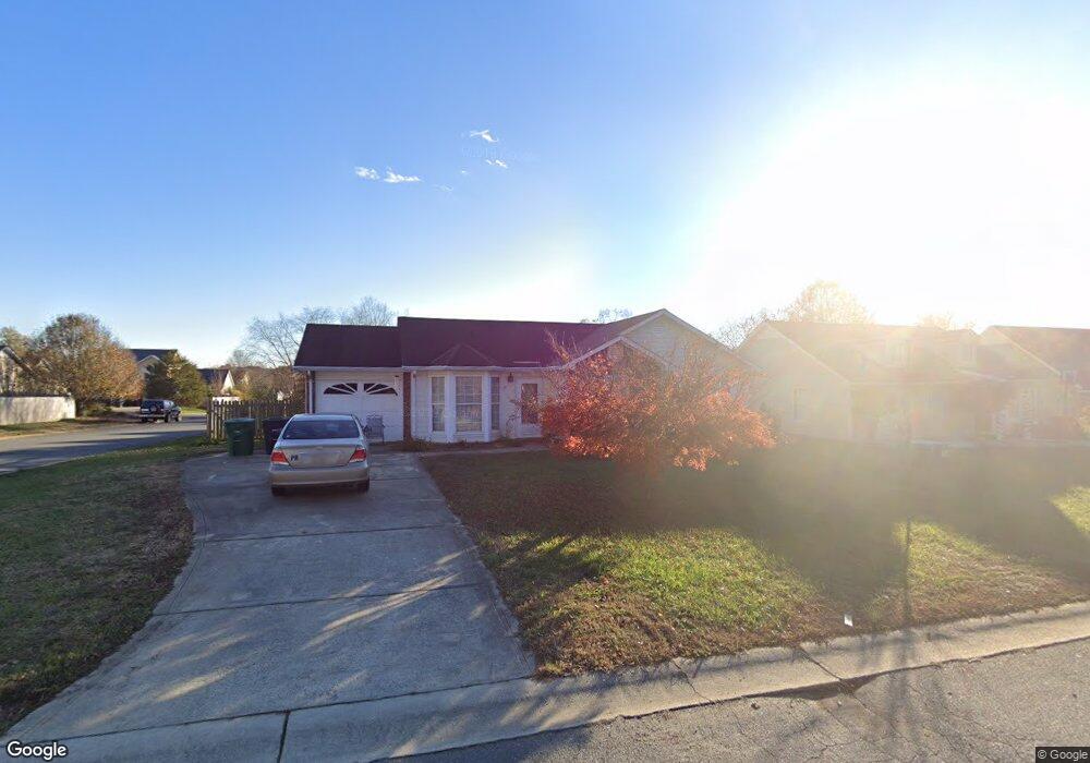
6001 White Cliffs Dr Monroe, NC 28110
Estimated Value: $291,000 - $310,000
2
Beds
2
Baths
1,062
Sq Ft
$279/Sq Ft
Est. Value
About This Home
This home is located at 6001 White Cliffs Dr, Monroe, NC 28110 and is currently estimated at $296,729, approximately $279 per square foot. 6001 White Cliffs Dr is a home located in Union County with nearby schools including Sardis Elementary School, Porter Ridge Middle School, and Porter Ridge High School.
Ownership History
Date
Name
Owned For
Owner Type
Purchase Details
Closed on
Dec 7, 2022
Sold by
Desrochers Margaret Hamilton
Bought by
Desrochers Margaret Hamilton
Current Estimated Value
Home Financials for this Owner
Home Financials are based on the most recent Mortgage that was taken out on this home.
Original Mortgage
$150,000
Outstanding Balance
$145,310
Interest Rate
7.08%
Mortgage Type
Credit Line Revolving
Estimated Equity
$151,419
Purchase Details
Closed on
Oct 4, 1996
Sold by
Wood Margaret H
Bought by
Wood Margaret H
Create a Home Valuation Report for This Property
The Home Valuation Report is an in-depth analysis detailing your home's value as well as a comparison with similar homes in the area
Purchase History
| Date | Buyer | Sale Price | Title Company |
|---|---|---|---|
| Desrochers Margaret Hamilton | -- | -- | |
| Wood Margaret H | $83,000 | -- |
Source: Public Records
Mortgage History
| Date | Status | Borrower | Loan Amount |
|---|---|---|---|
| Open | Desrochers Margaret Hamilton | $150,000 |
Source: Public Records
Tax History
| Year | Tax Paid | Tax Assessment Tax Assessment Total Assessment is a certain percentage of the fair market value that is determined by local assessors to be the total taxable value of land and additions on the property. | Land | Improvement |
|---|---|---|---|---|
| 2025 | $1,924 | $289,500 | $0 | $0 |
| 2024 | $1,591 | $186,600 | $36,900 | $149,700 |
| 2023 | $1,578 | $186,600 | $36,900 | $149,700 |
| 2022 | $1,578 | $186,600 | $36,900 | $149,700 |
| 2021 | $1,578 | $186,600 | $36,900 | $149,700 |
| 2020 | $892 | $114,400 | $22,000 | $92,400 |
| 2019 | $1,157 | $114,400 | $22,000 | $92,400 |
| 2018 | $892 | $114,400 | $22,000 | $92,400 |
| 2017 | $1,216 | $114,400 | $22,000 | $92,400 |
| 2016 | $932 | $114,400 | $22,000 | $92,400 |
| 2015 | $947 | $114,400 | $22,000 | $92,400 |
| 2014 | $789 | $110,520 | $25,000 | $85,520 |
Source: Public Records
Map
Nearby Homes
- 4001 Croftwood Ln
- 2801 Ashe Croft Dr
- 2907 Ashe Croft Dr
- 3309 Arbor Pointe Dr
- 2014 Paddington Dr
- 1022 Mendenhall St
- 2006 Chapman St
- 3608 Braefield Dr
- 2218 Tree Ridge Rd
- 3702 Arthur St
- 1010 Glen Hollow Dr
- 3702 Esther St
- 5909 Oakwood Ln
- 3312 Brookstone Trail
- 3402 Mayhurst Dr
- 3708 Wesley Chapel Stouts Rd
- 333 Knotty Wood Dr
- 0 W Highway 74
- 6018 Creft Cir
- 3619 Wesley Chapel Stouts Rd
- 6005 White Cliffs Dr
- 4403 Windjammer Dr
- 5909 White Cliffs Dr
- 6007 White Cliffs Dr
- 4401 Windjammer Dr
- 6002 White Cliffs Dr
- 6004 White Cliffs Dr
- 5908 Heathrow Ct
- 6000 White Cliffs Dr
- 6006 White Cliffs Dr
- 4209 Swan Sea Ct
- 5910 White Cliffs Dr
- 6009 White Cliffs Dr
- 5907 White Cliffs Dr
- 4309 Windjammer Dr
- 4211 Swan Sea Ct
- 6008 White Cliffs Dr
- 5908 White Cliffs Dr
- 4210 Swan Sea Ct
- 6010 White Cliffs Dr