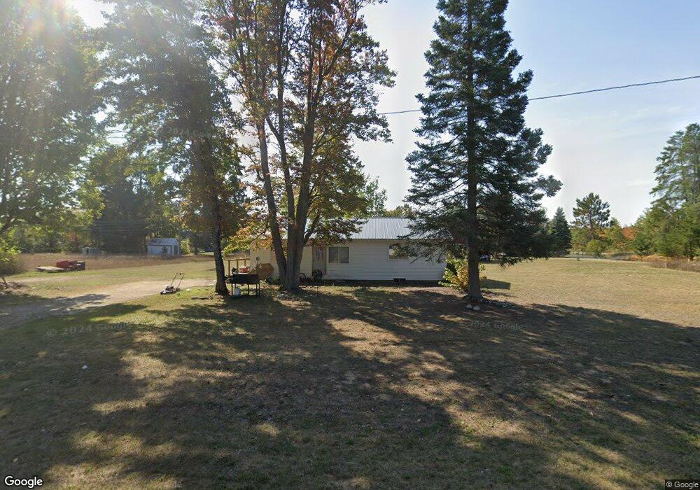
6004 Pell St Pellston, MI 49769
Estimated Value: $142,000 - $171,000
Studio
--
Bath
--
Sq Ft
33,803
Sq Ft Lot
About This Home
This home is located at 6004 Pell St, Pellston, MI 49769 and is currently estimated at $153,927. 6004 Pell St is a home located in Emmet County with nearby schools including Pellston Elementary School and Pellston Middle/High School.
Ownership History
Date
Name
Owned For
Owner Type
Purchase Details
Closed on
Jan 8, 2025
Sold by
Emmet County Treasurer
Bought by
Rodriguez Rachel Kay and Rodriguez Inocenia
Current Estimated Value
Purchase Details
Closed on
Mar 1, 2024
Sold by
Rodriguez Rachel Kay
Bought by
Emmet County Treasurer
Purchase Details
Closed on
Sep 30, 2022
Sold by
Emmet County Treasurer
Bought by
Rodriguez Rachel Kay and Rodriguez Inocenia
Purchase Details
Closed on
Mar 1, 2022
Sold by
Rodriguez Rachel Kay Rodriguez I
Bought by
Emmet County Treasurer
Purchase Details
Closed on
Jan 18, 2018
Sold by
Rodriguez Rachel Kay
Bought by
Rodriguez Rachel Kay and Rodriguez Inocencia
Purchase Details
Closed on
Feb 24, 2012
Sold by
Federal Home Loan Mortgage Corporation
Bought by
Keller Wishkobaykikijeebowigut S
Purchase Details
Closed on
Mar 3, 2011
Sold by
Erickson Michael R
Bought by
Federal Home Loan Mortgage Corp
Purchase Details
Closed on
Jan 9, 2006
Sold by
Berglund Kimberly S and Givens John L
Bought by
Heynig Michael Lance
Create a Home Valuation Report for This Property
The Home Valuation Report is an in-depth analysis detailing your home's value as well as a comparison with similar homes in the area
Purchase History
| Date | Buyer | Sale Price | Title Company |
|---|---|---|---|
| Rodriguez Rachel Kay | $1,838 | -- | |
| Emmet County Treasurer | $1,626 | -- | |
| Rodriguez Rachel Kay | $1,787 | -- | |
| Emmet County Treasurer | $1,685 | -- | |
| Rodriguez Rachel Kay | -- | None Available | |
| Keller Wishkobaykikijeebowigut S | $34,000 | -- | |
| Federal Home Loan Mortgage Corp | $46,500 | -- | |
| Heynig Michael Lance | $70,000 | -- |
Source: Public Records
Tax History
| Year | Tax Paid | Tax Assessment Tax Assessment Total Assessment is a certain percentage of the fair market value that is determined by local assessors to be the total taxable value of land and additions on the property. | Land | Improvement |
|---|---|---|---|---|
| 2025 | $1,111 | $52,700 | $52,700 | $0 |
| 2024 | $18 | $49,400 | $49,400 | $0 |
| 2023 | $1,036 | $44,600 | $44,600 | $0 |
| 2022 | $1,036 | $40,100 | $40,100 | $0 |
| 2021 | $1,075 | $38,100 | $38,100 | $0 |
| 2020 | $1,079 | $36,600 | $36,600 | $0 |
| 2019 | -- | $33,100 | $33,100 | $0 |
| 2018 | -- | $32,400 | $32,400 | $0 |
| 2017 | -- | $32,400 | $32,400 | $0 |
| 2016 | -- | $31,200 | $31,200 | $0 |
| 2015 | -- | $31,200 | $0 | $0 |
| 2014 | -- | $28,100 | $0 | $0 |
Source: Public Records
Map
Nearby Homes
- 6457 State St
- 6421 Airport Crossing Rd Unit 1
- TBD Teal Rd
- 8959 Robinson Rd
- 8016 Silver Strand Rd
- 11115 Douglas Lake Rd
- 4333 U S 31
- 6105 U S 31
- 10999 Koepke Rd
- 10222 W Munro Lake Dr
- 5100 N Bay Way
- 6167 Lambert Dr
- 393 Beaux Rivages Dr
- 6737 Honeysette Rd
- 319 Beaux Rivages Dr
- 1830 Indian Point Rd
- 1253 Walkabout Ln
- 3955 S Pleasantview Rd Unit 6
- 5441 Valley Rd
- 7084 Center St
Your Personal Tour Guide
Ask me questions while you tour the home.