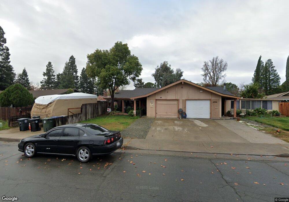
6004 Shupe Dr Citrus Heights, CA 95621
Estimated Value: $108,000 - $394,000
3
Beds
1
Bath
1,049
Sq Ft
$289/Sq Ft
Est. Value
About This Home
This home is located at 6004 Shupe Dr, Citrus Heights, CA 95621 and is currently estimated at $303,150, approximately $288 per square foot. 6004 Shupe Dr is a home located in Sacramento County with nearby schools including Skycrest Elementary School, Will Rogers Middle School, and San Juan High School.
Ownership History
Date
Name
Owned For
Owner Type
Purchase Details
Closed on
Oct 25, 2019
Sold by
Faber Michael L and Faber Mai T
Bought by
Faber Mai T and Faber Michael L
Current Estimated Value
Purchase Details
Closed on
May 31, 2010
Sold by
Federal National Mortgage Association
Bought by
Faber Michael and Faber Mai
Purchase Details
Closed on
Mar 2, 2010
Sold by
Henderson Angela C
Bought by
Federal National Mortgage Association
Purchase Details
Closed on
Jun 14, 2005
Sold by
Hill Rita and Moore Family Trust
Bought by
Henderson Angela C
Home Financials for this Owner
Home Financials are based on the most recent Mortgage that was taken out on this home.
Original Mortgage
$232,000
Interest Rate
5.62%
Mortgage Type
Purchase Money Mortgage
Purchase Details
Closed on
Nov 8, 1996
Sold by
Moore Thomas A and Moore Margaret M
Bought by
Moore Thomas A and Moore Margaret M
Create a Home Valuation Report for This Property
The Home Valuation Report is an in-depth analysis detailing your home's value as well as a comparison with similar homes in the area
Home Values in the Area
Average Home Value in this Area
Purchase History
| Date | Buyer | Sale Price | Title Company |
|---|---|---|---|
| Faber Mai T | -- | National Title Ins Of Ny Inc | |
| Faber Michael | $94,500 | Fidelity National Title Co | |
| Federal National Mortgage Association | $244,039 | Servicelink | |
| Henderson Angela C | $290,000 | -- | |
| Moore Thomas A | -- | -- |
Source: Public Records
Mortgage History
| Date | Status | Borrower | Loan Amount |
|---|---|---|---|
| Previous Owner | Henderson Angela C | $232,000 |
Source: Public Records
Tax History Compared to Growth
Tax History
| Year | Tax Paid | Tax Assessment Tax Assessment Total Assessment is a certain percentage of the fair market value that is determined by local assessors to be the total taxable value of land and additions on the property. | Land | Improvement |
|---|---|---|---|---|
| 2025 | $1,453 | $121,449 | $32,263 | $89,186 |
| 2024 | $1,453 | $119,069 | $31,631 | $87,438 |
| 2023 | $1,417 | $116,735 | $31,011 | $85,724 |
| 2022 | $1,410 | $114,447 | $30,403 | $84,044 |
| 2021 | $1,387 | $112,204 | $29,807 | $82,397 |
| 2020 | $1,361 | $111,055 | $29,502 | $81,553 |
| 2019 | $1,334 | $108,878 | $28,924 | $79,954 |
| 2018 | $1,319 | $106,744 | $28,357 | $78,387 |
| 2017 | $1,306 | $104,651 | $27,801 | $76,850 |
| 2016 | $1,222 | $102,600 | $27,256 | $75,344 |
| 2015 | $1,201 | $101,060 | $26,847 | $74,213 |
| 2014 | $1,177 | $99,082 | $26,322 | $72,760 |
Source: Public Records
Map
Nearby Homes
- 5861 Sperry Dr
- 7210 Grady Dr
- 5829 Sperry Dr
- 5829 San Juan Ave Unit 5
- 5829 San Juan Ave Unit 39
- 5813 Northgrove Way
- 6071 Peoria Dr
- 6164 Peoria Dr
- 5659 Gerard Way
- 5645 San Juan Ave
- 5978 Brooktree Dr
- 5664 San Juan Ave
- 6940 Burnham Dr
- 6945 Amberwick Way
- 5718 Southgrove Dr
- 6820 Brooknoll Ct
- 7032 San Altos Cir
- 7449 Thalia Ct
- 7449 Willowcreek Dr
- 6405 El Porto Ln