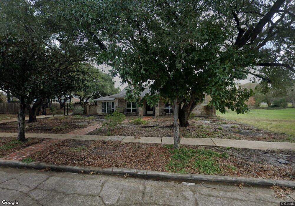
6005 Burning Tree Dr Houston, TX 77036
Sharpstown NeighborhoodEstimated Value: $382,000 - $509,000
4
Beds
5
Baths
3,546
Sq Ft
$132/Sq Ft
Est. Value
About This Home
This home is located at 6005 Burning Tree Dr, Houston, TX 77036 and is currently estimated at $468,011, approximately $131 per square foot. 6005 Burning Tree Dr is a home located in Harris County with nearby schools including Neff Elementary School, Sugar Grove Academy, and Sharpstown High School.
Ownership History
Date
Name
Owned For
Owner Type
Purchase Details
Closed on
Dec 9, 2016
Sold by
Fox Youping H
Bought by
Han Zaide
Current Estimated Value
Home Financials for this Owner
Home Financials are based on the most recent Mortgage that was taken out on this home.
Original Mortgage
$300,000
Outstanding Balance
$43,548
Interest Rate
3.54%
Mortgage Type
Purchase Money Mortgage
Estimated Equity
$424,463
Purchase Details
Closed on
May 30, 2014
Sold by
Reitz Roberta J
Bought by
Fox You Ping H
Purchase Details
Closed on
Jul 13, 2001
Sold by
Reitz Roberta J
Bought by
Corner Time Ii Lp
Home Financials for this Owner
Home Financials are based on the most recent Mortgage that was taken out on this home.
Original Mortgage
$211,500
Interest Rate
7.18%
Create a Home Valuation Report for This Property
The Home Valuation Report is an in-depth analysis detailing your home's value as well as a comparison with similar homes in the area
Home Values in the Area
Average Home Value in this Area
Purchase History
| Date | Buyer | Sale Price | Title Company |
|---|---|---|---|
| Han Zaide | -- | None Available | |
| Fox You Ping H | -- | American Title Co | |
| Reitz Robert J | -- | American Title Co | |
| Corner Time Ii Lp | -- | None Available | |
| Reitz Roberta J | -- | First American Title |
Source: Public Records
Mortgage History
| Date | Status | Borrower | Loan Amount |
|---|---|---|---|
| Open | Han Zaide | $300,000 | |
| Previous Owner | Reitz Roberta J | $211,500 |
Source: Public Records
Tax History Compared to Growth
Tax History
| Year | Tax Paid | Tax Assessment Tax Assessment Total Assessment is a certain percentage of the fair market value that is determined by local assessors to be the total taxable value of land and additions on the property. | Land | Improvement |
|---|---|---|---|---|
| 2025 | $2,788 | $456,046 | $202,000 | $254,046 |
| 2024 | $2,788 | $461,299 | $202,000 | $259,299 |
| 2023 | $2,788 | $472,296 | $202,000 | $270,296 |
| 2022 | $10,782 | $472,500 | $202,000 | $270,500 |
| 2021 | $10,655 | $457,185 | $202,000 | $255,185 |
| 2020 | $11,437 | $457,185 | $202,000 | $255,185 |
| 2019 | $11,558 | $457,185 | $202,000 | $255,185 |
| 2018 | $5,628 | $402,500 | $202,000 | $200,500 |
| 2017 | $10,499 | $402,500 | $202,000 | $200,500 |
| 2016 | $10,499 | $402,500 | $202,000 | $200,500 |
| 2015 | $5,546 | $402,500 | $202,000 | $200,500 |
| 2014 | $5,546 | $385,119 | $202,000 | $183,119 |
Source: Public Records
Map
Nearby Homes
- 8579 Sands Point Dr Unit 102
- 8555 Sands Point Dr Unit 90
- 8543 Sands Point Dr
- 6411 Redding Rd
- 8435 Sands Point Dr
- 8411 Sands Point Dr Unit 18
- 8359 Sands Point Dr Unit 218
- 8275 Sands Point Dr Unit 176
- 8267 Sands Point Dr Unit 172
- 8257 Sands Point Dr Unit 167
- 8231 Sands Point Dr Unit 154
- 8153 Sands Point Dr Unit 115
- 6602 Harbor Town Dr Unit 1207
- 6602 Harbor Town Dr Unit 1202
- 6500 Harbor Town Dr Unit 3208
- 6500 Harbor Town Dr Unit 2808
- 6500 Harbor Town Dr Unit 3204
- 6500 Harbor Town Dr Unit 3408
- 6500 Harbor Town Dr Unit 2902
- 8223 Golf Green Cir
- 6101 Burning Tree Dr
- 8599 Sands Point Dr Unit 112
- 8591 Sands Point Dr Unit 108
- 6105 Burning Tree Dr
- 8597 Sands Point Dr Unit 111
- 8589 Sands Point Dr Unit 107
- 6006 Burning Tree Dr
- 8595 Sands Point Dr Unit 110
- 6010 Burning Tree Dr
- 8587 Sands Point Dr Unit 106
- 6002 Burning Tree Dr
- 5911 Burning Tree Dr
- 8593 Sands Point Dr Unit 109
- 8585 Sands Point Dr Unit 105
- 6102 Burning Tree Dr
- 8583 Sands Point Dr Unit 104
- 8575 Sands Point Dr Unit 100
- 6109 Burning Tree Dr
- 8581 Sands Point Dr Unit 103
- 6106 Burning Tree Dr