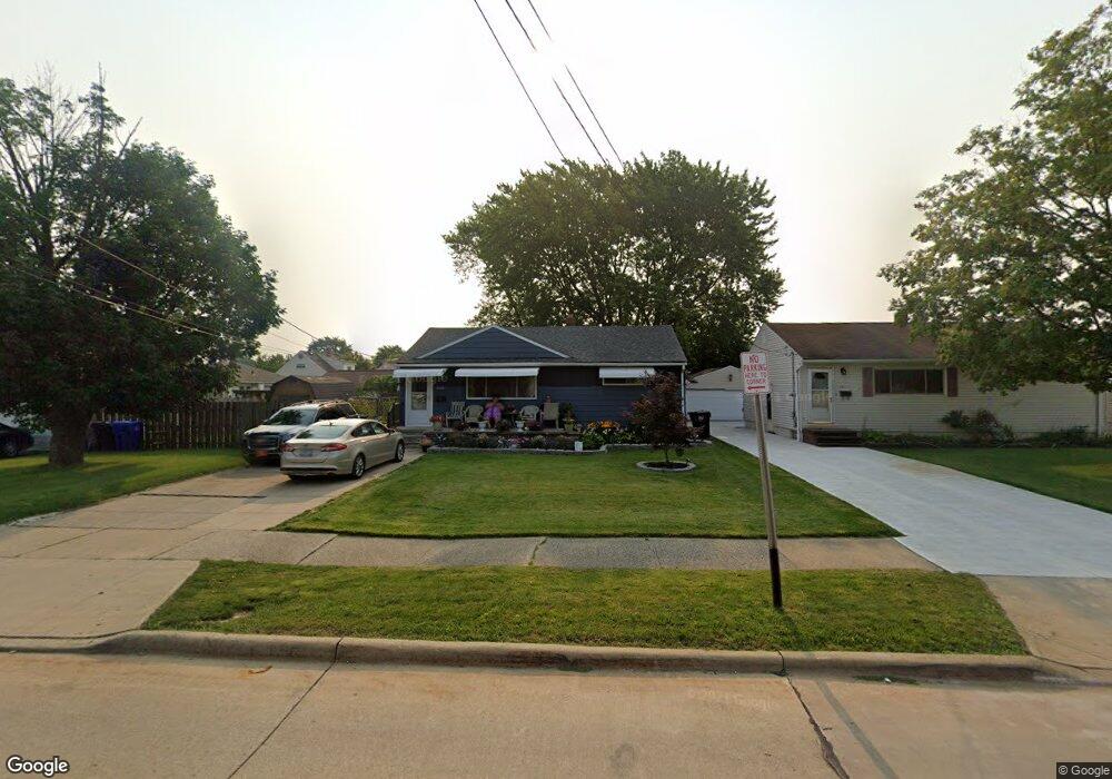
6005 Michael Dr Brookpark, OH 44142
Estimated Value: $193,924 - $220,000
3
Beds
2
Baths
1,183
Sq Ft
$175/Sq Ft
Est. Value
About This Home
This home is located at 6005 Michael Dr, Brookpark, OH 44142 and is currently estimated at $206,981, approximately $174 per square foot. 6005 Michael Dr is a home located in Cuyahoga County with nearby schools including Berea-Midpark Middle School, Berea-Midpark High School, and Huber Heights Preparatory Academy Parma Academy.
Ownership History
Date
Name
Owned For
Owner Type
Purchase Details
Closed on
Dec 12, 2007
Sold by
Meyers Natalie G and Hawkins Preston K
Bought by
Myers Natalie G
Current Estimated Value
Home Financials for this Owner
Home Financials are based on the most recent Mortgage that was taken out on this home.
Original Mortgage
$143,673
Outstanding Balance
$90,137
Interest Rate
6.13%
Mortgage Type
FHA
Estimated Equity
$116,844
Purchase Details
Closed on
Mar 16, 1999
Sold by
Mercier Edward D and Mercier Marian J
Bought by
Hawkins Preston K and Meyers Natalie G
Home Financials for this Owner
Home Financials are based on the most recent Mortgage that was taken out on this home.
Original Mortgage
$123,978
Interest Rate
6.8%
Mortgage Type
FHA
Purchase Details
Closed on
Jan 1, 1975
Bought by
Mercier Edward D and M J
Create a Home Valuation Report for This Property
The Home Valuation Report is an in-depth analysis detailing your home's value as well as a comparison with similar homes in the area
Home Values in the Area
Average Home Value in this Area
Purchase History
| Date | Buyer | Sale Price | Title Company |
|---|---|---|---|
| Myers Natalie G | $64,850 | Heavyweight Title Co | |
| Hawkins Preston K | $125,000 | Resource Title Agency Inc | |
| Mercier Edward D | -- | -- |
Source: Public Records
Mortgage History
| Date | Status | Borrower | Loan Amount |
|---|---|---|---|
| Open | Myers Natalie G | $143,673 | |
| Closed | Hawkins Preston K | $123,978 |
Source: Public Records
Tax History
| Year | Tax Paid | Tax Assessment Tax Assessment Total Assessment is a certain percentage of the fair market value that is determined by local assessors to be the total taxable value of land and additions on the property. | Land | Improvement |
|---|---|---|---|---|
| 2024 | $2,837 | $56,245 | $10,640 | $45,605 |
| 2023 | $2,974 | $48,830 | $8,160 | $40,670 |
| 2022 | $2,953 | $48,830 | $8,160 | $40,670 |
| 2021 | $2,936 | $48,830 | $8,160 | $40,670 |
| 2020 | $2,647 | $38,750 | $6,480 | $32,270 |
| 2019 | $2,568 | $110,700 | $18,500 | $92,200 |
| 2018 | $2,455 | $38,750 | $6,480 | $32,270 |
| 2017 | $2,549 | $35,670 | $6,090 | $29,580 |
| 2016 | $2,528 | $35,670 | $6,090 | $29,580 |
| 2015 | $2,372 | $35,670 | $6,090 | $29,580 |
| 2014 | $2,372 | $35,670 | $6,090 | $29,580 |
Source: Public Records
Map
Nearby Homes
- 6014 Westbrook Dr
- 6103 Westbrook Dr
- 6095 Stark Dr
- 5889 Westbrook Dr
- 13874 Heatherwood Dr
- 14024 Donald Dr
- 6131 Hardin Dr
- 5727 Gateway Ln Unit 1203
- 13602 Holland Rd
- 15532 Rademaker Dr
- 15424 Holland Rd
- 15497 Hummel Rd
- 16001 Sylvia Dr
- 16117 Hocking Blvd
- 15633 Harrison Dr
- 16159 Bowfin Blvd
- 14398 Sheldon Rd
- 6377 Ledgebrook Dr
- 6333 W 130th St
- 13375 Kathleen Dr
- 6011 Michael Dr
- 14415 Fayette Blvd
- 14433 Fayette Blvd
- 6017 Michael Dr
- 14399 Fayette Blvd
- 6028 Brook Ct
- 14381 Fayette Blvd
- 6030 Brook Ct
- 6023 Michael Dr
- 14473 Fayette Blvd
- 14363 Fayette Blvd
- 6029 Michael Dr
- 6026 Brook Ct
- 14491 Fayette Blvd
- 14341 Fayette Blvd
- 14468 Fayette Blvd
- 6016 Michael Dr
- 6032 Brook Ct
- 6035 Michael Dr
- 6022 Michael Dr
Your Personal Tour Guide
Ask me questions while you tour the home.