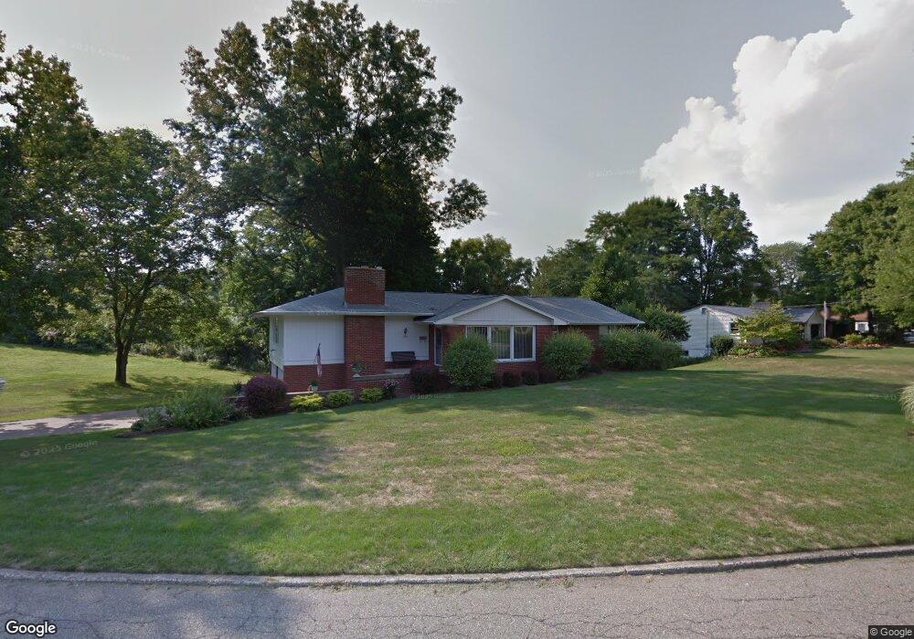
6009 Frontier Dr Youngstown, OH 44514
Estimated Value: $250,982 - $303,000
3
Beds
3
Baths
1,822
Sq Ft
$154/Sq Ft
Est. Value
About This Home
This home is located at 6009 Frontier Dr, Youngstown, OH 44514 and is currently estimated at $280,496, approximately $153 per square foot. 6009 Frontier Dr is a home located in Mahoning County with nearby schools including Poland Union Elementary School, Poland Middle School, and Poland Seminary High School.
Ownership History
Date
Name
Owned For
Owner Type
Purchase Details
Closed on
Sep 17, 1996
Sold by
Lauer June E
Bought by
Polis David A and Polis Josephine A
Current Estimated Value
Home Financials for this Owner
Home Financials are based on the most recent Mortgage that was taken out on this home.
Original Mortgage
$92,000
Outstanding Balance
$5,381
Interest Rate
8.29%
Mortgage Type
New Conventional
Estimated Equity
$275,115
Purchase Details
Closed on
Nov 27, 1962
Bought by
Lauer June E
Create a Home Valuation Report for This Property
The Home Valuation Report is an in-depth analysis detailing your home's value as well as a comparison with similar homes in the area
Purchase History
| Date | Buyer | Sale Price | Title Company |
|---|---|---|---|
| Polis David A | $115,000 | -- | |
| Lauer June E | -- | -- |
Source: Public Records
Mortgage History
| Date | Status | Borrower | Loan Amount |
|---|---|---|---|
| Open | Polis David A | $92,000 |
Source: Public Records
Tax History
| Year | Tax Paid | Tax Assessment Tax Assessment Total Assessment is a certain percentage of the fair market value that is determined by local assessors to be the total taxable value of land and additions on the property. | Land | Improvement |
|---|---|---|---|---|
| 2025 | $3,390 | $71,210 | $8,960 | $62,250 |
| 2024 | $3,491 | $71,210 | $8,960 | $62,250 |
| 2023 | $3,410 | $71,210 | $8,960 | $62,250 |
| 2022 | $2,837 | $49,510 | $8,960 | $40,550 |
| 2021 | $2,706 | $49,510 | $8,960 | $40,550 |
| 2020 | $2,718 | $49,510 | $8,960 | $40,550 |
| 2019 | $2,397 | $40,640 | $8,960 | $31,680 |
| 2018 | $2,246 | $40,640 | $8,960 | $31,680 |
| 2017 | $2,349 | $40,640 | $8,960 | $31,680 |
| 2016 | $2,455 | $42,260 | $8,960 | $33,300 |
| 2015 | $2,402 | $42,260 | $8,960 | $33,300 |
| 2014 | $2,411 | $42,260 | $8,960 | $33,300 |
| 2013 | $2,380 | $42,260 | $8,960 | $33,300 |
Source: Public Records
Map
Nearby Homes
- 6074 Frontier Dr
- 2751 Saginaw Dr
- 6534 Diana Dr
- 172 Lakeshore Dr
- 0 Clingan Rd Unit 4461196
- 3081 Heatherbrae Dr
- 6137 Acatello Place
- 2350 Hamilton Ave
- 118 N Main St
- 2301 Lyon Blvd
- 2370 Lyon Blvd
- 232 Edna St
- 50 College St
- 112 N Lima Rd
- 6695 Clingan Rd Unit 24
- 6695 Clingan Rd Unit 10
- 6695 Clingan Rd Unit 32
- 6695 Clingan Rd Unit 4
- 2035 Woodward Ave
- 43 Greystone
- 6033 Frontier Dr
- 6261 Duncan Dr
- 6247 Duncan Dr
- 6047 Frontier Dr
- 6004 Frontier Dr
- 6028 Frontier Dr
- 6018 Frontier Dr
- 6283 Duncan Dr
- 6199 Circle Dr
- 6042 Frontier Dr
- 6235 Duncan Dr
- 6058 Frontier Dr
- 6189 Circle Dr
- 6301 Duncan Dr
- 6221 Duncan Dr
- 6079 Frontier Dr
- 6222 Diana Dr
- 6236 Diana Dr
- 6206 Diana Dr
- 6252 Diana Dr
Your Personal Tour Guide
Ask me questions while you tour the home.