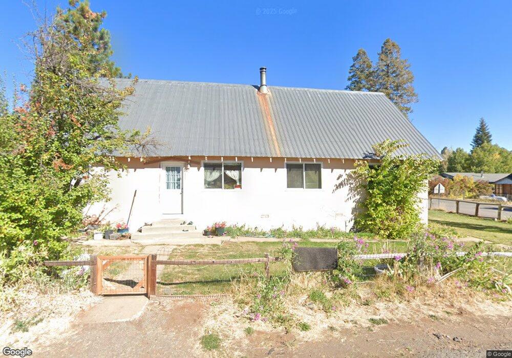
601 Cedar Canyon Rd Westwood, CA 96137
Estimated Value: $663,000 - $846,000
3
Beds
3
Baths
2,679
Sq Ft
$289/Sq Ft
Est. Value
About This Home
This home is located at 601 Cedar Canyon Rd, Westwood, CA 96137 and is currently estimated at $774,277, approximately $289 per square foot. 601 Cedar Canyon Rd is a home located in Lassen County.
Ownership History
Date
Name
Owned For
Owner Type
Purchase Details
Closed on
Apr 20, 2020
Sold by
Biermann Barry D and Biermann Betsy
Bought by
Biermann Barry Doane and Biermann Betsy Lucille
Current Estimated Value
Purchase Details
Closed on
Dec 20, 2019
Sold by
Biermann Barry D and Biermann Betsy
Bought by
Biermann Barry Doane and Biermann Betsy Lucille
Purchase Details
Closed on
Aug 27, 2012
Sold by
Cheek William Sherman and Cheek Sharon Marie
Bought by
Biermann Barry D and Biermann Betsy
Home Financials for this Owner
Home Financials are based on the most recent Mortgage that was taken out on this home.
Original Mortgage
$315,000
Outstanding Balance
$216,936
Interest Rate
3.47%
Mortgage Type
New Conventional
Estimated Equity
$557,341
Purchase Details
Closed on
Feb 10, 2006
Sold by
Cheek William S and Cheek Sharon M
Bought by
Cheek William Sherman and Cheek Sharon Marie
Create a Home Valuation Report for This Property
The Home Valuation Report is an in-depth analysis detailing your home's value as well as a comparison with similar homes in the area
Home Values in the Area
Average Home Value in this Area
Purchase History
| Date | Buyer | Sale Price | Title Company |
|---|---|---|---|
| Biermann Barry Doane | -- | None Available | |
| Biermann Barry Doane | -- | None Available | |
| Biermann Barry D | $350,000 | Cal Sierra Title Company | |
| Cheek William Sherman | -- | None Available |
Source: Public Records
Mortgage History
| Date | Status | Borrower | Loan Amount |
|---|---|---|---|
| Open | Biermann Barry D | $315,000 |
Source: Public Records
Tax History Compared to Growth
Tax History
| Year | Tax Paid | Tax Assessment Tax Assessment Total Assessment is a certain percentage of the fair market value that is determined by local assessors to be the total taxable value of land and additions on the property. | Land | Improvement |
|---|---|---|---|---|
| 2025 | $5,307 | $430,987 | $49,250 | $381,737 |
| 2023 | $5,307 | $414,253 | $47,339 | $366,914 |
| 2022 | $4,849 | $406,131 | $46,411 | $359,720 |
| 2021 | $4,571 | $398,168 | $45,501 | $352,667 |
| 2020 | $4,670 | $394,086 | $45,035 | $349,051 |
| 2019 | $4,582 | $386,359 | $44,152 | $342,207 |
| 2018 | $4,396 | $378,785 | $43,287 | $335,498 |
| 2017 | $4,374 | $371,359 | $42,439 | $328,920 |
| 2016 | $4,046 | $364,078 | $41,607 | $322,471 |
| 2015 | $3,995 | $358,611 | $40,983 | $317,628 |
| 2014 | $3,927 | $351,588 | $40,181 | $311,407 |
Source: Public Records
Map
Nearby Homes
- 631 Cedar Canyon Rd
- 663 Peninsula Dr
- 623 Cedar Canyon Rd
- 662 Peninsula Dr
- 625 Deep Forest Rd
- 665 Peninsula Dr
- 719 Peninsula Dr
- 1213 Peninsula Dr
- 629 Pine Canyon Rd
- 547 Ponderosa Dr
- 525 Peninsula Dr
- 523 Peninsula Dr
- 728 Lake Ridge Rd
- 379 Clifford Dr
- 1129 Clifford Dr
- 101 Clifford Dr
- 319 Clifford Dr
- 611 E Burnt Cedar Rd
- 614 E Burnt Cedar Rd
- 673 E Mountain Ridge Rd
- 605 Cedar Canyon Rd
- 602 Cedar Canyon Rd
- 611 Cedar Canyon Rd
- 615 Cedar Canyon Rd
- 600 Cedar Canyon Rd
- 606 Cedar Canyon Rd
- 620 Cedar Canyon Rd Unit PO Box 1816
- 620 Cedar Canyon Rd
- 608 Cedar Canyon Rd
- 649 Peninsula Dr
- 622 Cedar Canyon Rd
- 626 Cedar Canyon Rd
- 647 Peninsula Dr
- 610 Cedar Canyon Rd
- 610 Cedar Canyon Rd
- 612 Cedar Canyon Trail
- 655 Peninsula Dr
- 618 Cedar Canyon Rd
- 643 Peninsula Dr
- 645 Peninsula Dr