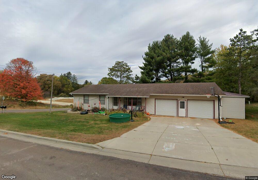
601 Circle Dr Lanesboro, MN 55949
Estimated Value: $214,000 - $326,000
3
Beds
2
Baths
1,232
Sq Ft
$223/Sq Ft
Est. Value
About This Home
This home is located at 601 Circle Dr, Lanesboro, MN 55949 and is currently estimated at $274,163, approximately $222 per square foot. 601 Circle Dr is a home located in Fillmore County with nearby schools including Lanesboro Elementary School and Lanesboro High School.
Ownership History
Date
Name
Owned For
Owner Type
Purchase Details
Closed on
Jun 30, 2016
Bought by
Hungerholt Cody Cody
Current Estimated Value
Home Financials for this Owner
Home Financials are based on the most recent Mortgage that was taken out on this home.
Original Mortgage
$137,000
Outstanding Balance
$109,013
Interest Rate
3.48%
Estimated Equity
$165,150
Create a Home Valuation Report for This Property
The Home Valuation Report is an in-depth analysis detailing your home's value as well as a comparison with similar homes in the area
Home Values in the Area
Average Home Value in this Area
Purchase History
| Date | Buyer | Sale Price | Title Company |
|---|---|---|---|
| Hungerholt Cody Cody | $138,000 | -- |
Source: Public Records
Mortgage History
| Date | Status | Borrower | Loan Amount |
|---|---|---|---|
| Open | Hungerholt Cody Cody | $137,000 |
Source: Public Records
Tax History Compared to Growth
Tax History
| Year | Tax Paid | Tax Assessment Tax Assessment Total Assessment is a certain percentage of the fair market value that is determined by local assessors to be the total taxable value of land and additions on the property. | Land | Improvement |
|---|---|---|---|---|
| 2025 | $3,782 | $223,300 | $35,000 | $188,300 |
| 2024 | $3,782 | $228,300 | $35,000 | $193,300 |
| 2023 | $2,760 | $228,300 | $35,000 | $193,300 |
| 2022 | $2,760 | $200,400 | $35,000 | $165,400 |
| 2021 | $2,760 | $181,300 | $32,000 | $149,300 |
| 2020 | $3,640 | $181,300 | $32,000 | $149,300 |
| 2019 | $3,666 | $147,600 | $30,500 | $117,100 |
| 2018 | $1,812 | $147,600 | $30,500 | $117,100 |
| 2017 | -- | $140,400 | $30,500 | $109,900 |
| 2016 | $1,644 | $140,400 | $30,500 | $109,900 |
| 2015 | $1,546 | $105,200 | $24,549 | $80,651 |
| 2014 | $1,546 | $115,800 | $25,156 | $90,644 |
| 2013 | $1,546 | $115,000 | $25,107 | $89,893 |
Source: Public Records
Map
Nearby Homes
- TBD State 16
- 708 Parkway Ave S
- 301 Kirkwood St E
- 709 Rochelle Ave S
- 407 Johnson Dr
- 300 Whittier St W
- 201 Ridgeview Ln S Unit 204
- 402 Hillcrest St E
- 206 Elmwood St E
- 208 Elmwood St E
- 105 Parkway Ave N
- 34760 Fawn Dr
- 34869 Fawn Dr
- Tbd State Highway 16
- TBD 331st Ave
- 20376 County Highway 19
- 20376 County 19
- TBD County Road 19
- 22485 391st Ave
- 605 Lincoln St SE
- 602 Circle Dr
- 814 Auburn Ave S
- 605 Circle Dr
- 617 Circle Dr
- 604 Circle Dr
- 811 Auburn Ave S
- 906 Auburn Ave S
- 103 Zenith St
- 105 Zenith St
- 107 Zenith St
- 806 Auburn Ave S
- 808 Auburn Ave S
- 812 Auburn Ave S
- 100 Zenith St
- 804 Auburn Ave S
- 109 Zenith St
- 802 Auburn Ave S
- 805 Auburn Ave S
- 1000 Auburn Ave S
- 800 Auburn Ave S