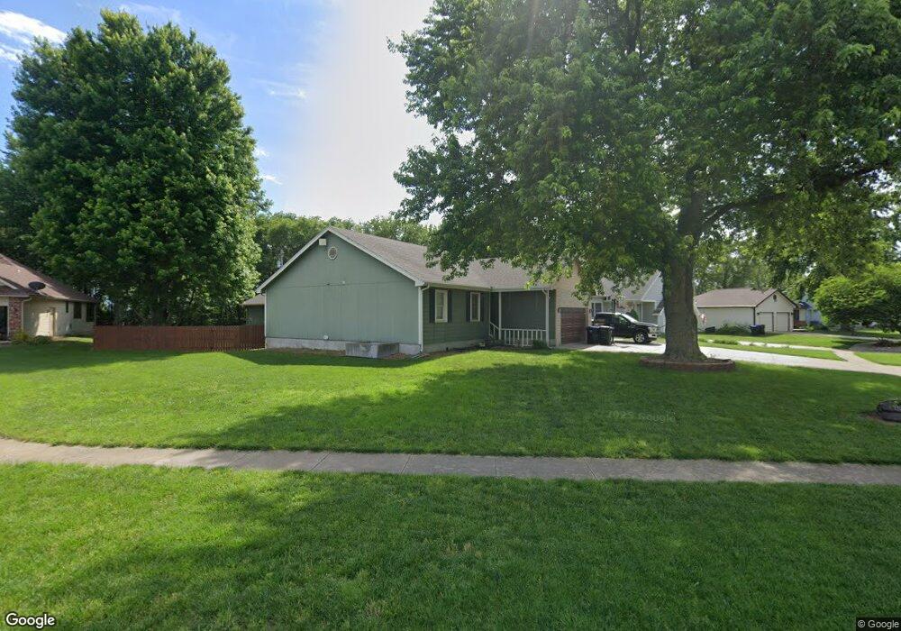
601 Kross Cir Rossville, KS 66533
Estimated Value: $228,000 - $254,000
4
Beds
2
Baths
1,296
Sq Ft
$186/Sq Ft
Est. Value
About This Home
This home is located at 601 Kross Cir, Rossville, KS 66533 and is currently estimated at $241,168, approximately $186 per square foot. 601 Kross Cir is a home located in Shawnee County with nearby schools including Rossville Elementary School and Rossville Junior/Senior High School.
Ownership History
Date
Name
Owned For
Owner Type
Purchase Details
Closed on
Mar 13, 2025
Sold by
Rietcheck Andrew A and Rietcheck Denise A
Bought by
Prior Jeffrey and Prior Taylor
Current Estimated Value
Home Financials for this Owner
Home Financials are based on the most recent Mortgage that was taken out on this home.
Original Mortgage
$245,000
Outstanding Balance
$243,746
Interest Rate
6.87%
Mortgage Type
New Conventional
Estimated Equity
-$2,578
Purchase Details
Closed on
Aug 14, 2006
Sold by
Hammer Scott M and Hammer Cathy J
Bought by
Rietcheck Andrew A and Rietcheck Denise A
Home Financials for this Owner
Home Financials are based on the most recent Mortgage that was taken out on this home.
Original Mortgage
$111,040
Interest Rate
6.78%
Mortgage Type
New Conventional
Create a Home Valuation Report for This Property
The Home Valuation Report is an in-depth analysis detailing your home's value as well as a comparison with similar homes in the area
Home Values in the Area
Average Home Value in this Area
Purchase History
| Date | Buyer | Sale Price | Title Company |
|---|---|---|---|
| Prior Jeffrey | -- | Heartland Title | |
| Rietcheck Andrew A | -- | Heartlandtitle Services Inc |
Source: Public Records
Mortgage History
| Date | Status | Borrower | Loan Amount |
|---|---|---|---|
| Open | Prior Jeffrey | $245,000 | |
| Previous Owner | Rietcheck Andrew A | $111,040 |
Source: Public Records
Tax History Compared to Growth
Tax History
| Year | Tax Paid | Tax Assessment Tax Assessment Total Assessment is a certain percentage of the fair market value that is determined by local assessors to be the total taxable value of land and additions on the property. | Land | Improvement |
|---|---|---|---|---|
| 2025 | $3,662 | $27,439 | -- | -- |
| 2023 | $3,662 | $23,442 | $0 | $0 |
| 2022 | $3,294 | $21,119 | $0 | $0 |
| 2021 | $2,991 | $18,855 | $0 | $0 |
| 2020 | $2,607 | $17,957 | $0 | $0 |
| 2019 | $2,571 | $17,266 | $0 | $0 |
| 2018 | $2,412 | $16,603 | $0 | $0 |
| 2017 | $2,422 | $16,277 | $0 | $0 |
| 2014 | $2,178 | $16,037 | $0 | $0 |
Source: Public Records
Map
Nearby Homes
- 354 Anderson St
- 611 Pearl St
- 321 W Perry St
- 117 N Main St
- 16037 U S 24
- 0000 NW Bailey Rd
- XXX NW Douglas Rd
- Lot 2 NW Douglas Rd
- Lot 1 NW Douglas Rd
- 00000 NW 86th St
- 308 Beaubein St
- 215 & 219 Main St
- 302 Sunset Ln
- Lot 2, Blk B SW 17th St
- Lot 3, Blk A SW Urish Rd
- 0000 NW 86th St
- 0000 NW 86th St Unit Lot 2
- 0000 NW 86th St Unit Lot 4
- 0000 NW 86th St Unit Lot 1
- 0000 NW 86th St Unit Lot 3
- 597 Griswold St
- 605 Kross Cir
- 593 Griswold St
- 598 Griswold St
- 648 Griswold St
- 609 Kross Cir
- 594 Griswold St
- 612 Kross Cir
- 589 Griswold St
- 641 Griswold St
- 636 Griswold St
- 588 Griswold St
- 635 Griswold St
- 581 Griswold St
- 632 Griswold St
- 629 Griswold St
- 580 Griswold St
- 628 Griswold St
- 631 Redwood Dr
- 632 Redwood Dr